TopoQuest Logo
Do you find TopoQuest useful?
Help keep TopoQuest running and adding new maps/features by donating!
Bitcoin:  19c7KJd3qBynnjoSw5npx9KScwjBe4ifkT
Litecoin:  LXs6TkuXGGXo1vDsWCkWVdjQX94eUKd6ui
Home View Maps Find Maps Find Places Resources & Links


Zumbro Falls, Minnesota Topographic Map

USGS Map Title: Zumbro Falls, MN
USGS Map MRC: 44092C4
DRG (GeoTIFF) Download: o44092c4.tif


Neighboring USGS Topographic Map Quads:


  Goodhue East, MN  
44092D5
 

  Lake City NW, MN  
44092D4
 

  Lake City, MN  
44092D3
 

  Mazeppa, MN  
44092C5
 

  Zumbro Falls, MN  
44092C4
 

  West Albany, MN  
44092C3
 

  Oronoco, MN  
44092B5
 

  Zumbro Lake, MN  
44092B4
 

  Millville, MN  
44092B3


Map MRC Location:

N45°
W93°
N45°
W92°
H8 H7 H6 H5 H4 H3 H2 H1
G8 G7 G6 G5 G4 G3 G2 G1
F8 F7 F6 F5 F4 F3 F2 F1
E8 E7 E6 E5 E4 E3 E2 E1
D8 D7 D6 D5 D4 D3 D2 D1
C8 C7 C6 C5 C4 C3 C2 C1
B8 B7 B6 B5 B4 B3 B2 B1
A8 A7 A6 A5 A4 A3 A2 A1
N44°
W93°
N44°
W92°

Zumbro Falls, MN USGS 1:24K Topographic Map Preview:
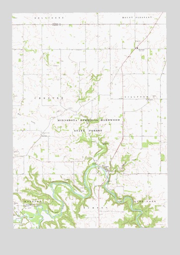
Zumbro Falls, MN USGS Topographic Map
Click on map above to begin viewing in our Map Viewer.

This topographic map contains these locations and features:
Feature Name Type Latitude Longitude GNIS ID View Map
Bear ValleyPopulated PlaceN44.3033°W92.4774°654590View Map
Bear ValleyValleyN44.3052°W92.4698°639786View Map
Bear Valley CemeteryCemeteryN44.3047°W92.4750°2064656View Map
Bear Valley Post Office (historical)Post OfficeN44.3033°W92.4772°2064609View Map
Black CemeteryCemeteryN44.3583°W92.4005°640208View Map
Bluff Valley CampgroundsLocaleN44.2739°W92.4417°2064644View Map
Buckman CouleeValleyN44.2829°W92.4229°640595View Map
Chester CemeteryCemeteryN44.3469°W92.4605°2064658View Map
Chester CemeteryCemeteryN44.3536°W92.4488°641149View Map
City of Zumbro FallsCivilN44.2847°W92.4265°2397403View Map
Cold Brook SpringSpringN44.2997°W92.4243°641386View Map
Cold CreekStreamN44.2864°W92.4355°641387View Map
English CemeteryCemeteryN44.3250°W92.3860°643381View Map
Lincoln ChurchChurchN44.3244°W92.3899°646673View Map
Mazeppa State Wildlife Management AreaParkN44.2639°W92.4907°647649View Map
North Fork Zumbro RiverStreamN44.2583°W92.4799°639169View Map
Oak CenterPopulated PlaceN44.3539°W92.4005°654855View Map
Oak Center Post Office (historical)Post OfficeN44.3539°W92.4003°2064589View Map
Saint John's Bear Valley Lutheran ChurchChurchN44.3044°W92.4769°2064659View Map
Saint John's Lutheran CemeteryCemeteryN44.3047°W92.4769°2064657View Map
Structure S-16A DamDamN44.3433°W92.4252°1776599View Map
Township of ChesterCivilN44.3249°W92.4909°663793View Map
Trinity Lutheran CemeteryCemeteryN44.3244°W92.3900°2064637View Map
Trout BrookStreamN44.2569°W92.4932°653342View Map
Zumbro Community ChurchChurchN44.2833°W92.4219°2064642View Map
Zumbro FallsPopulated PlaceN44.2833°W92.4221°654507View Map
Zumbro Falls (historical)LocaleN44.2833°W92.4219°2064638View Map
Zumbro Falls City HallBuildingN44.2833°W92.4219°2064641View Map
Zumbro Falls Fire DepartmentBuildingN44.2836°W92.4230°2064640View Map
Zumbro Falls Golf ClubLocaleN44.2833°W92.4219°2064639View Map
Zumbro Falls Post OfficePost OfficeN44.2833°W92.4219°2064643View Map
Zumbro Parkway BridgeBridgeN44.2800°W92.4200°2064724View Map

Note: Coordinates in the location and feature list above are referenced to NAD83 datum.


Copyright (C) 2008-2024 Ryan Niemi / Sunset Dynamics ... All Rights Reserved