TopoQuest Logo
Do you find TopoQuest useful?
Help keep TopoQuest running and adding new maps/features by donating!
Bitcoin:  19c7KJd3qBynnjoSw5npx9KScwjBe4ifkT
Litecoin:  LXs6TkuXGGXo1vDsWCkWVdjQX94eUKd6ui
Home View Maps Find Maps Find Places Resources & Links


Lake City, Minnesota Topographic Map

USGS Map Title: Lake City, MN
USGS Map MRC: 44092D3
DRG (GeoTIFF) Download: o44092d3.tif


Neighboring USGS Topographic Map Quads:


  Bay City, WI  
44092E4
 

  Maiden Rock, WI  
44092E3
 

  Nerike Hill, WI  
44092E2
 

  Lake City NW, MN  
44092D4
 

  Lake City, MN  
44092D3
 

  Pepin, WI  
44092D2
 

  Zumbro Falls, MN  
44092C4
 

  West Albany, MN  
44092C3
 

  Theilman, MN  
44092C2


Map MRC Location:

N45°
W93°
N45°
W92°
H8 H7 H6 H5 H4 H3 H2 H1
G8 G7 G6 G5 G4 G3 G2 G1
F8 F7 F6 F5 F4 F3 F2 F1
E8 E7 E6 E5 E4 E3 E2 E1
D8 D7 D6 D5 D4 D3 D2 D1
C8 C7 C6 C5 C4 C3 C2 C1
B8 B7 B6 B5 B4 B3 B2 B1
A8 A7 A6 A5 A4 A3 A2 A1
N44°
W93°
N44°
W92°

Lake City, MN USGS 1:24K Topographic Map Preview:
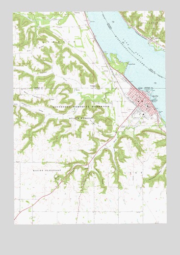
Lake City, MN USGS Topographic Map
Click on map above to begin viewing in our Map Viewer.

This topographic map contains these locations and features:
Feature Name Type Latitude Longitude GNIS ID View Map
Baptist Calvary ChurchChurchN44.4481°W92.2728°2064683View Map
Bethany CemeteryCemeteryN44.4389°W92.2786°2064635View Map
Bethany Lutheran ChurchChurchN44.4428°W92.2661°2064682View Map
Bluff View Elementary SchoolSchoolN44.4363°W92.2726°2064684View Map
Boston CouleeValleyN44.4086°W92.3169°640394View Map
Bushel and Peck OrchardLocaleN44.4992°W92.3192°2651173View Map
Central PointCapeN44.4698°W92.2806°2778766View Map
Central PointLocaleN44.4686°W92.2816°641073View Map
Central Point Post Office (historical)Post OfficeN44.4686°W92.2814°2064887View Map
City of Lake CityCivilN44.4451°W92.2795°664666View Map
County Line CemeteryCemeteryN44.4545°W92.3693°642394View Map
Erickson PointCapeN44.4903°W92.2799°2761263View Map
First Congregational ChurchChurchN44.4483°W92.2686°2064681View Map
First Lutheran ChurchChurchN44.4475°W92.2744°2064680View Map
Gerken CouleeValleyN44.4070°W92.3107°644090View Map
Gilbert CreekStreamN44.4697°W92.2841°644126View Map
Gilbert ValleyValleyN44.4385°W92.3309°644129View Map
Gilbert Valley CemeteryCemeteryN44.4389°W92.3478°2064634View Map
Gold Star Mothers ParkParkN44.4544°W92.2728°2064686View Map
Hansen's Harbor and Trailer CourtPopulated PlaceN44.4994°W92.3153°2064745View Map
Hazelett CouleeValleyN44.4073°W92.3131°644807View Map
Hok-Si-La City ParkParkN44.4856°W92.2903°2064751View Map
Horrigan HillSummitN44.4336°W92.3107°645195View Map
Hoyt ParkParkN44.4422°W92.2728°2064689View Map
J Goihl DamDamN44.3966°W92.2718°1776598View Map
Jefferson SchoolSchoolN44.4439°W92.2649°645607View Map
Kohn HillSummitN44.4841°W92.3741°646225View Map
Lake CityPopulated PlaceN44.4494°W92.2668°646338View Map
Lake CityLocaleN44.4417°W92.2717°2064674View Map
Lake City Ambulance ServicesBuildingN44.4478°W92.2656°2775463View Map
Lake City City HallBuildingN44.4481°W92.2661°2064672View Map
Lake City Clinic - Mayo HealthHospitalN44.4586°W92.2875°2064749View Map
Lake City ConcourseParkN44.4456°W92.2614°2064726View Map
Lake City Country ClubLocaleN44.4647°W92.2968°659871View Map
Lake City Fire DepartmentBuildingN44.4475°W92.2663°2064673View Map
Lake City Nursing HomeHospitalN44.4586°W92.2875°2064748View Map
Lake City Police DepartmentBuildingN44.4479°W92.2657°2064669View Map
Lake City Post OfficePost OfficeN44.4486°W92.2670°2064671View Map
Lake City Public LibraryBuildingN44.4486°W92.2661°2064670View Map
Lake Pepin Campgrounds and Trailer ParkLocaleN44.4625°W92.2883°2064746View Map
Lake Pepin Rest AreaLocaleN44.4944°W92.3139°2065027View Map
Lakewood CemeteryCemeteryN44.4346°W92.2720°646447View Map
Lewis McChaill Memorial ParkParkN44.4477°W92.2632°646622View Map
Lincoln High SchoolSchoolN44.4448°W92.2671°646690View Map
Maplewood Trailer ParkPopulated PlaceN44.4494°W92.2667°2064667View Map
Mayo Clinic Health System Lake CityHospitalN44.4594°W92.2878°2064747View Map
McCahill Ball FieldParkN44.4492°W92.2761°2064688View Map
Moran CouleeValleyN44.4214°W92.2940°648100View Map
North End ParkParkN44.4544°W92.2800°2064687View Map
Oak RidgeRidgeN44.4764°W92.3557°648854View Map
Oakland CemeteryCemeteryN44.4922°W92.2588°1570701View Map
Oakwood CemeteryCemeteryN44.4371°W92.2784°648884View Map
Ohuta ParkParkN44.4519°W92.2641°648908View Map
Old Stockholm CemeteryCemeteryN44.4913°W92.2768°1570787View Map
Patton ParkParkN44.4483°W92.2672°2064690View Map
Peter's ParkParkN44.4353°W92.2686°2064685View Map
Ralph Lenz Detention Structure DamDamN44.4516°W92.3202°1777252View Map
River Oaks Health Care CenterHospitalN44.4544°W92.2761°2064668View Map
Roschen ParkParkN44.4402°W92.2566°650253View Map
Saint John's Lutheran ChurchChurchN44.4469°W92.2725°2064679View Map
Saint Johns CemeteryCemeteryN44.4366°W92.2791°650667View Map
Saint Johns Lutheran SchoolSchoolN44.4469°W92.2723°2064678View Map
Saint Mark's Episcopal ChurchChurchN44.4475°W92.2686°2064675View Map
Saint Mary's ChurchChurchN44.4469°W92.2694°2064676View Map
Saint Marys CemeteryCemeteryN44.4402°W92.2804°650850View Map
StockholmPopulated PlaceN44.4833°W92.2621°1574907View Map
Sugarloaf BluffCliffN44.4558°W92.3060°652777View Map
Sugarloaf CreekStreamN44.4497°W92.3157°652778View Map
Township of FlorenceCivilN44.4961°W92.3609°664180View Map
Township of Mount PleasantCivilN44.4115°W92.3700°665057View Map
United Methodist ChurchChurchN44.4489°W92.2703°2064677View Map
Valley View Assembly of God ChurchChurchN44.4583°W92.2836°2064750View Map
Village of StockholmCivilN44.4850°W92.2631°1584228View Map
Vining CemeteryCemeteryN44.4908°W92.3391°653670View Map
West Florence RidgeRidgeN44.4511°W92.3613°653955View Map
William Dankwart DamDamN44.4750°W92.3385°1776610View Map

Note: Coordinates in the location and feature list above are referenced to NAD83 datum.


Copyright (C) 2008-2024 Ryan Niemi / Sunset Dynamics ... All Rights Reserved