TopoQuest Logo
Do you find TopoQuest useful?
Help keep TopoQuest running and adding new maps/features by donating!
Bitcoin:  19c7KJd3qBynnjoSw5npx9KScwjBe4ifkT
Litecoin:  LXs6TkuXGGXo1vDsWCkWVdjQX94eUKd6ui
Home View Maps Find Maps Find Places Resources & Links


Brandonville, West Virginia Topographic Map

USGS Map Title: Brandonville, WV
USGS Map MRC: 39079F5
DRG (GeoTIFF) Download: o39079f5.tif


Neighboring USGS Topographic Map Quads:


  Brownfield, PA  
39079G6
 

  Fort Necessity, PA  
39079G5
 

  Ohiopyle, PA  
39079G4
 

  Bruceton Mills, WV  
39079F6
 

  Brandonville, WV  
39079F5
 

  Friendsville, MD  
39079F4
 

  Valley Point, WV  
39079E6
 

  Cuzzart, WV  
39079E5
 

  Sang Run, MD  
39079E4


Map MRC Location:

N40°
W80°
N40°
W79°
H8 H7 H6 H5 H4 H3 H2 H1
G8 G7 G6 G5 G4 G3 G2 G1
F8 F7 F6 F5 F4 F3 F2 F1
E8 E7 E6 E5 E4 E3 E2 E1
D8 D7 D6 D5 D4 D3 D2 D1
C8 C7 C6 C5 C4 C3 C2 C1
B8 B7 B6 B5 B4 B3 B2 B1
A8 A7 A6 A5 A4 A3 A2 A1
N39°
W80°
N39°
W79°

Brandonville, WV USGS 1:24K Topographic Map Preview:
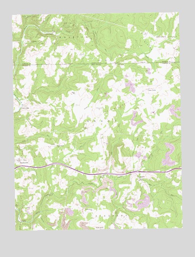
Brandonville, WV USGS Topographic Map
Click on map above to begin viewing in our Map Viewer.

This topographic map contains these locations and features:
Feature Name Type Latitude Longitude GNIS ID View Map
Barnes RunStreamN39.6456°W79.5989°1535259View Map
Beaver CreekStreamN39.6356°W79.6048°1535449View Map
BrandonvillePopulated PlaceN39.6659°W79.6206°1553965View Map
Brandonville United Methodist ChurchChurchN39.6662°W79.6209°1558452View Map
Bruceton Mills Wildlife Management AreaParkN39.6829°W79.6178°1558463View Map
Canaan ChurchChurchN39.7326°W79.5917°1171145View Map
Canaan School (historical)SchoolN39.7409°W79.5917°1206128View Map
Cherry RunStreamN39.6592°W79.5320°1537251View Map
Clifton MillsPopulated PlaceN39.6970°W79.6178°1537408View Map
Clifton Mills Union ChurchChurchN39.6973°W79.6170°1558487View Map
Cuppert School (historical)SchoolN39.7104°W79.5092°1558498View Map
Elk RunStreamN39.6537°W79.5498°1538637View Map
Federal Correctional Institution HazeltonBuildingN39.6698°W79.5130°2768067View Map
Fike RunStreamN39.7456°W79.5770°1538959View Map
Fike RunStreamN39.7404°W79.5634°1174744View Map
Five ForksPopulated PlaceN39.7212°W79.5470°1174859View Map
Five ForksPopulated PlaceN39.7209°W79.5481°1549684View Map
Gibbon GladePopulated PlaceN39.7398°W79.5945°1175582View Map
Gibbon Glade Post OfficePost OfficeN39.7395°W79.5942°2772714View Map
Glade FarmsPopulated PlaceN39.7056°W79.5242°1539427View Map
Glade Farms United Methodist ChurchChurchN39.7056°W79.5237°1558526View Map
GladesPopulated PlaceN39.7309°W79.5223°1203674View Map
Glover School (historical)SchoolN39.6929°W79.5564°1558529View Map
Guthrie School (historical)SchoolN39.6620°W79.5839°1558536View Map
HazeltonPopulated PlaceN39.6537°W79.5306°1540100View Map
Hazelton Post OfficePost OfficeN39.6537°W79.5298°1558547View Map
Hazelton Union ChurchChurchN39.6531°W79.5300°1558548View Map
Hog RunStreamN39.6559°W79.5528°1540356View Map
Interchange 29CrossingN39.6581°W79.5328°1558568View Map
Kelley KnobSummitN39.6254°W79.5625°1541129View Map
Locust Grove School House (historical)SchoolN39.6356°W79.5667°1558592View Map
Locust Grove United Methodist ChurchChurchN39.6359°W79.5664°1542296View Map
McCracken School (historical)SchoolN39.7290°W79.5373°1206127View Map
Mill RunStreamN39.6592°W79.5320°1543354View Map
Old Brick Church (historical)ChurchN39.6537°W79.5770°1558622View Map
Piney RunStreamN39.6584°W79.5362°1544932View Map
Pleasant Grove CemeteryCemeteryN39.6942°W79.5612°1544983View Map
Saint Johns Evangelical Lutheran ChurchChurchN39.7054°W79.5242°1558657View Map
SalemPopulated PlaceN39.7048°W79.5775°1558663View Map
Salem Church of the BrethrenChurchN39.7042°W79.5781°1558664View Map
Salem School (historical)SchoolN39.7040°W79.5789°1546294View Map
Shady Grove ChurchChurchN39.6740°W79.5928°1546596View Map
Shafer School (historical)SchoolN39.6381°W79.5239°1558670View Map
Spurgeon School (historical)SchoolN39.6801°W79.5217°1558678View Map
Teets CemeteryCemeteryN39.7103°W79.5225°1547954View Map
Union CemeteryCemeteryN39.6740°W79.5959°1548468View Map
Wrights (historical)Populated PlaceN39.7067°W79.5462°1558718View Map
Zar (historical)Populated PlaceN39.6301°W79.5650°1558721View Map

Note: Coordinates in the location and feature list above are referenced to NAD83 datum.


Copyright (C) 2008-2024 Ryan Niemi / Sunset Dynamics ... All Rights Reserved