TopoQuest Logo
Do you find TopoQuest useful?
Help keep TopoQuest running and adding new maps/features by donating!
Bitcoin:  19c7KJd3qBynnjoSw5npx9KScwjBe4ifkT
Litecoin:  LXs6TkuXGGXo1vDsWCkWVdjQX94eUKd6ui
Home View Maps Find Maps Find Places Resources & Links


Brush Creek, Missouri Topographic Map

USGS Map Title: Brush Creek, MO
USGS Map MRC: 37092E6
DRG (GeoTIFF) Download: o37092e6.tif


Neighboring USGS Topographic Map Quads:


  Bennett Springs, MO  
37092F7
 

  Lebanon, MO  
37092F6
 

  Oakland, MO  
37092F5
 

  Phillipsburg, MO  
37092E7
 

  Brush Creek, MO  
37092E6
 

  Russ, MO  
37092E5
 

  Niangua, MO  
37092D7
 

  Rader, MO  
37092D6
 

  Grovespring, MO  
37092D5


Map MRC Location:

N38°
W93°
N38°
W92°
H8 H7 H6 H5 H4 H3 H2 H1
G8 G7 G6 G5 G4 G3 G2 G1
F8 F7 F6 F5 F4 F3 F2 F1
E8 E7 E6 E5 E4 E3 E2 E1
D8 D7 D6 D5 D4 D3 D2 D1
C8 C7 C6 C5 C4 C3 C2 C1
B8 B7 B6 B5 B4 B3 B2 B1
A8 A7 A6 A5 A4 A3 A2 A1
N37°
W93°
N37°
W92°

Brush Creek, MO USGS 1:24K Topographic Map Preview:
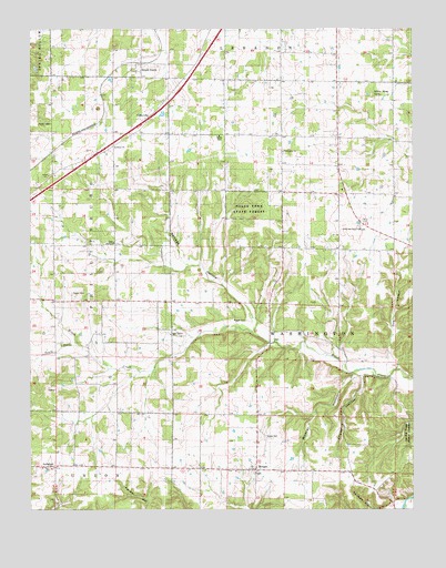
Brush Creek, MO USGS Topographic Map
Click on map above to begin viewing in our Map Viewer.

This topographic map contains these locations and features:
Feature Name Type Latitude Longitude GNIS ID View Map
Bear Thicket ChurchChurchN37.5456°W92.7043°713826View Map
Bear Thicket SchoolSchoolN37.5470°W92.7088°741520View Map
Brush CreekPopulated PlaceN37.6162°W92.7135°714821View Map
Brush Creek ChurchChurchN37.6128°W92.7146°735027View Map
Builderback CemeteryCemeteryN37.5111°W92.7424°715021View Map
CaffeyvillePopulated PlaceN37.6020°W92.7124°715181View Map
Churchill HollowValleyN37.5348°W92.6418°715848View Map
Dog HollowValleyN37.5392°W92.6329°716958View Map
Dry and Dusty SchoolSchoolN37.5912°W92.7135°741519View Map
Ecklund Lake DamDamN37.6034°W92.7068°765395View Map
Kissee CemeteryCemeteryN37.5564°W92.7363°720651View Map
Lebanon I-44 SpeedwayLocaleN37.5978°W92.6755°1829047View Map
Liberty ChurchChurchN37.5945°W92.7224°720975View Map
MorganPopulated PlaceN37.5103°W92.6766°722607View Map
Morgan School (historical)SchoolN37.5098°W92.6643°735028View Map
Pisgah CemeteryCemeteryN37.5492°W92.6799°724435View Map
Roper CemeteryCemeteryN37.5192°W92.6738°725553View Map
Salem ChurchChurchN37.5695°W92.7227°725933View Map
Santiago SchoolSchoolN37.5106°W92.7118°741523View Map
Selvage HollowValleyN37.5495°W92.6771°726197View Map
Silver Mine SinkBasinN37.6081°W92.6399°726455View Map
South Fork Brush CreekStreamN37.5439°W92.7357°736188View Map
Township of UnionCivilN37.5058°W92.7260°766868View Map
Upper Odell SchoolSchoolN37.5448°W92.6588°741522View Map
Washington ChurchChurchN37.5934°W92.6674°728373View Map
Washington SchoolSchoolN37.5889°W92.6596°741521View Map
White Oak Pond CemeteryCemeteryN37.5722°W92.6424°2702396View Map
White Oak Pond ChurchChurchN37.5731°W92.6424°728755View Map
Wildcat HollowValleyN37.5356°W92.6449°728839View Map

Note: Coordinates in the location and feature list above are referenced to NAD83 datum.


Copyright (C) 2008-2024 Ryan Niemi / Sunset Dynamics ... All Rights Reserved