TopoQuest Logo
Do you find TopoQuest useful?
Help keep TopoQuest running and adding new maps/features by donating!
Bitcoin:  19c7KJd3qBynnjoSw5npx9KScwjBe4ifkT
Litecoin:  LXs6TkuXGGXo1vDsWCkWVdjQX94eUKd6ui
Home View Maps Find Maps Find Places Resources & Links


Oakland, Missouri Topographic Map

USGS Map Title: Oakland, MO
USGS Map MRC: 37092F5
DRG (GeoTIFF) Download: o37092f5.tif


Neighboring USGS Topographic Map Quads:


  Eldridge East, MO  
37092G6
 

  Stoutland, MO  
37092G5
 

  Richland, MO  
37092G4
 

  Lebanon, MO  
37092F6
 

  Oakland, MO  
37092F5
 

  Drynob, MO  
37092F4
 

  Brush Creek, MO  
37092E6
 

  Russ, MO  
37092E5
 

  Drew, MO  
37092E4


Map MRC Location:

N38°
W93°
N38°
W92°
H8 H7 H6 H5 H4 H3 H2 H1
G8 G7 G6 G5 G4 G3 G2 G1
F8 F7 F6 F5 F4 F3 F2 F1
E8 E7 E6 E5 E4 E3 E2 E1
D8 D7 D6 D5 D4 D3 D2 D1
C8 C7 C6 C5 C4 C3 C2 C1
B8 B7 B6 B5 B4 B3 B2 B1
A8 A7 A6 A5 A4 A3 A2 A1
N37°
W93°
N37°
W92°

Oakland, MO USGS 1:24K Topographic Map Preview:
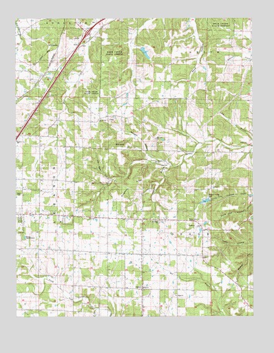
Oakland, MO USGS Topographic Map
Click on map above to begin viewing in our Map Viewer.

This topographic map contains these locations and features:
Feature Name Type Latitude Longitude GNIS ID View Map
Abbott HollowValleyN37.6878°W92.5424°713121View Map
Antioch ChurchChurchN37.6367°W92.5591°713342View Map
Bacon SchoolSchoolN37.6278°W92.5996°741526View Map
Bear Creek School (historical)SchoolN37.7478°W92.5663°741532View Map
Bear Creek State ForestForestN37.7353°W92.5732°735475View Map
Bee Branch SchoolSchoolN37.6289°W92.5027°741528View Map
Carrol JunctionPopulated PlaceN37.7387°W92.6018°740724View Map
Cook SchoolSchoolN37.7000°W92.6027°741531View Map
Dalton School (historical)SchoolN37.6259°W92.5493°741527View Map
Detherage ChurchChurchN37.6650°W92.5493°716853View Map
Detherage SchoolSchoolN37.6650°W92.5496°741529View Map
Hidden Valley LakeReservoirN37.6734°W92.5235°758289View Map
Hidden Valley Lake DamDamN37.6734°W92.5235°763832View Map
Jarrell CemeteryCemeteryN37.6973°W92.5032°720261View Map
Knob SchoolSchoolN37.6681°W92.6024°741530View Map
Laclede CountyCivilN37.6583°W92.5904°758507View Map
Lebanon Rural Fire Protection District Station 2BuildingN37.6683°W92.6085°2620819View Map
Lillard CemeteryCemeteryN37.6886°W92.5452°721053View Map
Marvin Church (historical)ChurchN37.7320°W92.6232°735023View Map
Mayfield School (historical)SchoolN37.7384°W92.6166°741525View Map
Mill Creek ChurchChurchN37.6998°W92.5507°722342View Map
Mill Creek SchoolSchoolN37.6998°W92.5510°741524View Map
Morgan HollowValleyN37.6903°W92.5471°722616View Map
Mount Olivette ChurchChurchN37.7070°W92.5805°722839View Map
OaklandPopulated PlaceN37.6364°W92.5593°723662View Map
Oakland ChurchChurchN37.6339°W92.5413°723671View Map
Pig Pen HollowValleyN37.6825°W92.5743°724325View Map
Ridgewood Post OfficePost OfficeN37.7189°W92.5235°760003View Map
RidgewoodsLocaleN37.7189°W92.5235°740509View Map
Rock SpringSpringN37.6970°W92.5725°725469View Map
Singleton RidgeRidgeN37.6803°W92.5646°726481View Map
South Fork North Cobb CreekStreamN37.6284°W92.5830°726747View Map
Thomas ChapelChurchN37.6653°W92.5313°727583View Map
Wilderness LakeReservoirN37.7362°W92.5572°764733View Map
Wilderness Lake DamDamN37.7367°W92.5585°764732View Map

Note: Coordinates in the location and feature list above are referenced to NAD83 datum.


Copyright (C) 2008-2024 Ryan Niemi / Sunset Dynamics ... All Rights Reserved