TopoQuest Logo
Do you find TopoQuest useful?
Help keep TopoQuest running and adding new maps/features by donating!
Bitcoin:  19c7KJd3qBynnjoSw5npx9KScwjBe4ifkT
Litecoin:  LXs6TkuXGGXo1vDsWCkWVdjQX94eUKd6ui
Home View Maps Find Maps Find Places Resources & Links


Burnville, Arkansas Topographic Map

USGS Map Title: Burnville, AR
USGS Map MRC: 35094B2
DRG (GeoTIFF) Download: o35094b2.tif


Neighboring USGS Topographic Map Quads:


  Barling, AR  
35094C3
 

  Lavaca, AR  
35094C2
 

  Charleston, AR  
35094C1
 

  Greenwood, AR  
35094B3
 

  Burnville, AR  
35094B2
 

  Barber, AR  
35094B1
 

  Huntington, AR  
35094A3
 

  Abbott, AR  
35094A2
 

  Ione, AR  
35094A1


Map MRC Location:

N36°
W95°
N36°
W94°
H8 H7 H6 H5 H4 H3 H2 H1
G8 G7 G6 G5 G4 G3 G2 G1
F8 F7 F6 F5 F4 F3 F2 F1
E8 E7 E6 E5 E4 E3 E2 E1
D8 D7 D6 D5 D4 D3 D2 D1
C8 C7 C6 C5 C4 C3 C2 C1
B8 B7 B6 B5 B4 B3 B2 B1
A8 A7 A6 A5 A4 A3 A2 A1
N35°
W95°
N35°
W94°

Burnville, AR USGS 1:24K Topographic Map Preview:
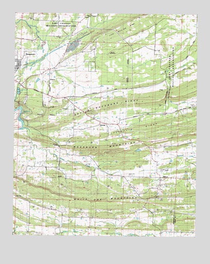
Burnville, AR USGS Topographic Map
Click on map above to begin viewing in our Map Viewer.

This topographic map contains these locations and features:
Feature Name Type Latitude Longitude GNIS ID View Map
Arkansas Noname 212 DamDamN35.1684°W94.1585°80698View Map
Big Creek NarrowsCliffN35.2059°W94.1444°46548View Map
Bragg Gas FieldOilfieldN35.1729°W94.1563°67200View Map
BurnvillePopulated PlaceN35.1887°W94.1891°57475View Map
Burnville Baptist ChurchChurchN35.1879°W94.1788°67202View Map
Burnville SchoolSchoolN35.1881°W94.1791°47213View Map
CarnisPopulated PlaceN35.2481°W94.2030°57513View Map
City of GreenwoodCivilN35.2136°W94.2409°2403755View Map
Clarks ChapelChurchN35.1465°W94.2488°56706View Map
Dawson Memorial CemeteryCemeteryN35.1587°W94.1708°76753View Map
East Hills Middle SchoolSchoolN35.2045°W94.2384°2039146View Map
East Pointe Elementary SchoolSchoolN35.2046°W94.2384°2039147View Map
Fidelity (historical)Populated PlaceN35.2334°W94.2133°67212View Map
Greenwood CemeteryCemeteryN35.2184°W94.2471°83600View Map
Greenwood LakeLakeN35.1877°W94.2449°75242View Map
Greenwood Rural Fire DepartmentBuildingN35.2115°W94.2439°2116507View Map
Heartsill CreekStreamN35.2140°W94.2466°56719View Map
KEZU-FM (Booneville)TowerN35.1837°W94.1291°85369View Map
Liberty CemeteryCemeteryN35.2179°W94.2252°56704View Map
Liberty ChurchLocaleN35.2195°W94.2285°51111View Map
Little White Oak RidgeRidgeN35.2445°W94.1769°51340View Map
Lone Star CemeteryCemeteryN35.1981°W94.1263°83605View Map
Mc Connel CemeteryCemeteryN35.2370°W94.2188°56705View Map
MilltownPopulated PlaceN35.1570°W94.1497°58191View Map
Milltown BridgeBridgeN35.1587°W94.1763°67244View Map
Milltown ChurchChurchN35.1465°W94.1530°56707View Map
Milltown Washburn Fire StationBuildingN35.1565°W94.1492°2116799View Map
Mount Harmony Baptist ChurchChurchN35.1759°W94.2369°78848View Map
Oak View FarmLocaleN35.1904°W94.1916°52946View Map
Pinnacle RidgeRidgeN35.1909°W94.1369°53501View Map
Stone CemeteryCemeteryN35.2062°W94.1319°56703View Map
Township of Bates (historical)CivilN35.2334°W94.1266°67192View Map
Township of CenterCivilN35.1958°W94.2439°69104View Map
Township of Eagle (historical)CivilN35.1959°W94.1335°67206View Map
Township of White OakCivilN35.1588°W94.1600°69121View Map
Vineyard CreekStreamN35.1851°W94.2441°55922View Map
Washburn MountainsRidgeN35.1893°W94.1299°56074View Map
White Oak MountainsRidgeN35.1451°W94.1652°56292View Map

Note: Coordinates in the location and feature list above are referenced to NAD83 datum.


Copyright (C) 2008-2024 Ryan Niemi / Sunset Dynamics ... All Rights Reserved