TopoQuest Logo
Do you find TopoQuest useful?
Help keep TopoQuest running and adding new maps/features by donating!
Bitcoin:  19c7KJd3qBynnjoSw5npx9KScwjBe4ifkT
Litecoin:  LXs6TkuXGGXo1vDsWCkWVdjQX94eUKd6ui
Home View Maps Find Maps Find Places Resources & Links


Blakeslee, Ohio Topographic Map

USGS Map Title: Blakeslee, OH
USGS Map MRC: 41084E6
DRG (GeoTIFF) Download: o41084e6.tif


Neighboring USGS Topographic Map Quads:


  Clear Lake, IN  
41084F7
 

  Nettle Lake, OH  
41084F6
 

  Pioneer, OH  
41084F5
 

  Edon, OH  
41084E7
 

  Blakeslee, OH  
41084E6
 

  Montpelier, OH  
41084E5
 

  Butler East, IN  
41084D7
 

  Edgerton, OH  
41084D6
 

  Bryan, OH  
41084D5


Map MRC Location:

N42°
W85°
N42°
W84°
H8 H7 H6 H5 H4 H3 H2 H1
G8 G7 G6 G5 G4 G3 G2 G1
F8 F7 F6 F5 F4 F3 F2 F1
E8 E7 E6 E5 E4 E3 E2 E1
D8 D7 D6 D5 D4 D3 D2 D1
C8 C7 C6 C5 C4 C3 C2 C1
B8 B7 B6 B5 B4 B3 B2 B1
A8 A7 A6 A5 A4 A3 A2 A1
N41°
W85°
N41°
W84°

Blakeslee, OH USGS 1:24K Topographic Map Preview:
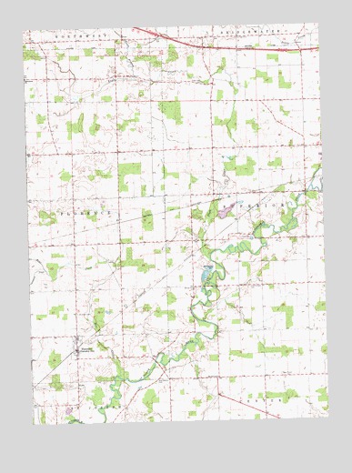
Blakeslee, OH USGS Topographic Map
Click on map above to begin viewing in our Map Viewer.

This topographic map contains these locations and features:
Feature Name Type Latitude Longitude GNIS ID View Map
Bear CreekStreamN41.5145°W84.7141°430617View Map
Bethlehem Christian Union ChurchChurchN41.6095°W84.7497°1064433View Map
BlakesleePopulated PlaceN41.5242°W84.7302°1064447View Map
Bratton School (historical)SchoolN41.5570°W84.7113°1069581View Map
Browns Recreation LakeReservoirN41.5660°W84.6662°1078280View Map
Browns Recreation Lake DamDamN41.5667°W84.6700°1078279View Map
Creek FarmsLocaleN41.6019°W84.6447°2706146View Map
Eagle CreekStreamN41.5514°W84.6738°1039918View Map
Eagle Creek CemeteryCemeteryN41.6212°W84.6613°1039921View Map
Farm Service Agency Interest of OhioParkN41.6159°W84.7348°2776749View Map
Fetter School (historical)SchoolN41.5562°W84.7494°1080871View Map
Hepker CemeteryCemeteryN41.5137°W84.6708°1806082View Map
Heritage CemeteryCemeteryN41.6211°W84.6604°1041497View Map
Marvin Thiel FieldAirportN41.5212°W84.7229°2442621View Map
Mount Olive ChurchChurchN41.5139°W84.6713°1043600View Map
North Branch Eagle CreekStreamN41.6092°W84.7052°1043916View Map
Saint Joseph Catholic ChurchChurchN41.5276°W84.7300°1063671View Map
Saint Joseph CemeteryCemeteryN41.5348°W84.7300°1045561View Map
Saint Joseph SchoolSchoolN41.5270°W84.7300°1063672View Map
School Number 1 (historical)SchoolN41.6062°W84.7108°1080869View Map
School Number 10 (historical)SchoolN41.6023°W84.6716°1080864View Map
School Number 11 (historical)SchoolN41.5273°W84.7497°1080873View Map
School Number 12 (historical)SchoolN41.5276°W84.7108°1080872View Map
School Number 3 (historical)SchoolN41.5139°W84.6919°1080867View Map
School Number 4 (historical)SchoolN41.6014°W84.6330°1080859View Map
School Number 5 (historical)SchoolN41.5576°W84.6319°1080860View Map
School Number 6 (historical)SchoolN41.5278°W84.6311°1080861View Map
School Number 6 (historical)SchoolN41.5853°W84.7108°1080870View Map
School Number 7 (historical)SchoolN41.5284°W84.6608°1080862View Map
School Number 8 (historical)SchoolN41.5426°W84.6802°1080866View Map
School Number 9 (historical)SchoolN41.6212°W84.6702°1080863View Map
School Number 9 (historical)SchoolN41.5717°W84.6716°1080865View Map
Township of FlorenceCivilN41.5661°W84.7485°1087169View Map
Township of SuperiorCivilN41.5649°W84.6349°1087177View Map
Union Chapel CemeteryCemeteryN41.5425°W84.6567°1047308View Map
Union CornersLocaleN41.6098°W84.7116°1080868View Map
Village of BlakesleeCivilN41.5242°W84.7311°2398130View Map
West Buffalo (historical)Populated PlaceN41.5159°W84.6941°1063675View Map
West Buffalo CemeteryCemeteryN41.5137°W84.6955°1047741View Map
West Woodly AdditionPopulated PlaceN41.5873°W84.6380°1055274View Map

Note: Coordinates in the location and feature list above are referenced to NAD83 datum.


Copyright (C) 2008-2024 Ryan Niemi / Sunset Dynamics ... All Rights Reserved