TopoQuest Logo
Do you find TopoQuest useful?
Help keep TopoQuest running and adding new maps/features by donating!
Bitcoin:  19c7KJd3qBynnjoSw5npx9KScwjBe4ifkT
Litecoin:  LXs6TkuXGGXo1vDsWCkWVdjQX94eUKd6ui
Home View Maps Find Maps Find Places Resources & Links


Cedar Vista, Missouri Topographic Map

USGS Map Title: Cedar Vista, MO
USGS Map MRC: 37093E3
DRG (GeoTIFF) Download: o37093e3.tif


Neighboring USGS Topographic Map Quads:


  Cliquot, MO  
37093F4
 

  Polk, MO  
37093F3
 

  Buffalo NW, MO  
37093F2
 

  Bolivar, MO  
37093E4
 

  Cedar Vista, MO  
37093E3
 

  Halfway, MO  
37093E2
 

  Morrisville, MO  
37093D4
 

  Pleasant Hope, MO  
37093D3
 

  Fair Grove, MO  
37093D2


Map MRC Location:

N38°
W94°
N38°
W93°
H8 H7 H6 H5 H4 H3 H2 H1
G8 G7 G6 G5 G4 G3 G2 G1
F8 F7 F6 F5 F4 F3 F2 F1
E8 E7 E6 E5 E4 E3 E2 E1
D8 D7 D6 D5 D4 D3 D2 D1
C8 C7 C6 C5 C4 C3 C2 C1
B8 B7 B6 B5 B4 B3 B2 B1
A8 A7 A6 A5 A4 A3 A2 A1
N37°
W94°
N37°
W93°

Cedar Vista, MO USGS 1:24K Topographic Map Preview:
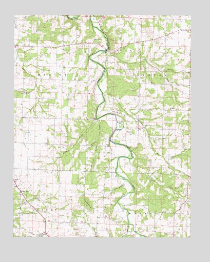
Cedar Vista, MO USGS Topographic Map
Click on map above to begin viewing in our Map Viewer.

This topographic map contains these locations and features:
Feature Name Type Latitude Longitude GNIS ID View Map
Bolivar Municipal AirportAirportN37.5983°W93.3495°2679301View Map
Brushy CreekStreamN37.5928°W93.2702°737894View Map
BurnsPopulated PlaceN37.6048°W93.3091°715084View Map
Cedar VistaPopulated PlaceN37.5259°W93.3702°715620View Map
Cherryvale School (historical)SchoolN37.5878°W93.3405°732768View Map
Deer CreekStreamN37.5809°W93.3121°737900View Map
Graveyard HillSummitN37.5178°W93.3224°718755View Map
Half Way ChurchChurchN37.6164°W93.2530°718997View Map
Hawk Lake DamDamN37.5950°W93.3569°765149View Map
Kilburn BranchStreamN37.5662°W93.3166°720576View Map
Leith School (historical)SchoolN37.5598°W93.3663°732769View Map
McKinney BranchStreamN37.5664°W93.3169°735717View Map
McKinney School (historical)SchoolN37.6067°W93.2988°732772View Map
Mount Gilead ChurchChurchN37.5809°W93.3671°722751View Map
New Bethel ChurchChurchN37.5717°W93.2655°723185View Map
New Bethel School (historical)SchoolN37.5712°W93.2602°732773View Map
North Deer CreekStreamN37.5445°W93.2685°737908View Map
Owens Lake Section 8 DamDamN37.5217°W93.3652°763124View Map
Pleasant Hill ChurchChurchN37.6112°W93.3188°724530View Map
Providence ChurchChurchN37.5017°W93.2616°724970View Map
Providence School (historical)SchoolN37.5048°W93.2616°732778View Map
Ralph Brooks DamDamN37.5000°W93.3469°762970View Map
Ratcliff School (historical)SchoolN37.6150°W93.2624°732771View Map
Schultz CreekStreamN37.5442°W93.2932°737914View Map
Slagle ChurchChurchN37.5123°W93.3702°726525View Map
Slagle School (historical)SchoolN37.5120°W93.3702°732770View Map
Steinshouer BranchStreamN37.5539°W93.3163°727062View Map
SunsetPopulated PlaceN37.5512°W93.3077°732779View Map
Sunset BridgeBridgeN37.5545°W93.3071°755421View Map
Sunset ChurchChurchN37.5514°W93.3082°727325View Map
Sunset School (historical)SchoolN37.5520°W93.3235°732775View Map
Sycamore CreekStreamN37.5070°W93.2938°727411View Map
Township of Southeast MarionCivilN37.5767°W93.3612°767225View Map
VanPopulated PlaceN37.5614°W93.2871°728109View Map
Van School (historical)SchoolN37.5612°W93.2888°732774View Map
Wells School (historical)SchoolN37.5356°W93.2580°732776View Map
Whitman BranchStreamN37.5325°W93.2971°728797View Map
Wilmington School (historical)SchoolN37.6109°W93.3408°732767View Map
Wilson School (historical)SchoolN37.5114°W93.3160°732777View Map
Wolf CreekStreamN37.6048°W93.3113°737916View Map
Woodmansey FordLocaleN37.5667°W93.3169°729116View Map

Note: Coordinates in the location and feature list above are referenced to NAD83 datum.


Copyright (C) 2008-2024 Ryan Niemi / Sunset Dynamics ... All Rights Reserved