TopoQuest Logo
Do you find TopoQuest useful?
Help keep TopoQuest running and adding new maps/features by donating!
Bitcoin:  19c7KJd3qBynnjoSw5npx9KScwjBe4ifkT
Litecoin:  LXs6TkuXGGXo1vDsWCkWVdjQX94eUKd6ui
Home View Maps Find Maps Find Places Resources & Links


Glenbrook, Oregon Topographic Map

USGS Map Title: Glenbrook, OR
USGS Map MRC: 44123C4
DRG (GeoTIFF) Download: o44123c4.tif


Neighboring USGS Topographic Map Quads:


  Alsea, OR  
44123D5
 

  Flat Mountain, OR  
44123D4
 

  Greenberry, OR  
44123D3
 

  Prairie Peak, OR  
44123C5
 

  Glenbrook, OR  
44123C4
 

  Monroe, OR  
44123C3
 

  Triangle Lake, OR  
44123B5
 

  Horton, OR  
44123B4
 

  Cheshire, OR  
44123B3


Map MRC Location:

N45°
W124°
N45°
W123°
H8 H7 H6 H5 H4 H3 H2 H1
G8 G7 G6 G5 G4 G3 G2 G1
F8 F7 F6 F5 F4 F3 F2 F1
E8 E7 E6 E5 E4 E3 E2 E1
D8 D7 D6 D5 D4 D3 D2 D1
C8 C7 C6 C5 C4 C3 C2 C1
B8 B7 B6 B5 B4 B3 B2 B1
A8 A7 A6 A5 A4 A3 A2 A1
N44°
W124°
N44°
W123°

Glenbrook, OR USGS 1:24K Topographic Map Preview:
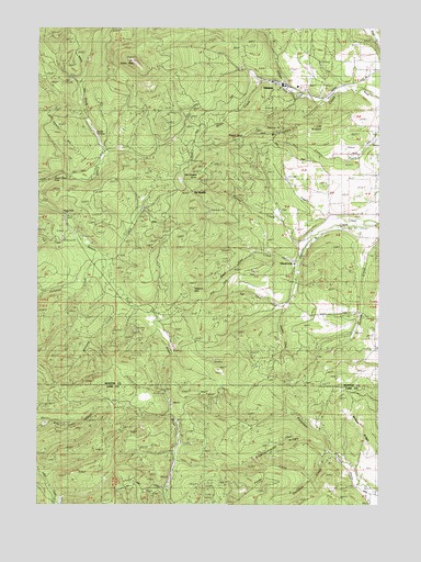
Glenbrook, OR USGS Topographic Map
Click on map above to begin viewing in our Map Viewer.

This topographic map contains these locations and features:
Feature Name Type Latitude Longitude GNIS ID View Map
Alsea FallsFallsN44.3264°W123.4918°1130736View Map
Alsea Falls Recreation SiteParkN44.3205°W123.4840°1130735View Map
Bellfountain County ParkParkN44.3654°W123.3751°1117499View Map
Cebu (historical)LocaleN44.3582°W123.3957°1166751View Map
Cedar SwampSwampN44.3429°W123.4832°1130734View Map
Coleman CreekStreamN44.3165°W123.4784°1134173View Map
Davidson CreekStreamN44.2640°W123.3945°1134174View Map
DawsonLocaleN44.3607°W123.4118°1166638View Map
Eisenschmidt RidgeRidgeN44.2665°W123.4134°1134176View Map
Fall CreekStreamN44.3215°W123.4870°1141983View Map
Gardner CreekStreamN44.3012°W123.4112°1134170View Map
GlenbrookPopulated PlaceN44.3137°W123.4065°1136319View Map
Glenbrook Log PondSwampN44.3109°W123.4061°1130726View Map
Glenbrook Post Office (historical)Post OfficeN44.3137°W123.4065°1165313View Map
Green PeakSummitN44.3660°W123.4659°1121390View Map
Green Peak FallsFallsN44.3358°W123.4945°1134167View Map
Howell CreekStreamN44.3157°W123.4179°1130730View Map
Hull-Oakes Log PondReservoirN44.3605°W123.4137°1130728View Map
Jacksons Mill (historical)LocaleN44.3221°W123.3965°1166238View Map
McCloskey KnobSummitN44.3368°W123.4257°1134168View Map
McCloskey RidgeRidgeN44.3490°W123.4073°1134165View Map
McCready (historical)LocaleN44.3610°W123.4184°1166590View Map
Miller CreekStreamN44.3590°W123.4104°1134166View Map
Minert RidgeRidgeN44.2707°W123.3823°1134177View Map
Munsey (historical)LocaleN44.3229°W123.3801°1166239View Map
Nye CreekStreamN44.3021°W123.4112°1134171View Map
Owl CreekStreamN44.2623°W123.3901°1130724View Map
Pitney CreekStreamN44.2568°W123.4009°1134175View Map
Rambo CreekStreamN44.3207°W123.4001°1158433View Map
Rambo ReservoirReservoirN44.3270°W123.4126°1130729View Map
Sims (historical)LocaleN44.3601°W123.3873°1166592View Map
Skinner (historical)LocaleN44.3201°W123.3990°1166240View Map
The SaddleGapN44.3318°W123.4445°1134169View Map
Wagon WheelSummitN44.3451°W123.4290°1134164View Map
Walters MountainSummitN44.3071°W123.4437°1134172View Map
Weaver CreekStreamN44.3140°W123.4045°1130727View Map
Williams CreekStreamN44.3065°W123.4704°1129113View Map

Note: Coordinates in the location and feature list above are referenced to NAD83 datum.


Copyright (C) 2008-2024 Ryan Niemi / Sunset Dynamics ... All Rights Reserved