TopoQuest Logo
Do you find TopoQuest useful?
Help keep TopoQuest running and adding new maps/features by donating!
Bitcoin:  19c7KJd3qBynnjoSw5npx9KScwjBe4ifkT
Litecoin:  LXs6TkuXGGXo1vDsWCkWVdjQX94eUKd6ui
Home View Maps Find Maps Find Places Resources & Links


Rogers, Texas Topographic Map

USGS Map Title: Rogers, TX
USGS Map MRC: 30097H2
DRG (GeoTIFF) Download: o30097h2.tif


Neighboring USGS Topographic Map Quads:


  Temple, TX  
31097A3
 

  Seaton, TX  
31097A2
 

  Westphalia, TX  
31097A1
 

  Little River, TX  
30097H3
 

  Rogers, TX  
30097H2
 

  Yarrelton, TX  
30097H1
 

  Davilla, TX  
30097G3
 

  Sharp, TX  
30097G2
 

  Pettibone, TX  
30097G1


Map MRC Location:

N31°
W98°
N31°
W97°
H8 H7 H6 H5 H4 H3 H2 H1
G8 G7 G6 G5 G4 G3 G2 G1
F8 F7 F6 F5 F4 F3 F2 F1
E8 E7 E6 E5 E4 E3 E2 E1
D8 D7 D6 D5 D4 D3 D2 D1
C8 C7 C6 C5 C4 C3 C2 C1
B8 B7 B6 B5 B4 B3 B2 B1
A8 A7 A6 A5 A4 A3 A2 A1
N30°
W98°
N30°
W97°

Rogers, TX USGS 1:24K Topographic Map Preview:
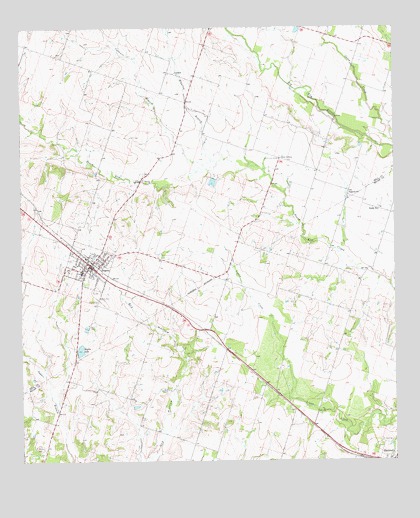
Rogers, TX USGS Topographic Map
Click on map above to begin viewing in our Map Viewer.

This topographic map contains these locations and features:
Feature Name Type Latitude Longitude GNIS ID View Map
BowersPopulated PlaceN30.9119°W97.1861°2034627View Map
Buckholts DivisionCivilN30.8953°W97.1269°1938576View Map
Burke SchoolSchoolN30.9349°W97.2247°1353323View Map
Cubhunt BranchStreamN30.9605°W97.1886°1373306View Map
EdgeworthPopulated PlaceN30.9516°W97.1405°1379702View Map
Hope CemeteryCemeteryN30.8807°W97.1300°1359534View Map
LeedalePopulated PlaceN30.9866°W97.1981°1380073View Map
McCann CemeteryCemeteryN30.8794°W97.2458°1362372View Map
New ColonyPopulated PlaceN30.9621°W97.1630°1380246View Map
Prewitt Lake 3ReservoirN30.9628°W97.2468°1858891View Map
Prewitt Lake 3 DamDamN30.9635°W97.2453°1858890View Map
RogersPopulated PlaceN30.9316°W97.2267°1366825View Map
Rogers CemeteryCemeteryN30.9221°W97.2247°1366826View Map
Rogers Elementary SchoolSchoolN30.9250°W97.2250°2002864View Map
Rogers High SchoolSchoolN30.9297°W97.2300°2002865View Map
Rogers LakeReservoirN30.9075°W97.2304°1858895View Map
Rogers Lake DamDamN30.9069°W97.2319°1858894View Map
Rogers Middle SchoolSchoolN30.9292°W97.2301°2002866View Map
Rogers Police DepartmentBuildingN30.9320°W97.2270°2739277View Map
Rogers Post OfficePost OfficeN30.9335°W97.2288°2731850View Map
Rogers Volunteer Fire Department First RespondersBuildingN30.9321°W97.2272°2552421View Map
South ElmPopulated PlaceN30.9474°W97.1303°1380575View Map
Taplin View CemeteryCemeteryN30.8925°W97.2365°2041895View Map
Town of RogersCivilN30.9299°W97.2289°2412570View Map
Whatley BranchStreamN30.9616°W97.1856°1371321View Map
Wolfe FieldAirportN30.9080°W97.1721°2676575View Map
Zane LakeReservoirN30.9555°W97.1859°1865212View Map
Zane Lake DamDamN30.9569°W97.1853°1865211View Map

Note: Coordinates in the location and feature list above are referenced to NAD83 datum.


Copyright (C) 2008-2024 Ryan Niemi / Sunset Dynamics ... All Rights Reserved