TopoQuest Logo
Do you find TopoQuest useful?
Help keep TopoQuest running and adding new maps/features by donating!
Bitcoin:  19c7KJd3qBynnjoSw5npx9KScwjBe4ifkT
Litecoin:  LXs6TkuXGGXo1vDsWCkWVdjQX94eUKd6ui
Home View Maps Find Maps Find Places Resources & Links


Alvada, Ohio Topographic Map

USGS Map Title: Alvada, OH
USGS Map MRC: 41083A4
DRG (GeoTIFF) Download: o41083a4.tif


Neighboring USGS Topographic Map Quads:


  Bloomdale, OH  
41083B5
 

  Fostoria, OH  
41083B4
 

  Bascom, OH  
41083B3
 

  Arcadia, OH  
41083A5
 

  Alvada, OH  
41083A4
 

  New Riegel, OH  
41083A3
 

  Mount Blanchard, OH  
40083H5
 

  Carey, OH  
40083H4
 

  McCutchenville, OH  
40083H3


Map MRC Location:

N42°
W84°
N42°
W83°
H8 H7 H6 H5 H4 H3 H2 H1
G8 G7 G6 G5 G4 G3 G2 G1
F8 F7 F6 F5 F4 F3 F2 F1
E8 E7 E6 E5 E4 E3 E2 E1
D8 D7 D6 D5 D4 D3 D2 D1
C8 C7 C6 C5 C4 C3 C2 C1
B8 B7 B6 B5 B4 B3 B2 B1
A8 A7 A6 A5 A4 A3 A2 A1
N41°
W84°
N41°
W83°

Alvada, OH USGS 1:24K Topographic Map Preview:
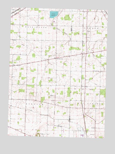
Alvada, OH USGS Topographic Map
Click on map above to begin viewing in our Map Viewer.

This topographic map contains these locations and features:
Feature Name Type Latitude Longitude GNIS ID View Map
AlvadaPopulated PlaceN41.0503°W83.4019°1064317View Map
Alvada Post OfficePost OfficeN41.0501°W83.4013°2045559View Map
Big Spring CemeteryCemeteryN41.0034°W83.3874°1038039View Map
Biglick CemeteryCemeteryN41.0356°W83.4410°1038047View Map
Diebleys AirportAirportN41.0847°W83.4363°1082691View Map
Enon Valley CemeteryCemeteryN41.0684°W83.4908°1700889View Map
Enon Valley ChurchChurchN41.0687°W83.4902°1065999View Map
Ewing CemeteryCemeteryN41.0574°W83.4963°1040291View Map
Fostoria ReservoirReservoirN41.1194°W83.4449°1078988View Map
Fostoria Upground Reservoir DamDamN41.1184°W83.4449°1078987View Map
German Baptist ChurchChurchN41.0106°W83.4305°1066015View Map
Graham CemeteryCemeteryN41.0403°W83.4471°1041019View Map
Hickory Grove CemeteryCemeteryN41.0028°W83.4533°1041525View Map
Lakeland Golf CourseLocaleN41.1103°W83.4430°1054441View Map
Saint Peters CemeteryCemeteryN41.0656°W83.3844°1730831View Map
Saints Peter and Paul ChurchChurchN41.0653°W83.3852°1057998View Map
Sheller CemeteryCemeteryN41.0981°W83.4024°1046175View Map
SpringvillePopulated PlaceN41.0098°W83.3866°1049204View Map
Springville Marsh State Natural AreaParkN41.0014°W83.4027°1079616View Map
Springville Post Office (historical)Post OfficeN41.0098°W83.3860°2045512View Map
Stone AirportAirportN41.0027°W83.4281°1082457View Map
Sunny Farms LandfillLocaleN41.0986°W83.4106°2635452View Map
The OutletCanalN41.0176°W83.4369°1066232View Map
Township of BiglickCivilN41.0355°W83.4779°1086240View Map
Township of WashingtonCivilN41.1227°W83.4781°1086255View Map
Union CemeteryCemeteryN41.0748°W83.4540°1047292View Map
WBVI-FM (Fostoria)TowerN41.1003°W83.4780°1085358View Map
Wells Family CemeteryCemeteryN41.1225°W83.4786°1730823View Map
West IndependencePopulated PlaceN41.0767°W83.4410°1061739View Map
West Independence Post Office (historical)Post OfficeN41.0764°W83.4416°1992807View Map
Weston Airport (historical)AirportN41.0464°W83.4402°1082209View Map
WFOB-AM (Fostoria)TowerN41.1031°W83.3999°1085274View Map

Note: Coordinates in the location and feature list above are referenced to NAD83 datum.


Copyright (C) 2008-2024 Ryan Niemi / Sunset Dynamics ... All Rights Reserved