TopoQuest Logo
Do you find TopoQuest useful?
Help keep TopoQuest running and adding new maps/features by donating!
Bitcoin:  19c7KJd3qBynnjoSw5npx9KScwjBe4ifkT
Litecoin:  LXs6TkuXGGXo1vDsWCkWVdjQX94eUKd6ui
Home View Maps Find Maps Find Places Resources & Links


Colwell, Iowa Topographic Map

USGS Map Title: Colwell, IA
USGS Map MRC: 43092B5
DRG (GeoTIFF) Download: o43092b5.tif


Neighboring USGS Topographic Map Quads:


  New Haven, IA  
43092C6
 

  Riceville, IA  
43092C5
 

  Saratoga, IA  
43092C4
 

  Floyd, IA  
43092B6
 

  Colwell, IA  
43092B5
 

  Elma, IA  
43092B4
 

  Charles City, IA  
43092A6
 

  Bassett, IA  
43092A5
 

  Ionia, IA  
43092A4


Map MRC Location:

N44°
W93°
N44°
W92°
H8 H7 H6 H5 H4 H3 H2 H1
G8 G7 G6 G5 G4 G3 G2 G1
F8 F7 F6 F5 F4 F3 F2 F1
E8 E7 E6 E5 E4 E3 E2 E1
D8 D7 D6 D5 D4 D3 D2 D1
C8 C7 C6 C5 C4 C3 C2 C1
B8 B7 B6 B5 B4 B3 B2 B1
A8 A7 A6 A5 A4 A3 A2 A1
N43°
W93°
N43°
W92°

Colwell, IA USGS 1:24K Topographic Map Preview:
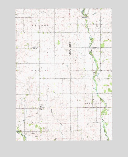
Colwell, IA USGS Topographic Map
Click on map above to begin viewing in our Map Viewer.

This topographic map contains these locations and features:
Feature Name Type Latitude Longitude GNIS ID View Map
Ackerson-Easterly Wildlife AreaParkN43.1611°W92.5099°1948524View Map
Beckwith CemeteryCemeteryN43.1318°W92.6049°454468View Map
City of ColwellCivilN43.1577°W92.5910°2393613View Map
ColwellPopulated PlaceN43.1558°W92.5941°455549View Map
Colwell (historical)LocaleN43.1555°W92.5941°1945285View Map
Colwell Community Volunteer Fire DepartmentBuildingN43.1562°W92.5913°2577211View Map
Colwell Cooperative ElevatorLocaleN43.1558°W92.5941°1945367View Map
Colwell Post Office (historical)Post OfficeN43.1558°W92.5941°1945286View Map
Colwell United Church of ChristChurchN43.1558°W92.5941°1945368View Map
Deerfield Wildlife AreaParkN43.1264°W92.5085°1948523View Map
Edna Pelz Wildlife AreaParkN43.1328°W92.6224°1945212View Map
Elma Wildlife AreaAreaN43.2461°W92.5368°464377View Map
Fix Wildlife AreaParkN43.1689°W92.5835°1945211View Map
Goodale ParkParkN43.1883°W92.5210°456960View Map
Merricks Pond Access Wildlife AreaParkN43.2444°W92.5196°1948702View Map
NilesvillePopulated PlaceN43.1405°W92.6135°464077View Map
Saint Cecilia ChurchChurchN43.2200°W92.5143°460961View Map
Saint Patricks CemeteryCemeteryN43.2198°W92.5153°1948766View Map
Township of NilesCivilN43.1271°W92.6119°468442View Map

Note: Coordinates in the location and feature list above are referenced to NAD83 datum.


Copyright (C) 2008-2024 Ryan Niemi / Sunset Dynamics ... All Rights Reserved