TopoQuest Logo
Do you find TopoQuest useful?
Help keep TopoQuest running and adding new maps/features by donating!
Bitcoin:  19c7KJd3qBynnjoSw5npx9KScwjBe4ifkT
Litecoin:  LXs6TkuXGGXo1vDsWCkWVdjQX94eUKd6ui
Home View Maps Find Maps Find Places Resources & Links


De Graff, Ohio Topographic Map

USGS Map Title: De Graff, OH
USGS Map MRC: 40083C8
DRG (GeoTIFF) Download: o40083c8.tif


Neighboring USGS Topographic Map Quads:


  Jackson Center, OH  
40084D1
 

  Russells Point, OH  
40083D8
 

  Huntsville, OH  
40083D7
 

  Port Jefferson, OH  
40084C1
 

  De Graff, OH  
40083C8
 

  Bellefontaine, OH  
40083C7
 

  Fletcher, OH  
40084B1
 

  Saint Paris, OH  
40083B8
 

  Northville, OH  
40083B7


Map MRC Location:

N41°
W84°
N41°
W83°
H8 H7 H6 H5 H4 H3 H2 H1
G8 G7 G6 G5 G4 G3 G2 G1
F8 F7 F6 F5 F4 F3 F2 F1
E8 E7 E6 E5 E4 E3 E2 E1
D8 D7 D6 D5 D4 D3 D2 D1
C8 C7 C6 C5 C4 C3 C2 C1
B8 B7 B6 B5 B4 B3 B2 B1
A8 A7 A6 A5 A4 A3 A2 A1
N40°
W84°
N40°
W83°

De Graff, OH USGS 1:24K Topographic Map Preview:
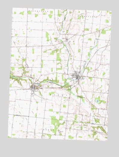
De Graff, OH USGS Topographic Map
Click on map above to begin viewing in our Map Viewer.

This topographic map contains these locations and features:
Feature Name Type Latitude Longitude GNIS ID View Map
Armstrong CemeteryCemeteryN40.3183°W83.9787°1037480View Map
Baughman School (historical)SchoolN40.2992°W83.9911°1055007View Map
Black LakeLakeN40.2881°W83.8890°1038077View Map
Black Lake School (historical)SchoolN40.2806°W83.8894°1055018View Map
Bokengehalas CreekStreamN40.3095°W83.9255°1065929View Map
Cost CemeteryCemeteryN40.2856°W83.9727°1039386View Map
Craig CemeteryCemeteryN40.2532°W83.8758°1961144View Map
De GraffPopulated PlaceN40.3120°W83.9158°1061018View Map
De Graff Baptist ChurchChurchN40.3120°W83.9144°1060788View Map
De Graff Branch Logan County District LibraryBuildingN40.3117°W83.9163°1806942View Map
De Graff Fire DepartmentBuildingN40.3102°W83.9150°2549876View Map
De Graff Post OfficePost OfficeN40.3126°W83.9152°2026281View Map
De Graff United Methodist ChurchChurchN40.3117°W83.9158°1060789View Map
DeGraff Police DepartmentBuildingN40.3097°W83.9150°2732737View Map
Graves CreekStreamN40.2798°W83.8966°1041081View Map
Greenwood CemeteryCemeteryN40.3187°W83.9144°1041168View Map
Hearst CemeteryCemeteryN40.2648°W83.9037°1041441View Map
Huber CemeteryCemeteryN40.3176°W83.8915°1041843View Map
Knight CemeteryCemeteryN40.3717°W83.9266°1042321View Map
Lee CreekStreamN40.2851°W83.9033°1042471View Map
LogansvillePopulated PlaceN40.3456°W83.9305°1061437View Map
Logansville CemeteryCemeteryN40.3489°W83.9297°1960460View Map
Logansville Community ChurchChurchN40.3462°W83.9285°1060801View Map
Loganville Post Office (historical)Post OfficeN40.3459°W83.9305°2026286View Map
Means CemeteryCemeteryN40.3269°W83.9275°1960462View Map
Miami Valley CampLocaleN40.3045°W83.9466°1043255View Map
Moores CemeteryCemeteryN40.3537°W83.9356°1960463View Map
Neals RunStreamN40.3212°W83.9283°1060803View Map
Newman CemeteryCemeteryN40.2747°W83.9261°1043861View Map
North Lake School (historical)SchoolN40.2964°W83.8941°1055054View Map
Olive Chapel CemeteryCemeteryN40.2753°W83.9252°1044164View Map
Pleasant View Mobile Home ParkPopulated PlaceN40.3169°W83.9133°2630934View Map
QuincyPopulated PlaceN40.2992°W83.9688°1044829View Map
Quincy - Miami Township Fire DepartmentBuildingN40.3003°W83.9687°2549869View Map
Quincy CemeteryCemeteryN40.3084°W83.9694°1044830View Map
Quincy Post OfficePost OfficeN40.2987°W83.9694°2026331View Map
Riverside Elementary SchoolSchoolN40.2995°W83.9710°1055061View Map
Riverside Emergency Medical ServicesBuildingN40.3100°W83.9164°2550733View Map
Riverside High SchoolSchoolN40.3134°W83.9197°1045056View Map
Rum CreekStreamN40.3737°W83.9316°1057974View Map
S and S FieldAirportN40.3009°W83.9751°1082976View Map
School Number 1 (historical)SchoolN40.3509°W83.9094°1055064View Map
School Number 2 (historical)SchoolN40.3245°W83.8955°1055069View Map
School Number 3 (historical)SchoolN40.3114°W83.9522°1055072View Map
School Number 4 (historical)SchoolN40.2809°W83.9252°1055077View Map
School Number 5 (historical)SchoolN40.2814°W83.9930°1055085View Map
School Number 5 (historical)SchoolN40.3206°W83.9894°1055083View Map
School Number 6 (historical)SchoolN40.3545°W83.9508°1055088View Map
School Number 7 (historical)SchoolN40.2884°W83.9535°1055093View Map
School Number 7 (historical)SchoolN40.3476°W83.9861°1069574View Map
School Number 9 (historical)SchoolN40.3620°W83.9844°1055099View Map
Shady Bowl SpeedwayLocaleN40.2578°W83.9358°1080190View Map
Stony CreekStreamN40.3048°W83.9291°1058049View Map
Township of MiamiCivilN40.2927°W83.9448°1086488View Map
Township of PleasantCivilN40.3411°W83.9382°1086491View Map
Village of De GraffCivilN40.3127°W83.9166°2398692View Map
Village of QuincyCivilN40.2956°W83.9687°2399032View Map
WDEQ-FM (De Graff)TowerN40.3134°W83.9183°1085348View Map

Note: Coordinates in the location and feature list above are referenced to NAD83 datum.


Copyright (C) 2008-2024 Ryan Niemi / Sunset Dynamics ... All Rights Reserved