TopoQuest Logo
Do you find TopoQuest useful?
Help keep TopoQuest running and adding new maps/features by donating!
Bitcoin:  19c7KJd3qBynnjoSw5npx9KScwjBe4ifkT
Litecoin:  LXs6TkuXGGXo1vDsWCkWVdjQX94eUKd6ui
Home View Maps Find Maps Find Places Resources & Links


Fletcher, Ohio Topographic Map

USGS Map Title: Fletcher, OH
USGS Map MRC: 40084B1
DRG (GeoTIFF) Download: o40084b1.tif


Neighboring USGS Topographic Map Quads:


  Sidney, OH  
40084C2
 

  Port Jefferson, OH  
40084C1
 

  De Graff, OH  
40083C8
 

  Piqua East, OH  
40084B2
 

  Fletcher, OH  
40084B1
 

  Saint Paris, OH  
40083B8
 

  Troy, OH  
40084A2
 

  Christiansburg, OH  
40084A1
 

  Thackery, OH  
40083A8


Map MRC Location:

N41°
W85°
N41°
W84°
H8 H7 H6 H5 H4 H3 H2 H1
G8 G7 G6 G5 G4 G3 G2 G1
F8 F7 F6 F5 F4 F3 F2 F1
E8 E7 E6 E5 E4 E3 E2 E1
D8 D7 D6 D5 D4 D3 D2 D1
C8 C7 C6 C5 C4 C3 C2 C1
B8 B7 B6 B5 B4 B3 B2 B1
A8 A7 A6 A5 A4 A3 A2 A1
N40°
W85°
N40°
W84°

Fletcher, OH USGS 1:24K Topographic Map Preview:
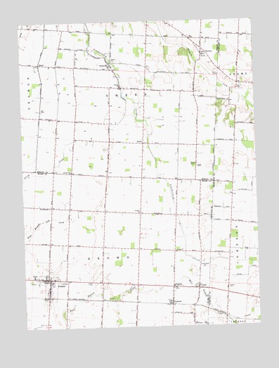
Fletcher, OH USGS Topographic Map
Click on map above to begin viewing in our Map Viewer.

This topographic map contains these locations and features:
Feature Name Type Latitude Longitude GNIS ID View Map
Alibi School (historical)SchoolN40.1751°W84.1197°1053952View Map
Anderson CemeteryCemeteryN40.1716°W84.0624°1037415View Map
BallouPopulated PlaceN40.1998°W84.0602°1062641View Map
Ballou Post Office (historical)Post OfficeN40.2001°W84.0597°2055281View Map
Charity ChapelChurchN40.1903°W84.0316°1038999View Map
ConoverPopulated PlaceN40.1353°W84.0463°1039318View Map
Conover Post OfficePost OfficeN40.1348°W84.0458°2037150View Map
DepewPopulated PlaceN40.2328°W84.1152°1064532View Map
Depew Post Office (historical)Post OfficeN40.2334°W84.1152°2055284View Map
Dorsey CemeteryCemeteryN40.1916°W84.0350°1039754View Map
Fairlawn SchoolSchoolN40.2239°W84.0727°1040315View Map
FletcherPopulated PlaceN40.1448°W84.1124°1048741View Map
Fletcher CemeteryCemeteryN40.1481°W84.1110°1069017View Map
Fletcher Elementary SchoolSchoolN40.1456°W84.1197°1081315View Map
Fletcher Post OfficePost OfficeN40.1445°W84.1124°2037154View Map
Fletcher Presbyterian Churchyard CemeteryCemeteryN40.1467°W84.1133°1963125View Map
Fletcher United Methodist ChurchChurchN40.1439°W84.1119°1066494View Map
Futura FarmsLocaleN40.1253°W84.0867°2723067View Map
Futureama FarmsLocaleN40.1550°W84.0797°2723068View Map
Gustin DitchCanalN40.1439°W84.1177°1041217View Map
Hageman (historical)Populated PlaceN40.2084°W84.0777°1063121View Map
Hill FarmsLocaleN40.1758°W84.1031°2723069View Map
Lake School (historical)SchoolN40.1723°W84.0811°1053990View Map
Leatherwood CemeteryCemeteryN40.1489°W84.0294°1042458View Map
Leatherwood School (historical)SchoolN40.1703°W84.0344°1053991View Map
LenaPopulated PlaceN40.1409°W84.0322°1070813View Map
Lena Baptist ChurchChurchN40.1414°W84.0341°1066496View Map
Lena Post Office (historical)Post OfficeN40.1403°W84.0319°2037066View Map
Miami East Junior High SchoolSchoolN40.1420°W84.0452°1080501View Map
Neal CemeteryCemeteryN40.2228°W84.0079°1043787View Map
New Hope School (historical)SchoolN40.1431°W84.0838°1053998View Map
Newton Presbyterian ChurchChurchN40.1464°W84.1136°1066493View Map
Pioneer CemeteryCemeteryN40.2336°W84.0761°1044486View Map
PlattsvillePopulated PlaceN40.2323°W84.0774°1049088View Map
Plattsville CemeteryCemeteryN40.2278°W84.0741°1731075View Map
Plattsville Post Office (historical)Post OfficeN40.2320°W84.0777°2055274View Map
Progress FarmsLocaleN40.1592°W84.1200°2710993View Map
R C T FarmLocaleN40.1731°W84.0756°2723070View Map
Roberts CemeteryCemeteryN40.1408°W84.0163°1045084View Map
Spring Creek ChurchChurchN40.1884°W84.0988°1046550View Map
Sturm CemeteryCemeteryN40.2279°W84.0191°1046785View Map
TawawaPopulated PlaceN40.2362°W84.0277°1061674View Map
Tawawa Post Office (historical)Post OfficeN40.2362°W84.0277°2055262View Map
Township of BrownCivilN40.1509°W84.0832°1086635View Map
Township of GreenCivilN40.2230°W84.0667°1086962View Map
Valentine (historical)Populated PlaceN40.2223°W84.0583°1063125View Map
Village of FletcherCivilN40.1418°W84.1119°2398885View Map

Note: Coordinates in the location and feature list above are referenced to NAD83 datum.


Copyright (C) 2008-2024 Ryan Niemi / Sunset Dynamics ... All Rights Reserved