TopoQuest Logo
Do you find TopoQuest useful?
Help keep TopoQuest running and adding new maps/features by donating!
Bitcoin:  19c7KJd3qBynnjoSw5npx9KScwjBe4ifkT
Litecoin:  LXs6TkuXGGXo1vDsWCkWVdjQX94eUKd6ui
Home View Maps Find Maps Find Places Resources & Links


Ding Dong, Texas Topographic Map

USGS Map Title: Ding Dong, TX
USGS Map MRC: 30097H7
DRG (GeoTIFF) Download: o30097h7.tif


Neighboring USGS Topographic Map Quads:


  Copperas Cove, TX  
31097A8
 

  McMillan Mountains, TX  
31097A7
 

  Killeen, TX  
31097A6
 

  Briggs, TX  
30097H8
 

  Ding Dong, TX  
30097H7
 

  Youngsport, TX  
30097H6
 

  Mahomet, TX  
30097G8
 

  Florence, TX  
30097G7
 

  Cobbs Cavern, TX  
30097G6


Map MRC Location:

N31°
W98°
N31°
W97°
H8 H7 H6 H5 H4 H3 H2 H1
G8 G7 G6 G5 G4 G3 G2 G1
F8 F7 F6 F5 F4 F3 F2 F1
E8 E7 E6 E5 E4 E3 E2 E1
D8 D7 D6 D5 D4 D3 D2 D1
C8 C7 C6 C5 C4 C3 C2 C1
B8 B7 B6 B5 B4 B3 B2 B1
A8 A7 A6 A5 A4 A3 A2 A1
N30°
W98°
N30°
W97°

Ding Dong, TX USGS 1:24K Topographic Map Preview:
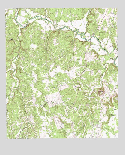
Ding Dong, TX USGS Topographic Map
Click on map above to begin viewing in our Map Viewer.

This topographic map contains these locations and features:
Feature Name Type Latitude Longitude GNIS ID View Map
Bennett BranchStreamN30.9771°W97.7947°1351880View Map
Ding DongPopulated PlaceN30.9818°W97.7711°2034698View Map
Ding DongPopulated PlaceN30.9738°W97.7775°1356032View Map
Fisher Ranch AirportAirportN30.9496°W97.7967°1387017View Map
Gann BranchStreamN30.9896°W97.8295°1357852View Map
Glover BranchStreamN30.9788°W97.8184°1358071View Map
Hog MountainSummitN30.9185°W97.7703°1359369View Map
Indian LakeLakeN30.9022°W97.7558°1359964View Map
MaxdalePopulated PlaceN30.9899°W97.8356°1380156View Map
Maxdale Community CenterLocaleN30.9880°W97.8195°1362310View Map
McDaniel BranchStreamN30.9243°W97.8631°1362413View Map
Mill CreekStreamN30.9838°W97.8575°1362870View Map
Reese CreekStreamN30.9746°W97.7870°1366310View Map
Rock Creek ChurchChurchN30.9507°W97.7545°1366654View Map
Rocky CreekStreamN30.9463°W97.7539°1366776View Map
Southwest Bell County Fire StationBuildingN30.9804°W97.7698°2552680View Map
Southwest Bell DivisionCivilN30.9808°W97.7849°1939218View Map
Sycamore BranchStreamN30.9902°W97.8470°1369497View Map
Tom Adams HollowValleyN30.9722°W97.8612°1369992View Map
White AirportAirportN30.9988°W97.7558°1387018View Map
Wilson BranchStreamN30.9177°W97.7803°1371705View Map
Wolf RidgeRidgeN30.8902°W97.8156°1371866View Map

Note: Coordinates in the location and feature list above are referenced to NAD83 datum.


Copyright (C) 2008-2024 Ryan Niemi / Sunset Dynamics ... All Rights Reserved