TopoQuest Logo
Do you find TopoQuest useful?
Help keep TopoQuest running and adding new maps/features by donating!
Bitcoin:  19c7KJd3qBynnjoSw5npx9KScwjBe4ifkT
Litecoin:  LXs6TkuXGGXo1vDsWCkWVdjQX94eUKd6ui
Home View Maps Find Maps Find Places Resources & Links


Copperas Cove, Texas Topographic Map

USGS Map Title: Copperas Cove, TX
USGS Map MRC: 31097A8
DRG (GeoTIFF) Download: o31097a8.tif


Neighboring USGS Topographic Map Quads:


  Rumley, TX  
31098B1
 

  Twin Mountains, TX  
31097B8
 

  Fort Hood, TX  
31097B7
 

  Kempner, TX  
31098A1
 

  Copperas Cove, TX  
31097A8
 

  McMillan Mountains, TX  
31097A7
 

  Bachelor Peak, TX  
30098H1
 

  Briggs, TX  
30097H8
 

  Ding Dong, TX  
30097H7


Map MRC Location:

N32°
W98°
N32°
W97°
H8 H7 H6 H5 H4 H3 H2 H1
G8 G7 G6 G5 G4 G3 G2 G1
F8 F7 F6 F5 F4 F3 F2 F1
E8 E7 E6 E5 E4 E3 E2 E1
D8 D7 D6 D5 D4 D3 D2 D1
C8 C7 C6 C5 C4 C3 C2 C1
B8 B7 B6 B5 B4 B3 B2 B1
A8 A7 A6 A5 A4 A3 A2 A1
N31°
W98°
N31°
W97°

Copperas Cove, TX USGS 1:24K Topographic Map Preview:
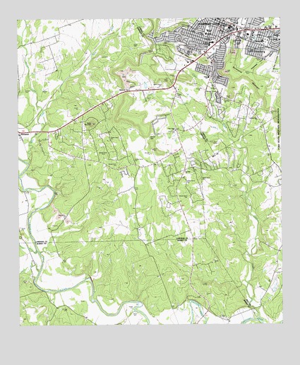
Copperas Cove, TX USGS Topographic Map
Click on map above to begin viewing in our Map Viewer.

This topographic map contains these locations and features:
Feature Name Type Latitude Longitude GNIS ID View Map
Binnion CreekStreamN31.0874°W97.9881°1384173View Map
Browning CemeteryCemeteryN31.0791°W97.9250°1352991View Map
Bulldog StadiumParkN31.1163°W97.8822°2027945View Map
Burnet BranchStreamN31.0310°W97.9917°1384166View Map
C R Clements Intermediate SchoolSchoolN31.1224°W97.9006°2004874View Map
Capital Ambulance ServiceBuildingN31.0708°W97.9239°2655791View Map
Church of Christ CoveChurchN31.1238°W97.9047°2017457View Map
City of Copperas CoveCivilN31.1192°W97.9140°2410225View Map
City of KempnerCivilN31.0754°W97.9724°2410177View Map
Clark CreekStreamN31.0841°W97.9056°1354562View Map
Clear CreekStreamN31.0013°W97.8859°1354616View Map
Clear Creek ChurchChurchN31.0796°W97.9256°1354627View Map
Clements Intermediate SchoolSchoolN31.1210°W97.8989°1385263View Map
Copperas CovePopulated PlaceN31.1241°W97.9031°1354974View Map
Copperas Cove City HallBuildingN31.1202°W97.9034°2753649View Map
Copperas Cove Fire Department Central StationBuildingN31.1217°W97.9026°2551854View Map
Copperas Cove Fire Department Station 3BuildingN31.1060°W97.9199°2551115View Map
Copperas Cove Junior High SchoolSchoolN31.1163°W97.8834°1385264View Map
Copperas Cove Police DepartmentBuildingN31.1217°W97.9005°2750375View Map
Copperas Cove Post OfficePost OfficeN31.1208°W97.8943°2032366View Map
Copperas Hill Estates ParkParkN31.1121°W97.8870°1385265View Map
Copperas PointCapeN31.1124°W97.9214°1354978View Map
Coryell County Constable's Office Precincts 1 and 2BuildingN31.1231°W97.9010°2750713View Map
Coryell County Sheriff's OfficeBuildingN31.1231°W97.9009°2750448View Map
Cove Christian SchoolSchoolN31.0985°W97.9078°1385266View Map
Crestview Christian ChurchChurchN31.0921°W97.9022°1385267View Map
Crossroads High SchoolSchoolN31.1215°W97.8993°2004875View Map
Deliverance Church of GodChurchN31.1202°W97.9192°2017459View Map
Eastside Baptist ChurchChurchN31.1180°W97.8759°1385268View Map
Ethridge CemeteryCemeteryN31.0067°W97.9775°1385269View Map
Fairview Baptist ChurchChurchN31.1188°W97.9117°1385270View Map
Fairview Elementary SchoolSchoolN31.1185°W97.9103°1385271View Map
First Assembly of God Church - Copperas CoveChurchN31.0980°W97.9097°2017447View Map
First Baptist Church of Copperas CoveChurchN31.1238°W97.9047°2017451View Map
Five Hills Assembly of God ChurchChurchN31.1235°W97.9011°2017448View Map
Grace United Methodist ChurchChurchN31.1224°W97.9034°2017462View Map
Heritage ParkParkN31.1016°W97.9064°1385272View Map
Highland ParkParkN31.1160°W97.9314°1385273View Map
Holy Family ChurchChurchN31.1152°W97.9070°1359474View Map
Kempner CemeteryCemeteryN31.0957°W97.9981°1360565View Map
Kempner Volunteer Fire Department Station 2BuildingN31.0708°W97.9239°2551215View Map
KOOV Radio Tower (Copperas Cove)TowerN31.1227°W97.9022°1385274View Map
Korean Baptist ChurchChurchN31.1227°W97.8920°2017452View Map
Korean Methodist Church of Copperas CoveChurchN31.1205°W97.8797°2017463View Map
Mae Stevens Elementary SchoolSchoolN31.1160°W97.8756°1385275View Map
Martin Walker Elementary SchoolSchoolN31.1013°W97.9095°1385276View Map
Minjou LakeReservoirN31.0978°W97.9394°1864981View Map
Minjou Lake DamDamN31.0968°W97.9386°1864980View Map
Miss Jewel Elementary SchoolSchoolN31.1199°W97.9095°1385277View Map
Oak Hills Baptist ChurchChurchN31.0627°W97.9209°1385278View Map
Ogletree GapGapN31.0957°W97.9495°1364350View Map
Panther Den BranchStreamN31.0138°W97.9825°1350814View Map
Rattlesnake PointCapeN31.1077°W97.8853°1366052View Map
Smith CemeteryCemeteryN31.0552°W97.9456°1368464View Map
Southern Hills Baptist ChurchChurchN31.0846°W97.8875°1385279View Map
Starkie GapGapN31.0763°W97.9381°1369124View Map
Taylor CreekStreamN31.0657°W97.9953°1384165View Map
Taylor MountainSummitN31.0824°W97.9650°1369652View Map
The Pentecostal Experience ChurchChurchN31.1230°W97.9050°2017465View Map
Tobey CemeteryCemeteryN31.0026°W97.9025°1369983View Map
Trinity Lutheran ChurchChurchN31.1177°W97.9006°1385280View Map
Variety Club Boys RanchLocaleN31.0563°W97.8806°1370593View Map
Victory Baptist ChurchChurchN31.0966°W97.9067°1385281View Map
Victory Baptist ChurchChurchN31.0880°W97.8895°2017455View Map

Note: Coordinates in the location and feature list above are referenced to NAD83 datum.


Copyright (C) 2008-2024 Ryan Niemi / Sunset Dynamics ... All Rights Reserved