TopoQuest Logo
Do you find TopoQuest useful?
Help keep TopoQuest running and adding new maps/features by donating!
Bitcoin:  19c7KJd3qBynnjoSw5npx9KScwjBe4ifkT
Litecoin:  LXs6TkuXGGXo1vDsWCkWVdjQX94eUKd6ui
Home View Maps Find Maps Find Places Resources & Links


Evansville, Wisconsin Topographic Map

USGS Map Title: Evansville, WI
USGS Map MRC: 42089G3
DRG (GeoTIFF) Download: o42089g3.tif


Neighboring USGS Topographic Map Quads:


  Oregon, WI  
42089H4
 

  Rutland, WI  
42089H3
 

  Stoughton, WI  
42089H2
 

  Attica, WI  
42089G4
 

  Evansville, WI  
42089G3
 

  Cooksville, WI  
42089G2
 

  Albany, WI  
42089F4
 

  Orfordville, WI  
42089F3
 

  Footville, WI  
42089F2


Map MRC Location:

N43°
W90°
N43°
W89°
H8 H7 H6 H5 H4 H3 H2 H1
G8 G7 G6 G5 G4 G3 G2 G1
F8 F7 F6 F5 F4 F3 F2 F1
E8 E7 E6 E5 E4 E3 E2 E1
D8 D7 D6 D5 D4 D3 D2 D1
C8 C7 C6 C5 C4 C3 C2 C1
B8 B7 B6 B5 B4 B3 B2 B1
A8 A7 A6 A5 A4 A3 A2 A1
N42°
W90°
N42°
W89°

Evansville, WI USGS 1:24K Topographic Map Preview:
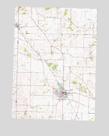
Evansville, WI USGS Topographic Map
Click on map above to begin viewing in our Map Viewer.

This topographic map contains these locations and features:
Feature Name Type Latitude Longitude GNIS ID View Map
BrooklynPopulated PlaceN42.8536°W89.3704°1562238View Map
Brooklyn Police DepartmentBuildingN42.8531°W89.3688°2759551View Map
Brooklyn Wastewater Treatment PlantLocaleN42.8464°W89.3722°2709423View Map
Brzezinski ParkParkN42.7789°W89.3098°1833942View Map
Butts CornersLocaleN42.8172°W89.3335°1562491View Map
Butts FarmLocaleN42.8025°W89.3400°2611488View Map
City of EvansvilleCivilN42.7781°W89.2967°1583177View Map
Congregational United Church of ChristChurchN42.7794°W89.3018°1833974View Map
Dane County Waterfowl Production AreaParkN42.8512°W89.3281°2765263View Map
Eager Free Public LibraryBuildingN42.7800°W89.3010°1833980View Map
EvansvillePopulated PlaceN42.7803°W89.2993°1564732View Map
Evansville City HallBuildingN42.7794°W89.2996°1833992View Map
Evansville Community Fire DistrictBuildingN42.7768°W89.2872°2698204View Map
Evansville Emergency Medical Ambulance ServicesBuildingN42.7788°W89.2997°2698370View Map
Evansville High SchoolSchoolN42.7703°W89.3107°1833995View Map
Evansville Historic DistrictParkN42.7792°W89.3035°1833994View Map
Evansville Police DepartmentBuildingN42.7794°W89.2999°2759599View Map
Evansville Wastewater Treatment PlantLocaleN42.7764°W89.2808°2709369View Map
First Baptist ChurchChurchN42.7789°W89.3018°1834011View Map
Franklin Street ParkParkN42.7797°W89.2940°1834030View Map
Free Methodist Church (historical)ChurchN42.7789°W89.3007°1834033View Map
Grace Independent Baptist ChurchChurchN42.7789°W89.3007°1834040View Map
Graves CemeteryCemeteryN42.8634°W89.3113°1565786View Map
Holy Cross CemeteryCemeteryN42.7893°W89.3006°1566586View Map
J C McKenna Middle SchoolSchoolN42.7766°W89.3018°1833996View Map
Lake LeotaReservoirN42.7883°W89.3041°1567986View Map
Lake Leota 3WR1965 DamDamN42.7864°W89.3021°1793094View Map
Lake Leota ParkParkN42.7856°W89.3010°1834071View Map
Leota School for GirlsSchoolN42.7742°W89.3015°1834073View Map
Levi Leonard Elementary SchoolSchoolN42.7752°W89.3071°1833993View Map
Maple Hill CemeteryCemeteryN42.7836°W89.2866°1568986View Map
Millard Home SchoolSchoolN42.7775°W89.3062°1834095View Map
Reindahl QuarriesMineN42.8567°W89.2989°2634041View Map
Rock County Waterfowl Production AreaParkN42.8417°W89.2939°2765479View Map
Saint Johns Episcopal Church (historical)ChurchN42.7797°W89.3010°1834156View Map
Saint Johns Lutheran ChurchChurchN42.7761°W89.3060°1834160View Map
Saint Paul Catholic ChurchChurchN42.7819°W89.3010°1834174View Map
Seventh Day Adventist ChurchChurchN42.7803°W89.3110°1834186View Map
StonePopulated PlaceN42.8747°W89.3101°1577840View Map
Theodore Robinson Intermediate SchoolSchoolN42.7741°W89.3087°2716658View Map
Town of UnionCivilN42.8044°W89.3109°1584313View Map
UnionPopulated PlaceN42.8244°W89.3018°1575858View Map
Village of BrooklynCivilN42.8525°W89.3723°1582869View Map
Wind Prairie ParkParkN42.7722°W89.3004°1834220View Map
Wyler School for BoysSchoolN42.7789°W89.3082°1834223View Map

Note: Coordinates in the location and feature list above are referenced to NAD83 datum.


Copyright (C) 2008-2024 Ryan Niemi / Sunset Dynamics ... All Rights Reserved