TopoQuest Logo
Do you find TopoQuest useful?
Help keep TopoQuest running and adding new maps/features by donating!
Bitcoin:  19c7KJd3qBynnjoSw5npx9KScwjBe4ifkT
Litecoin:  LXs6TkuXGGXo1vDsWCkWVdjQX94eUKd6ui
Home View Maps Find Maps Find Places Resources & Links


Orfordville, Wisconsin Topographic Map

USGS Map Title: Orfordville, WI
USGS Map MRC: 42089F3
DRG (GeoTIFF) Download: o42089f3.tif


Neighboring USGS Topographic Map Quads:


  Attica, WI  
42089G4
 

  Evansville, WI  
42089G3
 

  Cooksville, WI  
42089G2
 

  Albany, WI  
42089F4
 

  Orfordville, WI  
42089F3
 

  Footville, WI  
42089F2
 

  Brodhead West, WI  
42089E4
 

  Brodhead East, WI  
42089E3
 

  Newark, WI  
42089E2


Map MRC Location:

N43°
W90°
N43°
W89°
H8 H7 H6 H5 H4 H3 H2 H1
G8 G7 G6 G5 G4 G3 G2 G1
F8 F7 F6 F5 F4 F3 F2 F1
E8 E7 E6 E5 E4 E3 E2 E1
D8 D7 D6 D5 D4 D3 D2 D1
C8 C7 C6 C5 C4 C3 C2 C1
B8 B7 B6 B5 B4 B3 B2 B1
A8 A7 A6 A5 A4 A3 A2 A1
N42°
W90°
N42°
W89°

Orfordville, WI USGS 1:24K Topographic Map Preview:
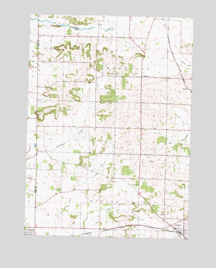
Orfordville, WI USGS Topographic Map
Click on map above to begin viewing in our Map Viewer.

This topographic map contains these locations and features:
Feature Name Type Latitude Longitude GNIS ID View Map
CainvillePopulated PlaceN42.7097°W89.2521°1562505View Map
Calvary CemeteryCemeteryN42.7267°W89.3679°1562532View Map
Kinkoona FarmLocaleN42.6733°W89.3300°2546803View Map
MagnoliaPopulated PlaceN42.7158°W89.2887°1568896View Map
Maloney PondsLakeN42.6756°W89.3687°2762362View Map
OrfordvillePopulated PlaceN42.6275°W89.2532°1570857View Map
Orfordville Elementary SchoolSchoolN42.6308°W89.2596°1831773View Map
Orfordville Fire StationBuildingN42.6291°W89.2551°2698025View Map
Orfordville Police DepartmentBuildingN42.6287°W89.2558°2759728View Map
Parkview High SchoolSchoolN42.6309°W89.2558°1831774View Map
Parkview Junior High SchoolSchoolN42.6309°W89.2557°2716768View Map
Purdy ParkParkN42.6311°W89.2576°1571977View Map
Scotch Hill CemeteryCemeteryN42.6514°W89.3484°1573835View Map
Spring ValleyPopulated PlaceN42.6583°W89.3084°1834197View Map
Spring Valley Farm Airport (historical)AirportN42.6425°W89.3112°1582128View Map
Town of MagnoliaCivilN42.7153°W89.3087°1583627View Map
Town of Spring ValleyCivilN42.6289°W89.3090°1584204View Map
Village of OrfordvilleCivilN42.6294°W89.2573°1583869View Map
West Magnolia CemeteryCemeteryN42.7167°W89.3096°1576533View Map
WMJB-FM (Evansville)TowerN42.7272°W89.2507°1582384View Map

Note: Coordinates in the location and feature list above are referenced to NAD83 datum.


Copyright (C) 2008-2024 Ryan Niemi / Sunset Dynamics ... All Rights Reserved