TopoQuest Logo
Do you find TopoQuest useful?
Help keep TopoQuest running and adding new maps/features by donating!
Bitcoin:  19c7KJd3qBynnjoSw5npx9KScwjBe4ifkT
Litecoin:  LXs6TkuXGGXo1vDsWCkWVdjQX94eUKd6ui
Home View Maps Find Maps Find Places Resources & Links


Cooksville, Wisconsin Topographic Map

USGS Map Title: Cooksville, WI
USGS Map MRC: 42089G2
DRG (GeoTIFF) Download: o42089g2.tif


Neighboring USGS Topographic Map Quads:


  Rutland, WI  
42089H3
 

  Stoughton, WI  
42089H2
 

  Rockdale, WI  
42089H1
 

  Evansville, WI  
42089G3
 

  Cooksville, WI  
42089G2
 

  Edgerton, WI  
42089G1
 

  Orfordville, WI  
42089F3
 

  Footville, WI  
42089F2
 

  Janesville West, WI  
42089F1


Map MRC Location:

N43°
W90°
N43°
W89°
H8 H7 H6 H5 H4 H3 H2 H1
G8 G7 G6 G5 G4 G3 G2 G1
F8 F7 F6 F5 F4 F3 F2 F1
E8 E7 E6 E5 E4 E3 E2 E1
D8 D7 D6 D5 D4 D3 D2 D1
C8 C7 C6 C5 C4 C3 C2 C1
B8 B7 B6 B5 B4 B3 B2 B1
A8 A7 A6 A5 A4 A3 A2 A1
N42°
W90°
N42°
W89°

Cooksville, WI USGS 1:24K Topographic Map Preview:
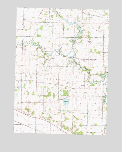
Cooksville, WI USGS Topographic Map
Click on map above to begin viewing in our Map Viewer.

This topographic map contains these locations and features:
Feature Name Type Latitude Longitude GNIS ID View Map
450 ReservoirReservoirN42.8462°W89.1698°1792013View Map
Badfish CreekStreamN42.8319°W89.1718°1561064View Map
Ball Tavern CemeteryCemeteryN42.7708°W89.2407°1561132View Map
Blackburn AirportAirportN42.8596°W89.1993°2444191View Map
CooksvillePopulated PlaceN42.8353°W89.2407°1563351View Map
Cooksville Lutheran ChurchChurchN42.8331°W89.2373°1833975View Map
Fellows Airport (historical)AirportN42.7508°W89.1912°1581972View Map
FultonPopulated PlaceN42.8081°W89.1276°1565365View Map
Fulton CemeteryCemeteryN42.8086°W89.1334°1565366View Map
Fulton DamDamN42.8100°W89.1301°1792010View Map
Fulton Pond 553ReservoirN42.8027°W89.1348°1792011View Map
Gibbs CreekStreamN42.8164°W89.1615°1565502View Map
Gibbs LakeLakeN42.7821°W89.1808°1565503View Map
Grass LakeLakeN42.7954°W89.2432°1565759View Map
Hanerville Post Office (historical)Post OfficeN42.8742°W89.1612°1847460View Map
Little Gibbs LakeLakeN42.7735°W89.1839°1834080View Map
Muskrat LakeSwampN42.8425°W89.1507°1570074View Map
Saint Michaels CemeteryCemeteryN42.8178°W89.1804°1573373View Map
South Porter CemeteryCemeteryN42.7717°W89.1759°1574479View Map
Spring CreekStreamN42.8381°W89.2468°1574631View Map
StebbinsvillePopulated PlaceN42.8444°W89.1732°1577837View Map
Stebbinsville WP 51 DamDamN42.8433°W89.1734°1792012View Map
Town of PorterCivilN42.8027°W89.1908°1583956View Map
Towns FarmsLocaleN42.7803°W89.1697°2546801View Map
Yahara Elementary SchoolSchoolN42.7989°W89.1569°1577074View Map

Note: Coordinates in the location and feature list above are referenced to NAD83 datum.


Copyright (C) 2008-2024 Ryan Niemi / Sunset Dynamics ... All Rights Reserved