TopoQuest Logo
Do you find TopoQuest useful?
Help keep TopoQuest running and adding new maps/features by donating!
Bitcoin:  19c7KJd3qBynnjoSw5npx9KScwjBe4ifkT
Litecoin:  LXs6TkuXGGXo1vDsWCkWVdjQX94eUKd6ui
Home View Maps Find Maps Find Places Resources & Links


Fairburn, Wisconsin Topographic Map

USGS Map Title: Fairburn, WI
USGS Map MRC: 43089H1
DRG (GeoTIFF) Download: o43089h1.tif


Neighboring USGS Topographic Map Quads:


  Spring Lake, WI  
44089A2
 

  Redgranite, WI  
44089A1
 

  Auroraville, WI  
44088A8
 

  Neshkoro, WI  
43089H2
 

  Fairburn, WI  
43089H1
 

  Berlin, WI  
43088H8
 

  Princeton West, WI  
43089G2
 

  Princeton East, WI  
43089G1
 

  Green Lake, WI  
43088G8


Map MRC Location:

N44°
W90°
N44°
W89°
H8 H7 H6 H5 H4 H3 H2 H1
G8 G7 G6 G5 G4 G3 G2 G1
F8 F7 F6 F5 F4 F3 F2 F1
E8 E7 E6 E5 E4 E3 E2 E1
D8 D7 D6 D5 D4 D3 D2 D1
C8 C7 C6 C5 C4 C3 C2 C1
B8 B7 B6 B5 B4 B3 B2 B1
A8 A7 A6 A5 A4 A3 A2 A1
N43°
W90°
N43°
W89°

Fairburn, WI USGS 1:24K Topographic Map Preview:
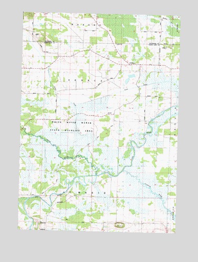
Fairburn, WI USGS Topographic Map
Click on map above to begin viewing in our Map Viewer.

This topographic map contains these locations and features:
Feature Name Type Latitude Longitude GNIS ID View Map
Black CreekStreamN43.8933°W89.1159°1561850View Map
FairburnPopulated PlaceN43.9711°W89.0373°1564802View Map
Fairburn CemeteryCemeteryN43.9827°W89.0496°1564803View Map
Mount TomSummitN43.8783°W89.0446°1575491View Map
Princeton Prairie State Natural AreaParkN43.8930°W89.0384°2057273View Map
Puchyan Prairie State Natural AreaParkN43.8911°W89.0201°2057274View Map
Puchyan RiverStreamN43.9100°W89.0421°1571956View Map
Saint Marie CemeteryCemeteryN43.8794°W89.1062°1573236View Map
School Number 1 (historical)SchoolN43.9750°W89.0962°1843785View Map
School Number 4 (historical)SchoolN43.9422°W89.0268°1843792View Map
School Number 6 (historical)SchoolN43.8922°W89.0876°1843797View Map
School Number 6 (historical)SchoolN43.9425°W89.0565°1843798View Map
Sucker CreekStreamN43.9172°W89.0704°1575005View Map
Town of Saint MarieCivilN43.8954°W89.0858°1584091View Map
Town of SenecaCivilN43.9530°W89.0855°1584122View Map
White RiverStreamN43.9075°W89.0634°1576655View Map
White River Lock (historical)DamN43.9003°W89.0843°1843823View Map
White River Marsh State Wildlife AreaParkN43.9389°W89.1015°1843824View Map
White River Sedge Meadow State Natural AreaParkN43.9208°W89.1048°2057278View Map

Note: Coordinates in the location and feature list above are referenced to NAD83 datum.


Copyright (C) 2008-2024 Ryan Niemi / Sunset Dynamics ... All Rights Reserved