TopoQuest Logo
Do you find TopoQuest useful?
Help keep TopoQuest running and adding new maps/features by donating!
Bitcoin:  19c7KJd3qBynnjoSw5npx9KScwjBe4ifkT
Litecoin:  LXs6TkuXGGXo1vDsWCkWVdjQX94eUKd6ui
Home View Maps Find Maps Find Places Resources & Links


Auroraville, Wisconsin Topographic Map

USGS Map Title: Auroraville, WI
USGS Map MRC: 44088A8
DRG (GeoTIFF) Download: o44088a8.tif


Neighboring USGS Topographic Map Quads:


  Saxeville, WI  
44089B1
 

  Poy Sippi, WI  
44088B8
 

  Lake Poygan, WI  
44088B7
 

  Redgranite, WI  
44089A1
 

  Auroraville, WI  
44088A8
 

  Eureka, WI  
44088A7
 

  Fairburn, WI  
43089H1
 

  Berlin, WI  
43088H8
 

  Rush Lake, WI  
43088H7


Map MRC Location:

N45°
W89°
N45°
W88°
H8 H7 H6 H5 H4 H3 H2 H1
G8 G7 G6 G5 G4 G3 G2 G1
F8 F7 F6 F5 F4 F3 F2 F1
E8 E7 E6 E5 E4 E3 E2 E1
D8 D7 D6 D5 D4 D3 D2 D1
C8 C7 C6 C5 C4 C3 C2 C1
B8 B7 B6 B5 B4 B3 B2 B1
A8 A7 A6 A5 A4 A3 A2 A1
N44°
W89°
N44°
W88°

Auroraville, WI USGS 1:24K Topographic Map Preview:
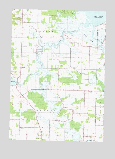
Auroraville, WI USGS Topographic Map
Click on map above to begin viewing in our Map Viewer.

This topographic map contains these locations and features:
Feature Name Type Latitude Longitude GNIS ID View Map
AuroravillePopulated PlaceN44.0519°W88.9926°1561023View Map
Auroraville 2WP588 DamDamN44.0533°W88.9918°1792304View Map
BorthPopulated PlaceN44.0911°W88.8959°1577521View Map
Fountain ValleyPopulated PlaceN44.0908°W88.9862°1565181View Map
Immanuel ChurchChurchN44.0691°W88.9865°1566873View Map
Leach Farms HeliportAirportN44.0880°W88.9254°1582160View Map
Mill PondReservoirN44.0541°W88.9909°1569496View Map
Pine Grove CemeteryCemeteryN44.0650°W88.9993°1571456View Map
Pine RiverStreamN44.1244°W88.9040°1578559View Map
Poygan MarshSwampN44.0989°W88.8987°1571863View Map
Pumpkinseed CreekStreamN44.1105°W88.8907°1571974View Map
Sheads Island CemeteryCemeteryN44.0483°W88.8968°1573988View Map
Town of AuroraCivilN44.0271°W88.9466°1582736View Map
Town of Poy SippiCivilN44.1124°W88.9463°1583970View Map
Trinity ChurchChurchN44.0689°W88.9023°1575626View Map
Welsh CemeteryCemeteryN44.0050°W88.9571°1576421View Map
Willow CreekStreamN44.1133°W88.8959°1576782View Map
Zink Airport (historical)AirportN44.0280°W88.8839°1581886View Map

Note: Coordinates in the location and feature list above are referenced to NAD83 datum.


Copyright (C) 2008-2024 Ryan Niemi / Sunset Dynamics ... All Rights Reserved