TopoQuest Logo
Do you find TopoQuest useful?
Help keep TopoQuest running and adding new maps/features by donating!
Bitcoin:  19c7KJd3qBynnjoSw5npx9KScwjBe4ifkT
Litecoin:  LXs6TkuXGGXo1vDsWCkWVdjQX94eUKd6ui
Home View Maps Find Maps Find Places Resources & Links


Francis Mill, Alabama Topographic Map

USGS Map Title: Francis Mill, AL
USGS Map MRC: 33086F1
DRG (GeoTIFF) Download: o33086f1.tif


Neighboring USGS Topographic Map Quads:


  Cox Gap, AL  
33086G2
 

  Ohatchee, AL  
33086G1
 

  Wellington, AL  
33085G8
 

  Ragland, AL  
33086F2
 

  Francis Mill, AL  
33086F1
 

  Eulaton, AL  
33085F8
 

  Riverside, AL  
33086E2
 

  Eastaboga, AL  
33086E1
 

  Munford, AL  
33085E8


Map MRC Location:

N34°
W87°
N34°
W86°
H8 H7 H6 H5 H4 H3 H2 H1
G8 G7 G6 G5 G4 G3 G2 G1
F8 F7 F6 F5 F4 F3 F2 F1
E8 E7 E6 E5 E4 E3 E2 E1
D8 D7 D6 D5 D4 D3 D2 D1
C8 C7 C6 C5 C4 C3 C2 C1
B8 B7 B6 B5 B4 B3 B2 B1
A8 A7 A6 A5 A4 A3 A2 A1
N33°
W87°
N33°
W86°

Francis Mill, AL USGS 1:24K Topographic Map Preview:
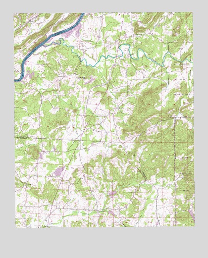
Francis Mill, AL USGS Topographic Map
Click on map above to begin viewing in our Map Viewer.

This topographic map contains these locations and features:
Feature Name Type Latitude Longitude GNIS ID View Map
Acker CreekStreamN33.7126°W86.1189°157875View Map
Alligator BranchStreamN33.6732°W86.1186°144708View Map
Bailey Springs ChurchChurchN33.7120°W86.0780°140801View Map
Bailey Springs School (historical)SchoolN33.7118°W86.0777°113363View Map
Blue Eye (historical)Populated PlaceN33.6473°W86.0208°166217View Map
Blue Eye Creek Watershed Dam Number 1DamN33.6418°W86.0616°131651View Map
Blue Eye Creek Watershed Dam Number 2DamN33.6334°W86.0616°131641View Map
Blue Eye Post Office (historical)Post OfficeN33.6473°W86.0208°169240View Map
Boiling SpringsPopulated PlaceN33.7365°W86.0422°156090View Map
Boiling SpringsSpringN33.7370°W86.0391°149294View Map
Boiling Springs Missionary Baptist ChurchChurchN33.7357°W86.0419°140817View Map
Boozer (historical)Populated PlaceN33.7020°W86.0458°166218View Map
Boozer Post Office (historical)Post OfficeN33.7020°W86.0458°169242View Map
Brooks DamDamN33.6584°W86.0966°131664View Map
Brooks LakeReservoirN33.6579°W86.0941°144736View Map
Bruner (historical)Populated PlaceN33.6848°W86.0769°140820View Map
Bruner CreekStreamN33.6945°W86.0819°115033View Map
Cane CreekStreamN33.7318°W86.1053°164594View Map
Cane Creek (historical)Populated PlaceN33.7168°W86.0064°166219View Map
Cane Creek Covered Bridge (historical)BridgeN33.7351°W86.0441°149171View Map
Cane Creek Post Office (historical)Post OfficeN33.7168°W86.0064°169245View Map
Carrols LakeReservoirN33.6334°W86.0580°131642View Map
Catfish LakeReservoirN33.6697°W86.1060°144752View Map
Cone ReservoirReservoirN33.6315°W86.0017°131638View Map
Creswell CemeteryCemeteryN33.6682°W86.0455°116862View Map
Dills SpringSpringN33.6429°W86.0258°144795View Map
Eastaboga Volunteer Fire Department Station 2BuildingN33.6508°W86.0359°2683252View Map
Everetts SpringSpringN33.6301°W86.0230°149300View Map
Faith Assembly Lighthouse ChurchChurchN33.7317°W86.0775°2130656View Map
Fombys Ferry (historical)CrossingN33.7318°W86.1058°165236View Map
Francis MillLocaleN33.7257°W86.0466°118589View Map
Green CemeteryCemeteryN33.6901°W86.0764°119333View Map
Hall CemeteryCemeteryN33.6509°W86.1169°119577View Map
Jones Blue Eye LakeReservoirN33.6418°W86.0616°131650View Map
Lick BranchStreamN33.7423°W86.0819°149194View Map
MaconPopulated PlaceN33.7307°W86.0772°166222View Map
Macon Post OfficePost OfficeN33.7307°W86.0772°169280View Map
Macon Quarter ChurchChurchN33.7273°W86.0772°140954View Map
Martins MillPopulated PlaceN33.6348°W86.0683°158009View Map
McGouirk DamDamN33.7451°W86.0366°131717View Map
McGouirk LakeReservoirN33.7447°W86.0372°131718View Map
Minden (historical)Populated PlaceN33.7023°W86.1061°166224View Map
Minden Post Office (historical)Post OfficeN33.7023°W86.1061°169289View Map
MitchellvillePopulated PlaceN33.7298°W86.0697°149200View Map
Mount OlivePopulated PlaceN33.7126°W86.0889°149202View Map
Mount Olive Baptist ChurchChurchN33.7132°W86.0900°123318View Map
Mount Olive Volunteer Fire DepartmentBuildingN33.7125°W86.0920°2682949View Map
Ohatchee FarmsLocaleN33.7108°W86.0669°2581956View Map
Old Sulphur Springs School (historical)SchoolN33.6901°W86.0616°124256View Map
Patton Chapel Baptist ChurchChurchN33.6348°W86.0686°144930View Map
Pattons Chapel CemeteryCemeteryN33.6354°W86.0694°1805663View Map
Poes BendBendN33.7126°W86.1180°149211View Map
RefugePopulated PlaceN33.6501°W86.1172°166162View Map
Refuge Baptist ChurchChurchN33.6509°W86.1158°153129View Map
Refuge CemeteryCemeteryN33.6551°W86.1094°125545View Map
Refuge Post OfficePost OfficeN33.6501°W86.1172°169302View Map
Steed DamDamN33.6701°W86.1083°131670View Map
Steeds LakeReservoirN33.6701°W86.1083°131671View Map
Stillhouse BranchStreamN33.6895°W86.0675°149216View Map
Sulfur Springs ChurchChurchN33.6923°W86.0558°141046View Map
Sulphur SpringsPopulated PlaceN33.6943°W86.0555°157125View Map
Union Grove Cumberland Methodist ChurchChurchN33.6918°W86.0591°128319View Map
Womack (historical)Populated PlaceN33.7029°W86.0208°166228View Map
Womack Post Office (historical)Post OfficeN33.7029°W86.0208°169317View Map
Yarbrough DamDamN33.7115°W86.0704°131695View Map
Yarbroughs LakeReservoirN33.7106°W86.0717°131696View Map

Note: Coordinates in the location and feature list above are referenced to NAD83 datum.


Copyright (C) 2008-2024 Ryan Niemi / Sunset Dynamics ... All Rights Reserved