TopoQuest Logo
Do you find TopoQuest useful?
Help keep TopoQuest running and adding new maps/features by donating!
Bitcoin:  19c7KJd3qBynnjoSw5npx9KScwjBe4ifkT
Litecoin:  LXs6TkuXGGXo1vDsWCkWVdjQX94eUKd6ui
Home View Maps Find Maps Find Places Resources & Links


Eulaton, Alabama Topographic Map

USGS Map Title: Eulaton, AL
USGS Map MRC: 33085F8
DRG (GeoTIFF) Download: o33085f8.tif


Neighboring USGS Topographic Map Quads:


  Ohatchee, AL  
33086G1
 

  Wellington, AL  
33085G8
 

  Jacksonville West, AL  
33085G7
 

  Francis Mill, AL  
33086F1
 

  Eulaton, AL  
33085F8
 

  Anniston, AL  
33085F7
 

  Eastaboga, AL  
33086E1
 

  Munford, AL  
33085E8
 

  Oxford, AL  
33085E7


Map MRC Location:

N34°
W86°
N34°
W85°
H8 H7 H6 H5 H4 H3 H2 H1
G8 G7 G6 G5 G4 G3 G2 G1
F8 F7 F6 F5 F4 F3 F2 F1
E8 E7 E6 E5 E4 E3 E2 E1
D8 D7 D6 D5 D4 D3 D2 D1
C8 C7 C6 C5 C4 C3 C2 C1
B8 B7 B6 B5 B4 B3 B2 B1
A8 A7 A6 A5 A4 A3 A2 A1
N33°
W86°
N33°
W85°

Eulaton, AL USGS 1:24K Topographic Map Preview:
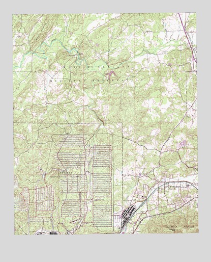
Eulaton, AL USGS Topographic Map
Click on map above to begin viewing in our Map Viewer.

This topographic map contains these locations and features:
Feature Name Type Latitude Longitude GNIS ID View Map
Aderhold Acres (historical)LocaleN33.7209°W85.8777°140783View Map
Anniston Army DepotMilitaryN33.6523°W85.9621°2512036View Map
Anniston CemeteryCemeteryN33.7326°W85.8805°113094View Map
Bera (historical)Populated PlaceN33.7062°W85.9255°140805View Map
BushPopulated PlaceN33.7304°W85.8786°156138View Map
Camp WillettLocaleN33.7243°W85.9564°115486View Map
Cane CreekPopulated PlaceN33.6654°W85.8852°140827View Map
Canebreak FarmsLocaleN33.7389°W85.8878°2704563View Map
Clarkes GapGapN33.7251°W85.9514°149174View Map
Cobb TownPopulated PlaceN33.6411°W85.8851°2407578View Map
Coker MountainSummitN33.6809°W85.9777°149176View Map
Coldwater MountainRidgeN33.6270°W85.8900°159428View Map
Coldwater PeakSummitN33.6270°W85.8900°116400View Map
Cone Reservoir DamDamN33.6284°W86.0000°131637View Map
EulatonPopulated PlaceN33.6457°W85.9125°118054View Map
Eulaton Baptist ChurchChurchN33.6443°W85.9191°140870View Map
Eulaton Elementary SchoolSchoolN33.6462°W85.9130°140871View Map
Eulaton United Methodist ChurchChurchN33.6457°W85.9122°140872View Map
Four Square ChurchChurchN33.6407°W85.8808°140893View Map
Freedom Riders National MonumentParkN33.6353°W85.9064°2783290View Map
Hampton CemeteryCemeteryN33.7484°W85.9289°149182View Map
Hurds GapGapN33.7454°W85.9089°149189View Map
Lake ContrerasReservoirN33.7158°W85.9335°131697View Map
LeatherwoodPopulated PlaceN33.7173°W85.8766°152008View Map
Leatherwood Baptist ChurchChurchN33.7165°W85.8752°140943View Map
Leatherwood SloughSwampN33.7223°W85.8791°149193View Map
Lloyds Chapel Baptist ChurchChurchN33.6912°W85.8830°152132View Map
Lloyds Chapel CemeteryCemeteryN33.6918°W85.8830°140950View Map
Lloyds School House (historical)SchoolN33.6915°W85.8830°149196View Map
MahlepPopulated PlaceN33.7448°W85.8811°156647View Map
Meade (historical)Populated PlaceN33.6598°W85.9777°140959View Map
MorrisvillePopulated PlaceN33.7268°W85.9572°156738View Map
Morrisville Baptist ChurchChurchN33.6718°W85.8944°140966View Map
Mount Limited ChurchChurchN33.6615°W85.8780°140969View Map
New Bethel CemeteryCemeteryN33.6873°W85.9627°123716View Map
New Liberty Baptist ChurchChurchN33.6584°W85.9097°140983View Map
New Mount Sellers CemeteryCemeteryN33.7434°W85.9180°123870View Map
New Mount Silla Baptist Church (historical)ChurchN33.7434°W85.9166°149204View Map
PeaceburgPopulated PlaceN33.7395°W85.9105°156861View Map
Peaceburg School (historical)SchoolN33.7287°W85.9100°149209View Map
Pelham Range DamDamN33.7151°W85.9366°131698View Map
Polkville (historical)Populated PlaceN33.7201°W85.9652°166225View Map
Polkville Post Office (historical)Post OfficeN33.7201°W85.9652°169301View Map
TarsusPopulated PlaceN33.6365°W85.9111°127700View Map
VinnettePopulated PlaceN33.6262°W85.9189°160788View Map
Walter Wellborn High SchoolSchoolN33.6526°W85.8816°165577View Map
WellbornPopulated PlaceN33.6534°W85.8811°141069View Map
Wellborn Elementary SchoolSchoolN33.6526°W85.8816°141070View Map
West Park Heights Baptist ChurchChurchN33.6504°W85.8941°153947View Map
Willett SpringSpringN33.7265°W85.9550°128991View Map
Zula (historical)Populated PlaceN33.7351°W85.9902°141088View Map

Note: Coordinates in the location and feature list above are referenced to NAD83 datum.


Copyright (C) 2008-2024 Ryan Niemi / Sunset Dynamics ... All Rights Reserved