TopoQuest Logo
Do you find TopoQuest useful?
Help keep TopoQuest running and adding new maps/features by donating!
Bitcoin:  19c7KJd3qBynnjoSw5npx9KScwjBe4ifkT
Litecoin:  LXs6TkuXGGXo1vDsWCkWVdjQX94eUKd6ui
Home View Maps Find Maps Find Places Resources & Links


Funks Grove, Illinois Topographic Map

USGS Map Title: Funks Grove, IL
USGS Map MRC: 40089C1
DRG (GeoTIFF) Download: o40089c1.tif


Neighboring USGS Topographic Map Quads:


  Stanford, IL  
40089D2
 

  Bloomington West, IL  
40089D1
 

  Bloomington East, IL  
40088D8
 

  McLean, IL  
40089C2
 

  Funks Grove, IL  
40089C1
 

  Heyworth, IL  
40088C8
 

  Waynesville West, IL  
40089B2
 

  Waynesville East, IL  
40089B1
 

  Clinton, IL  
40088B8


Map MRC Location:

N41°
W90°
N41°
W89°
H8 H7 H6 H5 H4 H3 H2 H1
G8 G7 G6 G5 G4 G3 G2 G1
F8 F7 F6 F5 F4 F3 F2 F1
E8 E7 E6 E5 E4 E3 E2 E1
D8 D7 D6 D5 D4 D3 D2 D1
C8 C7 C6 C5 C4 C3 C2 C1
B8 B7 B6 B5 B4 B3 B2 B1
A8 A7 A6 A5 A4 A3 A2 A1
N40°
W90°
N40°
W89°

Funks Grove, IL USGS 1:24K Topographic Map Preview:
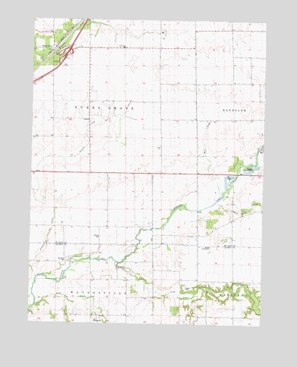
Funks Grove, IL USGS Topographic Map
Click on map above to begin viewing in our Map Viewer.

This topographic map contains these locations and features:
Feature Name Type Latitude Longitude GNIS ID View Map
Alexander School (historical)SchoolN40.2673°W89.0084°403402View Map
Big Grove CemeteryCemeteryN40.2765°W89.1059°404410View Map
Burr Oak School (historical)SchoolN40.2534°W89.0292°405261View Map
Campbells Hump Church (historical)ChurchN40.2736°W89.0784°405522View Map
Columbia School (historical)SchoolN40.2728°W89.0584°406404View Map
Fairview CemeteryCemeteryN40.2739°W89.0770°1748467View Map
Fremont CemeteryCemeteryN40.2858°W89.0874°404890View Map
Funks GrovePopulated PlaceN40.3636°W89.1145°422723View Map
Funks Grove Nature PreserveParkN40.3620°W89.1173°2013827View Map
Funks Grove TownhallBuildingN40.3336°W89.0845°1747573View Map
Funks SchoolSchoolN40.3636°W89.0773°408816View Map
Halsey CemeteryCemeteryN40.2649°W89.0422°409676View Map
Heyworth Centennial ParkParkN40.3139°W89.0040°1747581View Map
Holland FieldAirportN40.3030°W89.1235°2679107View Map
Holt Landing Strip (historical)AirportN40.2514°W89.0901°1748470View Map
Long Point CreekStreamN40.2753°W89.0787°412592View Map
Mud CreekStreamN40.3025°W89.0231°414166View Map
Prairie CreekStreamN40.2684°W89.1223°416116View Map
Rock CreekStreamN40.2570°W89.1229°416801View Map
Short Point CreekStreamN40.2986°W89.0267°418468View Map
Short Point School (historical)SchoolN40.2967°W89.0076°418470View Map
Stubblefield Woodlots Nature PreserveParkN40.3684°W89.1115°2013828View Map
Township of Funks GroveCivilN40.3409°W89.0934°429034View Map
Township of WaynesvilleCivilN40.2533°W89.0910°429906View Map
WM Quinton RLA Airport (historical)AirportN40.2862°W89.0280°427370View Map

Note: Coordinates in the location and feature list above are referenced to NAD83 datum.


Copyright (C) 2008-2024 Ryan Niemi / Sunset Dynamics ... All Rights Reserved