TopoQuest Logo
Do you find TopoQuest useful?
Help keep TopoQuest running and adding new maps/features by donating!
Bitcoin:  19c7KJd3qBynnjoSw5npx9KScwjBe4ifkT
Litecoin:  LXs6TkuXGGXo1vDsWCkWVdjQX94eUKd6ui
Home View Maps Find Maps Find Places Resources & Links


Heyworth, Illinois Topographic Map

USGS Map Title: Heyworth, IL
USGS Map MRC: 40088C8
DRG (GeoTIFF) Download: o40088c8.tif


Neighboring USGS Topographic Map Quads:


  Bloomington West, IL  
40089D1
 

  Bloomington East, IL  
40088D8
 

  Holder, IL  
40088D7
 

  Funks Grove, IL  
40089C1
 

  Heyworth, IL  
40088C8
 

  Le Roy, IL  
40088C7
 

  Waynesville East, IL  
40089B1
 

  Clinton, IL  
40088B8
 

  De Witt, IL  
40088B7


Map MRC Location:

N41°
W89°
N41°
W88°
H8 H7 H6 H5 H4 H3 H2 H1
G8 G7 G6 G5 G4 G3 G2 G1
F8 F7 F6 F5 F4 F3 F2 F1
E8 E7 E6 E5 E4 E3 E2 E1
D8 D7 D6 D5 D4 D3 D2 D1
C8 C7 C6 C5 C4 C3 C2 C1
B8 B7 B6 B5 B4 B3 B2 B1
A8 A7 A6 A5 A4 A3 A2 A1
N40°
W89°
N40°
W88°

Heyworth, IL USGS 1:24K Topographic Map Preview:
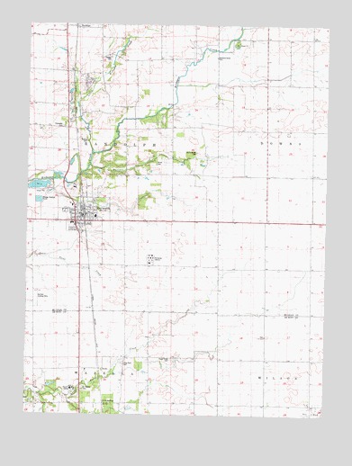
Heyworth, IL USGS Topographic Map
Click on map above to begin viewing in our Map Viewer.

This topographic map contains these locations and features:
Feature Name Type Latitude Longitude GNIS ID View Map
Bishop CemeteryCemeteryN40.3378°W88.9759°404469View Map
BucksPopulated PlaceN40.2650°W88.9701°422512View Map
Burlison CreekStreamN40.3289°W88.9751°405234View Map
Carle SpringsPopulated PlaceN40.2536°W88.9670°422529View Map
Diamond Grove CemeteryCemeteryN40.3648°W88.9219°1747558View Map
Diamond Grove Church (historical)ChurchN40.3650°W88.9217°407178View Map
Hamlow RLA Airport (historical)AirportN40.3306°W88.9279°427372View Map
HeyworthPopulated PlaceN40.3134°W88.9737°410130View Map
Heyworth Ambulance ServiceBuildingN40.3071°W88.9789°2673804View Map
Heyworth CemeteryCemeteryN40.3169°W88.9740°1952844View Map
Heyworth Elementary SchoolSchoolN40.3134°W88.9715°1822493View Map
Heyworth High SchoolSchoolN40.3117°W88.9815°1822494View Map
Heyworth Post OfficePost OfficeN40.3138°W88.9756°2788511View Map
Johnson AirportAirportN40.3356°W88.9537°427371View Map
Liberty School (historical)SchoolN40.2625°W88.9590°412035View Map
Little Kickapoo CreekStreamN40.3325°W88.9731°412363View Map
Little Kickapoo CreekStreamN40.3734°W88.9112°412364View Map
Littleville (historical)Populated PlaceN40.3417°W88.9556°1822533View Map
Long Point CemeteryCemeteryN40.2664°W88.9598°1748471View Map
Long Point Church (historical)ChurchN40.2667°W88.9590°412589View Map
Lytleville School (historical)SchoolN40.3409°W88.9562°1828985View Map
Old Rutledge CemeteryCemeteryN40.3343°W88.9294°415051View Map
Passwater CemeteryCemeteryN40.3422°W88.9857°415428View Map
Progress School (historical)SchoolN40.2595°W88.9284°416234View Map
Quinton Landing Strip (historical)AirportN40.2873°W88.9951°1747619View Map
Randolph Township Fire DepartmentBuildingN40.3138°W88.9778°2681725View Map
Saint Particks CemeteryCemeteryN40.2589°W88.9760°417665View Map
Shiloh CemeteryCemeteryN40.3300°W88.9473°418394View Map
Stewart CemeteryCemeteryN40.3645°W88.9659°419127View Map
Sugar Grove CemeteryCemeteryN40.2681°W88.9390°419302View Map
Township of RandolphCivilN40.3418°W88.9790°429617View Map
Valley Center Church (historical)ChurchN40.3417°W88.9542°420198View Map
Village of HeyworthCivilN40.3143°W88.9923°2398499View Map

Note: Coordinates in the location and feature list above are referenced to NAD83 datum.


Copyright (C) 2008-2024 Ryan Niemi / Sunset Dynamics ... All Rights Reserved