TopoQuest Logo
Do you find TopoQuest useful?
Help keep TopoQuest running and adding new maps/features by donating!
Bitcoin:  19c7KJd3qBynnjoSw5npx9KScwjBe4ifkT
Litecoin:  LXs6TkuXGGXo1vDsWCkWVdjQX94eUKd6ui
Home View Maps Find Maps Find Places Resources & Links


Gamaliel, Kentucky Topographic Map

USGS Map Title: Gamaliel, KY
USGS Map MRC: 36085F7
DRG (GeoTIFF) Download: o36085f7.tif


Neighboring USGS Topographic Map Quads:


  Tracy, KY  
36085G8
 

  Freedom, KY  
36085G7
 

  Sulphur Lick, KY  
36085G6
 

  Fountain Run, KY  
36085F8
 

  Gamaliel, KY  
36085F7
 

  Tompkinsville, KY  
36085F6
 

  Galen, TN  
36085E8
 

  Red Boiling Springs, TN  
36085E7
 

  Union Hill, TN  
36085E6


Map MRC Location:

N37°
W86°
N37°
W85°
H8 H7 H6 H5 H4 H3 H2 H1
G8 G7 G6 G5 G4 G3 G2 G1
F8 F7 F6 F5 F4 F3 F2 F1
E8 E7 E6 E5 E4 E3 E2 E1
D8 D7 D6 D5 D4 D3 D2 D1
C8 C7 C6 C5 C4 C3 C2 C1
B8 B7 B6 B5 B4 B3 B2 B1
A8 A7 A6 A5 A4 A3 A2 A1
N36°
W86°
N36°
W85°

Gamaliel, KY USGS 1:24K Topographic Map Preview:
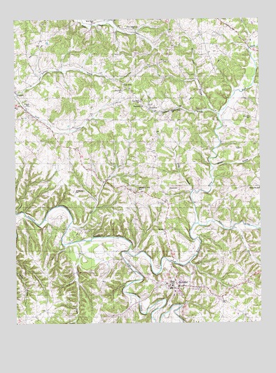
Gamaliel, KY USGS Topographic Map
Click on map above to begin viewing in our Map Viewer.

This topographic map contains these locations and features:
Feature Name Type Latitude Longitude GNIS ID View Map
Adams BranchStreamN36.6889°W85.7739°485755View Map
Alexander SchoolSchoolN36.6787°W85.8444°485829View Map
Belcher CemeteryCemeteryN36.7142°W85.8080°486775View Map
Cable BranchStreamN36.7381°W85.7544°488573View Map
Camp Anderson Historical MarkerParkN36.7058°W85.8574°2744613View Map
Cane CreekStreamN36.6587°W85.8433°488769View Map
City of GamalielCivilN36.6402°W85.7962°2403679View Map
East Fork Barren RiverStreamN36.6545°W85.8180°491438View Map
Ebenezer SchoolSchoolN36.6809°W85.7503°491541View Map
EmbertonPopulated PlaceN36.7131°W85.8064°507938View Map
FlippinPopulated PlaceN36.7203°W85.8741°492255View Map
Flippin SchoolSchoolN36.7151°W85.8694°492257View Map
Flippin Volunteer Fire DepartmentBuildingN36.7193°W85.8734°2637353View Map
Fountain Run DivisionCivilN36.6785°W85.8735°1937009View Map
Fox Hill SchoolSchoolN36.7095°W85.7547°492410View Map
Free Will ChurchChurchN36.7164°W85.8111°492494View Map
Free Will SchoolSchoolN36.7206°W85.8203°492495View Map
FreetownPopulated PlaceN36.6803°W85.7972°508039View Map
GamalielPopulated PlaceN36.6398°W85.7966°492661View Map
Gamaliel Police DepartmentBuildingN36.6398°W85.7964°2767742View Map
Gamaliel Volunteer Fire DepartmentBuildingN36.6383°W85.7939°2636763View Map
Gum TreePopulated PlaceN36.7242°W85.8194°508148View Map
Harmony ChurchChurchN36.7150°W85.8098°493761View Map
Isenburg BranchStreamN36.7107°W85.7709°495037View Map
Line CreekStreamN36.6542°W85.8181°496583View Map
Long BranchStreamN36.6639°W85.7633°497066View Map
McPeak SchoolSchoolN36.6339°W85.8555°497941View Map
Mill CreekStreamN36.6659°W85.7822°498255View Map
Miller BranchStreamN36.7484°W85.8294°498319View Map
Monroe County HomeBuildingN36.6970°W85.7600°498491View Map
Mount Olive ChurchChurchN36.6626°W85.7991°498788View Map
Mount Vernon CemeteryCemeteryN36.6748°W85.7989°498881View Map
Mud Slash School (historical)SchoolN36.7487°W85.8339°499017View Map
Neal CemeteryCemeteryN36.7100°W85.8680°499194View Map
New Salem ChurchChurchN36.7460°W85.8131°499386View Map
Old Rocky Hill SchoolSchoolN36.6803°W85.8122°499877View Map
Rocky BranchStreamN36.6795°W85.7847°502224View Map
Rocky Point SchoolSchoolN36.7126°W85.7953°502260View Map
South Fork Indian CreekStreamN36.7189°W85.8744°503929View Map
Sugar CreekStreamN36.6651°W85.8478°504646View Map
Tulip Poplar Tree Historical MarkerParkN36.7189°W85.8734°2744615View Map
White Oak BranchStreamN36.7120°W85.7736°506593View Map

Note: Coordinates in the location and feature list above are referenced to NAD83 datum.


Copyright (C) 2008-2024 Ryan Niemi / Sunset Dynamics ... All Rights Reserved