TopoQuest Logo
Do you find TopoQuest useful?
Help keep TopoQuest running and adding new maps/features by donating!
Bitcoin:  19c7KJd3qBynnjoSw5npx9KScwjBe4ifkT
Litecoin:  LXs6TkuXGGXo1vDsWCkWVdjQX94eUKd6ui
Home View Maps Find Maps Find Places Resources & Links


Tompkinsville, Kentucky Topographic Map

USGS Map Title: Tompkinsville, KY
USGS Map MRC: 36085F6
DRG (GeoTIFF) Download: o36085f6.tif


Neighboring USGS Topographic Map Quads:


  Freedom, KY  
36085G7
 

  Sulphur Lick, KY  
36085G6
 

  Dubre, KY  
36085G5
 

  Gamaliel, KY  
36085F7
 

  Tompkinsville, KY  
36085F6
 

  Vernon, KY  
36085F5
 

  Red Boiling Springs, TN  
36085E7
 

  Union Hill, TN  
36085E6
 

  Celina, TN  
36085E5


Map MRC Location:

N37°
W86°
N37°
W85°
H8 H7 H6 H5 H4 H3 H2 H1
G8 G7 G6 G5 G4 G3 G2 G1
F8 F7 F6 F5 F4 F3 F2 F1
E8 E7 E6 E5 E4 E3 E2 E1
D8 D7 D6 D5 D4 D3 D2 D1
C8 C7 C6 C5 C4 C3 C2 C1
B8 B7 B6 B5 B4 B3 B2 B1
A8 A7 A6 A5 A4 A3 A2 A1
N36°
W86°
N36°
W85°

Tompkinsville, KY USGS 1:24K Topographic Map Preview:
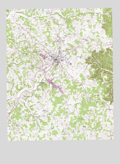
Tompkinsville, KY USGS Topographic Map
Click on map above to begin viewing in our Map Viewer.

This topographic map contains these locations and features:
Feature Name Type Latitude Longitude GNIS ID View Map
Athens ChurchChurchN36.6806°W85.7494°486112View Map
Beech Grove ChurchChurchN36.6306°W85.6817°486716View Map
Berea ChurchChurchN36.7092°W85.7133°486896View Map
Brown CemeteryCemeteryN36.7259°W85.7314°487987View Map
Cave Spring SchoolSchoolN36.7028°W85.6627°489141View Map
Chestnut Grove SchoolSchoolN36.6445°W85.6611°489445View Map
City of TompkinsvilleCivilN36.7012°W85.6926°2405594View Map
Corinth ChurchChurchN36.6484°W85.7080°490098View Map
Court House Burnings Historical MarkerParkN36.7010°W85.6924°2744610View Map
Curtis BranchStreamN36.6855°W85.7059°490509View Map
ForktonPopulated PlaceN36.7481°W85.7197°508025View Map
Freedom ChurchChurchN36.6287°W85.6283°492500View Map
GrandviewPopulated PlaceN36.7195°W85.6872°493097View Map
Gully CreekStreamN36.6653°W85.7400°493472View Map
Gully Creek ChurchChurchN36.6651°W85.7364°493473View Map
Hammer CemeteryCemeteryN36.6642°W85.6658°493633View Map
Harlan CrossroadsPopulated PlaceN36.6531°W85.7039°493747View Map
HestandPopulated PlaceN36.6542°W85.6294°494096View Map
Hickory Grove SchoolSchoolN36.6664°W85.7236°494132View Map
Liberty SchoolSchoolN36.6762°W85.6875°496389View Map
Lyon SchoolSchoolN36.7314°W85.7266°497389View Map
Lyons ChapelChurchN36.7198°W85.6552°497395View Map
Monroe ChurchChurchN36.7450°W85.6400°498489View Map
Monroe CountyCivilN36.7122°W85.7165°516932View Map
Monroe County Ambulance ServiceBuildingN36.7002°W85.6782°2719091View Map
Monroe County Fire and RescueBuildingN36.6973°W85.6962°2636994View Map
Monroe County Historical MarkerParkN36.7009°W85.6924°2744612View Map
Monroe County Medical CenterHospitalN36.7000°W85.6784°2660398View Map
Monroe County Sheriff's OfficeBuildingN36.7007°W85.6922°2767663View Map
Moores MillLocaleN36.6656°W85.6558°498566View Map
Moores Mill Historical MarkerParkN36.6648°W85.6535°2744616View Map
Morgans First Raid Historical MarkerParkN36.6778°W85.7042°2744609View Map
Mount GileadLocaleN36.7467°W85.6997°498728View Map
Mount Poland ChurchChurchN36.6609°W85.6458°498858View Map
Mount Zion SchoolSchoolN36.7239°W85.6789°498955View Map
Oak Hill CemeteryCemeteryN36.6989°W85.7014°499702View Map
Old Berea ChurchChurchN36.6492°W85.6994°499796View Map
Old Mount Hermon SchoolSchoolN36.7453°W85.6458°499859View Map
Old Mulkey Church Historical MarkerParkN36.6778°W85.7042°2744611View Map
Old Mulkey Meeting House State ParkParkN36.6798°W85.7083°499861View Map
Poplar Log Missionary Baptist ChurchChurchN36.7070°W85.7258°501123View Map
Poplar Log SchoolSchoolN36.7092°W85.7186°501126View Map
Red Hill SchoolSchoolN36.6364°W85.6989°501661View Map
Rush Point SchoolSchoolN36.6670°W85.6416°502490View Map
Sand Lick SchoolSchoolN36.7476°W85.7475°502932View Map
Sugar Grove SchoolSchoolN36.6392°W85.7375°504667View Map
Tinsley Hill SchoolSchoolN36.6259°W85.6436°505297View Map
TompkinsvillePopulated PlaceN36.7023°W85.6916°505341View Map
Tompkinsville DivisionCivilN36.6952°W85.6267°1937292View Map
Tompkinsville Police DepartmentBuildingN36.6999°W85.6921°2767666View Map
Tompkinsville Volunteer Fire DepartmentBuildingN36.7030°W85.6864°2636690View Map
Tompkinsville-Monroe County AirportAirportN36.7300°W85.6515°517495View Map
Town CreekStreamN36.6839°W85.7030°505389View Map
WTKY-AM (Tompkinsville)TowerN36.7242°W85.6814°517667View Map
WTKY-FM (Tompkinsville)TowerN36.7242°W85.6814°517742View Map

Note: Coordinates in the location and feature list above are referenced to NAD83 datum.


Copyright (C) 2008-2024 Ryan Niemi / Sunset Dynamics ... All Rights Reserved