TopoQuest Logo
Do you find TopoQuest useful?
Help keep TopoQuest running and adding new maps/features by donating!
Bitcoin:  19c7KJd3qBynnjoSw5npx9KScwjBe4ifkT
Litecoin:  LXs6TkuXGGXo1vDsWCkWVdjQX94eUKd6ui
Home View Maps Find Maps Find Places Resources & Links


Atlanta North, Texas Topographic Map

USGS Map Title: Atlanta North, TX
USGS Map MRC: 33094B2
DRG (GeoTIFF) Download: o33094b2.tif


Neighboring USGS Topographic Map Quads:


  Maud, TX  
33094C3
 

  Wright Patman Lake, TX  
33094C2
 

  Domino, TX  
33094C1
 

  Douglassville, TX  
33094B3
 

  Atlanta North, TX  
33094B2
 

  Bloomburg, TX  
33094B1
 

  Linden, TX  
33094A3
 

  Atlanta South, TX  
33094A2
 

  Ravanna, AR  
33094A1


Map MRC Location:

N34°
W95°
N34°
W94°
H8 H7 H6 H5 H4 H3 H2 H1
G8 G7 G6 G5 G4 G3 G2 G1
F8 F7 F6 F5 F4 F3 F2 F1
E8 E7 E6 E5 E4 E3 E2 E1
D8 D7 D6 D5 D4 D3 D2 D1
C8 C7 C6 C5 C4 C3 C2 C1
B8 B7 B6 B5 B4 B3 B2 B1
A8 A7 A6 A5 A4 A3 A2 A1
N33°
W95°
N33°
W94°

Atlanta North, TX USGS 1:24K Topographic Map Preview:
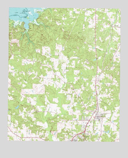
Atlanta North, TX USGS Topographic Map
Click on map above to begin viewing in our Map Viewer.

This topographic map contains these locations and features:
Feature Name Type Latitude Longitude GNIS ID View Map
Atlanta City ParkParkN33.1296°W94.1632°2028853View Map
Atlanta DivisionCivilN33.1739°W94.1461°1938507View Map
Atlanta State ParkParkN33.2321°W94.2494°1329822View Map
Butler CreekStreamN33.1443°W94.2069°1331746View Map
Cass County Fire District Station 2BuildingN33.1479°W94.1479°2655313View Map
City of Queen CityCivilN33.1508°W94.1524°2411506View Map
Country Place Community Baptist ChurchChurchN33.1365°W94.1852°2016692View Map
Courtland ChurchChurchN33.1696°W94.1807°1333527View Map
Elmo R Willard Branch LibraryBuildingN33.1585°W94.1380°2014927View Map
Forest Home CemeteryCemeteryN33.2268°W94.1730°1336026View Map
Hendrick Temple Church of God in ChristChurchN33.1260°W94.1757°2016699View Map
Hickory HillSummitN33.2223°W94.2110°1337680View Map
Hogan LakeReservoirN33.1585°W94.2369°1854972View Map
Hogan Lake DamDamN33.1585°W94.2369°1854971View Map
Honey Grove ChurchChurchN33.1532°W94.2180°1338024View Map
J K Hileman Elementary SchoolSchoolN33.1446°W94.1360°2003359View Map
Kite CreekStreamN33.1618°W94.2169°1339170View Map
LanarkPopulated PlaceN33.1821°W94.1494°1378556View Map
Lifenet - Queen City Post 70BuildingN33.1409°W94.1614°2720951View Map
Mathews-Powell HouseBuildingN33.1499°W94.1474°2030750View Map
Mill CreekStreamN33.2385°W94.2221°1341620View Map
Morris Upchurch Middle SchoolSchoolN33.1465°W94.1474°2003370View Map
Mount Zion ChurchChurchN33.2476°W94.1632°1342161View Map
Piney Grove ChurchChurchN33.1321°W94.2424°1344097View Map
Queen CityPopulated PlaceN33.1487°W94.1502°1344651View Map
Queen City City HallBuildingN33.1483°W94.1536°2753893View Map
Queen City High SchoolSchoolN33.1457°W94.1380°2003371View Map
Queen City Police DepartmentBuildingN33.1483°W94.1536°2751358View Map
Queen City Post OfficePost OfficeN33.1433°W94.1346°2731944View Map
Shady Grove ChurchChurchN33.1499°W94.2377°1346948View Map
SpringdalePopulated PlaceN33.2332°W94.1332°1379103View Map
Springdale ChurchChurchN33.2099°W94.1296°1347754View Map
Wilkins CreekStreamN33.2307°W94.2302°1350100View Map

Note: Coordinates in the location and feature list above are referenced to NAD83 datum.


Copyright (C) 2008-2024 Ryan Niemi / Sunset Dynamics ... All Rights Reserved