TopoQuest Logo
Do you find TopoQuest useful?
Help keep TopoQuest running and adding new maps/features by donating!
Bitcoin:  19c7KJd3qBynnjoSw5npx9KScwjBe4ifkT
Litecoin:  LXs6TkuXGGXo1vDsWCkWVdjQX94eUKd6ui
Home View Maps Find Maps Find Places Resources & Links


Ravanna, Arkansas Topographic Map

USGS Map Title: Ravanna, AR
USGS Map MRC: 33094A1
DRG (GeoTIFF) Download: o33094a1.tif


Neighboring USGS Topographic Map Quads:


  Atlanta North, TX  
33094B2
 

  Bloomburg, TX  
33094B1
 

  Doddridge NW, AR  
33093B8
 

  Atlanta South, TX  
33094A2
 

  Ravanna, AR  
33094A1
 

  Doddridge, AR  
33093A8
 

  Kildare, TX  
32094H2
 

  McLeod, TX  
32094H1
 

  Vivian North, LA  
32093H8


Map MRC Location:

N34°
W95°
N34°
W94°
H8 H7 H6 H5 H4 H3 H2 H1
G8 G7 G6 G5 G4 G3 G2 G1
F8 F7 F6 F5 F4 F3 F2 F1
E8 E7 E6 E5 E4 E3 E2 E1
D8 D7 D6 D5 D4 D3 D2 D1
C8 C7 C6 C5 C4 C3 C2 C1
B8 B7 B6 B5 B4 B3 B2 B1
A8 A7 A6 A5 A4 A3 A2 A1
N33°
W95°
N33°
W94°

Ravanna, AR USGS 1:24K Topographic Map Preview:
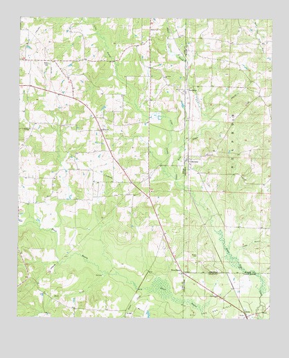
Ravanna, AR USGS Topographic Map
Click on map above to begin viewing in our Map Viewer.

This topographic map contains these locations and features:
Feature Name Type Latitude Longitude GNIS ID View Map
Alamance ChurchChurchN33.0787°W94.1196°1329290View Map
Beech Creek CemeteryCemeteryN33.1065°W94.1102°1330337View Map
Boggy CreekStreamN33.0110°W94.0596°1331013View Map
Brown CemeteryCemeteryN33.0268°W94.0366°46989View Map
Bull CreekStreamN33.0187°W94.0799°1372818View Map
Capps BranchStreamN33.0251°W94.0168°47462View Map
Enon ChurchChurchN33.0899°W94.0124°48900View Map
HammonsPopulated PlaceN33.0957°W94.0416°57873View Map
Line CreekStreamN33.0587°W94.0477°1339973View Map
Love ChapelChurchN33.0404°W94.1246°1340658View Map
McCoy (historical)Populated PlaceN33.0024°W94.0180°552858View Map
New Hope ChurchChurchN33.1007°W94.0535°1342481View Map
RavannaPopulated PlaceN33.0654°W94.0410°53912View Map
SandraPopulated PlaceN33.0035°W94.0130°543645View Map
SmyrnaPopulated PlaceN33.0782°W94.0844°1347312View Map
Three StatesPopulated PlaceN33.0193°W94.0427°1348527View Map
Three StatesPopulated PlaceN33.0193°W94.0427°539910View Map
Three States ChurchChurchN33.0096°W94.0263°539911View Map
ZylksPopulated PlaceN33.0018°W94.0116°540612View Map

Note: Coordinates in the location and feature list above are referenced to NAD83 datum.


Copyright (C) 2008-2024 Ryan Niemi / Sunset Dynamics ... All Rights Reserved