TopoQuest Logo
Do you find TopoQuest useful?
Help keep TopoQuest running and adding new maps/features by donating!
Bitcoin:  19c7KJd3qBynnjoSw5npx9KScwjBe4ifkT
Litecoin:  LXs6TkuXGGXo1vDsWCkWVdjQX94eUKd6ui
Home View Maps Find Maps Find Places Resources & Links


Greenwood, Wisconsin Topographic Map

USGS Map Title: Greenwood, WI
USGS Map MRC: 44090G5
DRG (GeoTIFF) Download: o44090g5.tif


Neighboring USGS Topographic Map Quads:


  Lombard, WI  
44090H6
 

  Owen, WI  
44090H5
 

  Curtiss, WI  
44090H4
 

  Mead Lake East, WI  
44090G6
 

  Greenwood, WI  
44090G5
 

  Riplinger, WI  
44090G4
 

  Willard, WI  
44090F6
 

  Loyal West, WI  
44090F5
 

  Loyal East, WI  
44090F4


Map MRC Location:

N45°
W91°
N45°
W90°
H8 H7 H6 H5 H4 H3 H2 H1
G8 G7 G6 G5 G4 G3 G2 G1
F8 F7 F6 F5 F4 F3 F2 F1
E8 E7 E6 E5 E4 E3 E2 E1
D8 D7 D6 D5 D4 D3 D2 D1
C8 C7 C6 C5 C4 C3 C2 C1
B8 B7 B6 B5 B4 B3 B2 B1
A8 A7 A6 A5 A4 A3 A2 A1
N44°
W91°
N44°
W90°

Greenwood, WI USGS 1:24K Topographic Map Preview:
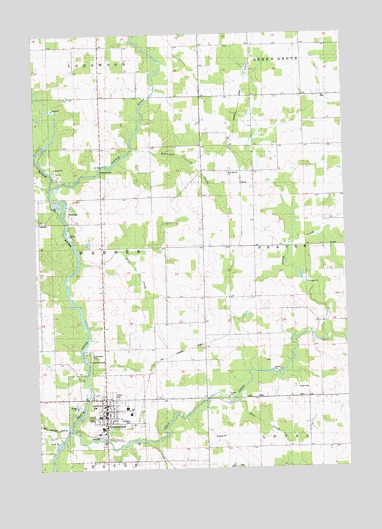
Greenwood, WI USGS Topographic Map
Click on map above to begin viewing in our Map Viewer.

This topographic map contains these locations and features:
Feature Name Type Latitude Longitude GNIS ID View Map
Bear CreekStreamN44.7702°W90.5457°1561361View Map
Behringer CreekStreamN44.8422°W90.5857°1561510View Map
Christopherson School (historical)SchoolN44.7922°W90.5735°1876585View Map
City of GreenwoodCivilN44.7655°W90.5995°1583323View Map
Gile CreekStreamN44.8097°W90.6071°1565521View Map
Grace United Methodist ChurchChurchN44.7669°W90.5960°1876591View Map
GreenwoodPopulated PlaceN44.7702°W90.5993°1565856View Map
Greenwood Area Volunteer Fire Department / Greenwood Area Ambulance ServiceBuildingN44.7600°W90.5995°2697585View Map
Greenwood City CemeteryCemeteryN44.7650°W90.6040°1837670View Map
Greenwood Elementary SchoolSchoolN44.7676°W90.5897°1837671View Map
Greenwood Middle / High SchoolSchoolN44.7652°W90.6009°1837672View Map
Greenwood ParkParkN44.7814°W90.6060°1565882View Map
Greenwood Police DepartmentBuildingN44.7656°W90.5985°2759469View Map
HemlockPopulated PlaceN44.8236°W90.6118°1577637View Map
LaTart School (historical)SchoolN44.8347°W90.5374°1567699View Map
Maple Center School (historical)SchoolN44.7952°W90.5218°1876593View Map
Nelson CreekStreamN44.7877°W90.5082°1570157View Map
Our Saviours Lutheran ChurchChurchN44.7705°W90.5993°1876599View Map
Popple RiverStreamN44.8308°W90.6182°1571775View Map
Rock CreekStreamN44.7608°W90.6135°1572432View Map
Saint Mary SchoolSchoolN44.7681°W90.5987°1837733View Map
Saint Mary's CemeteryCemeteryN44.7638°W90.5885°1573302View Map
Town Line AirportAirportN44.8513°W90.5555°1582004View Map
Town of WarnerCivilN44.8146°W90.6187°1584344View Map
Trondjem Church (historical)ChurchN44.7850°W90.5782°1876607View Map
West Beaver ChurchChurchN44.8350°W90.5474°1576449View Map

Note: Coordinates in the location and feature list above are referenced to NAD83 datum.


Copyright (C) 2008-2024 Ryan Niemi / Sunset Dynamics ... All Rights Reserved