TopoQuest Logo
Do you find TopoQuest useful?
Help keep TopoQuest running and adding new maps/features by donating!
Bitcoin:  19c7KJd3qBynnjoSw5npx9KScwjBe4ifkT
Litecoin:  LXs6TkuXGGXo1vDsWCkWVdjQX94eUKd6ui
Home View Maps Find Maps Find Places Resources & Links


Curtiss, Wisconsin Topographic Map

USGS Map Title: Curtiss, WI
USGS Map MRC: 44090H4
DRG (GeoTIFF) Download: o44090h4.tif


Neighboring USGS Topographic Map Quads:


  Lublin SE, WI  
45090A5
 

  Medford SW, WI  
45090A4
 

  Stetsonville, WI  
45090A3
 

  Owen, WI  
44090H5
 

  Curtiss, WI  
44090H4
 

  Abbotsford, WI  
44090H3
 

  Greenwood, WI  
44090G5
 

  Riplinger, WI  
44090G4
 

  Spencer North, WI  
44090G3


Map MRC Location:

N45°
W91°
N45°
W90°
H8 H7 H6 H5 H4 H3 H2 H1
G8 G7 G6 G5 G4 G3 G2 G1
F8 F7 F6 F5 F4 F3 F2 F1
E8 E7 E6 E5 E4 E3 E2 E1
D8 D7 D6 D5 D4 D3 D2 D1
C8 C7 C6 C5 C4 C3 C2 C1
B8 B7 B6 B5 B4 B3 B2 B1
A8 A7 A6 A5 A4 A3 A2 A1
N44°
W91°
N44°
W90°

Curtiss, WI USGS 1:24K Topographic Map Preview:
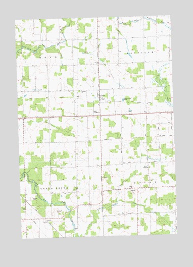
Curtiss, WI USGS Topographic Map
Click on map above to begin viewing in our Map Viewer.

This topographic map contains these locations and features:
Feature Name Type Latitude Longitude GNIS ID View Map
AtwoodPopulated PlaceN44.8861°W90.4818°1561001View Map
Atwood School (historical)SchoolN44.8936°W90.4496°1876579View Map
Bee Hive School (historical)SchoolN44.9297°W90.4957°1876580View Map
Clover Nook School (historical)SchoolN44.9439°W90.3974°1876586View Map
CurtissPopulated PlaceN44.9552°W90.4346°1563636View Map
Curtiss CemeteryCemeteryN44.9577°W90.4485°1563637View Map
Curtiss Volunteer Fire DepartmentBuildingN44.9534°W90.4344°2697896View Map
Midway SchoolSchoolN44.9594°W90.4746°1569447View Map
Norwegian ChurchChurchN44.9583°W90.4487°1837705View Map
Pine Hill CemeteryCemeteryN44.9736°W90.4335°1571464View Map
Saint Paul ChurchChurchN44.9089°W90.4340°1573449View Map
Sand Hill School (historical)SchoolN44.9166°W90.3971°1876601View Map
Town of ColbyCivilN44.9011°W90.3768°1582998View Map
Town of Green GroveCivilN44.9002°W90.4956°1583317View Map
Town of HoardCivilN44.9884°W90.4954°1583398View Map
Town of MayvilleCivilN44.9895°W90.3771°1583675View Map
Village of CurtissCivilN44.9522°W90.4348°1583039View Map
Woodland School (historical)SchoolN44.9225°W90.4451°1876609View Map

Note: Coordinates in the location and feature list above are referenced to NAD83 datum.


Copyright (C) 2008-2024 Ryan Niemi / Sunset Dynamics ... All Rights Reserved