TopoQuest Logo
Do you find TopoQuest useful?
Help keep TopoQuest running and adding new maps/features by donating!
Bitcoin:  19c7KJd3qBynnjoSw5npx9KScwjBe4ifkT
Litecoin:  LXs6TkuXGGXo1vDsWCkWVdjQX94eUKd6ui
Home View Maps Find Maps Find Places Resources & Links


Herculaneum, Missouri Topographic Map

USGS Map Title: Herculaneum, MO
USGS Map MRC: 38090C4
DRG (GeoTIFF) Download: o38090c4.tif


Neighboring USGS Topographic Map Quads:


  House Springs, MO  
38090D5
 

  Maxville, MO  
38090D4
 

  Oakville, MO  
38090D3
 

  Belews Creek, MO  
38090C5
 

  Herculaneum, MO  
38090C4
 

  Valmeyer, IL  
38090C3
 

  De Soto, MO  
38090B5
 

  Festus, MO  
38090B4
 

  Selma, MO  
38090B3


Map MRC Location:

N39°
W91°
N39°
W90°
H8 H7 H6 H5 H4 H3 H2 H1
G8 G7 G6 G5 G4 G3 G2 G1
F8 F7 F6 F5 F4 F3 F2 F1
E8 E7 E6 E5 E4 E3 E2 E1
D8 D7 D6 D5 D4 D3 D2 D1
C8 C7 C6 C5 C4 C3 C2 C1
B8 B7 B6 B5 B4 B3 B2 B1
A8 A7 A6 A5 A4 A3 A2 A1
N38°
W91°
N38°
W90°

Herculaneum, MO USGS 1:24K Topographic Map Preview:
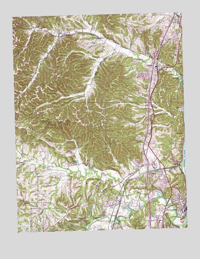
Herculaneum, MO USGS Topographic Map
Click on map above to begin viewing in our Map Viewer.

This topographic map contains these locations and features:
Feature Name Type Latitude Longitude GNIS ID View Map
AntoniaPopulated PlaceN38.3626°W90.4657°735487View Map
Antonia Fire Protection District Station 1BuildingN38.3627°W90.4653°2621177View Map
Antonia Fire Protection District Station 2BuildingN38.3529°W90.4268°2621381View Map
Antonia SchoolSchoolN38.3678°W90.4793°713350View Map
Antonia School (historical)SchoolN38.3462°W90.4829°748189View Map
Assumption CemeteryCemeteryN38.2600°W90.3937°713459View Map
Atwood Lake DamDamN38.2967°W90.4585°764987View Map
BarnhartPopulated PlaceN38.3442°W90.3935°713687View Map
Barnhart Census Designated PlaceCensusN38.3360°W90.4045°2393328View Map
Barnhart Post OfficePost OfficeN38.3469°W90.3992°2469224View Map
Big CreekStreamN38.2917°W90.4898°714153View Map
Booth Lake DamDamN38.2917°W90.4585°764175View Map
BushburgPopulated PlaceN38.3053°W90.3765°740715View Map
Camp Cedar LedgeLocaleN38.3042°W90.4573°715255View Map
Cedar LakeReservoirN38.2903°W90.4554°715611View Map
City of HerculaneumCivilN38.2573°W90.3935°2394358View Map
City of PevelyCivilN38.2871°W90.3992°2396196View Map
Dunklin Fire Protection DistrictBuildingN38.2817°W90.4184°2620374View Map
Dunklin-Fletcher Memorial ParkParkN38.2662°W90.3765°748196View Map
Emmanuel CemeteryCemeteryN38.3120°W90.3980°717579View Map
Engle (historical)Populated PlaceN38.3214°W90.3993°739956View Map
Francois Lake DamDamN38.3267°W90.4168°765173View Map
Glen ParkParkN38.3195°W90.3785°718499View Map
Harrington CemeteryCemeteryN38.2971°W90.3990°719141View Map
HerculaneumPopulated PlaceN38.2684°W90.3801°719395View Map
Herculaneum Fire DepartmentBuildingN38.2565°W90.3893°2620921View Map
Herculaneum Police DepartmentBuildingN38.2635°W90.3784°2752524View Map
Herculaneum Post OfficePost OfficeN38.2519°W90.3932°2782831View Map
Herculaneum Wastewater Treatment PlantLocaleN38.2555°W90.3772°2469043View Map
HorinePopulated PlaceN38.2667°W90.4246°736307View Map
Horine Census Designated PlaceCensusN38.2673°W90.4320°2393054View Map
ImperialPopulated PlaceN38.3698°W90.3785°736308View Map
Imperial Post OfficePost OfficeN38.3674°W90.3861°2469257View Map
Indian Foot LakeReservoirN38.2853°W90.4440°720129View Map
Interchange 185CrossingN38.3493°W90.3957°2468319View Map
Interchange 186CrossingN38.3696°W90.3830°2468320View Map
JarvisPopulated PlaceN38.2681°W90.4943°720264View Map
Jerseydale (historical)LocaleN38.2773°W90.4182°748194View Map
Koch Valley School (historical)SchoolN38.3139°W90.3971°748191View Map
Lake HorineReservoirN38.2591°W90.4365°764177View Map
Lake Horine DamDamN38.2584°W90.4368°764176View Map
Lake LouiseReservoirN38.2595°W90.4466°764174View Map
Lake Louise DamDamN38.2584°W90.4485°764173View Map
Liguori LakeReservoirN38.3401°W90.4101°764246View Map
Liguori Lake Dam - Nonane 255DamN38.3401°W90.4101°764245View Map
Liguori Post OfficePost OfficeN38.3420°W90.4097°2782710View Map
Mahlers CemeteryCemeteryN38.2813°W90.4715°721757View Map
Moss HollowValleyN38.3545°W90.4248°722676View Map
Moss Hollow School (historical)SchoolN38.3509°W90.4285°748188View Map
MunsonsPopulated PlaceN38.2514°W90.4262°723068View Map
Number 230 DamDamN38.2617°W90.4168°764141View Map
PevelyPopulated PlaceN38.2834°W90.3951°724274View Map
Pevely Elementary SchoolSchoolN38.2855°W90.3979°2468833View Map
Pevely LakeReservoirN38.2781°W90.4383°724275View Map
Pevely Police DepartmentBuildingN38.2841°W90.3930°2752120View Map
Pevely Post OfficePost OfficeN38.2843°W90.3944°2782936View Map
Pevely Wastewater Treatment PlantLocaleN38.2794°W90.4117°2469091View Map
Pleasant Valley SchoolSchoolN38.2795°W90.4210°748193View Map
RiversidePopulated PlaceN38.2867°W90.3801°741202View Map
Rock ChurchChurchN38.3534°W90.3787°725435View Map
Rock Community Fire Protection District House 2BuildingN38.3696°W90.3900°2621296View Map
Saint Lukes ChurchChurchN38.3612°W90.4360°725818View Map
Saint Pauls ChurchChurchN38.3698°W90.4993°725880View Map
Sandy ChurchChurchN38.2817°W90.4854°736346View Map
Sandy CreekStreamN38.2659°W90.4032°726038View Map
Sandy SchoolSchoolN38.2820°W90.4857°748190View Map
Schmitt (historical)LocaleN38.3001°W90.4015°748192View Map
Sun Valley ParkParkN38.3112°W90.4104°727298View Map
Teamsters DamDamN38.2884°W90.3818°763764View Map
Teamsters LakeReservoirN38.2880°W90.3829°763765View Map
Township of ImperialCivilN38.3684°W90.4493°2397815View Map
Township of JoachimCivilN38.2631°W90.4519°766824View Map
White School (historical)SchoolN38.3728°W90.3801°737705View Map
Windsor Lake DamDamN38.2584°W90.4468°764171View Map
Windsor SchoolSchoolN38.3623°W90.3751°728993View Map
Winsor LakeReservoirN38.2584°W90.4468°764172View Map
Zion ChurchChurchN38.2670°W90.4957°737704View Map
Zion ChurchChurchN38.2876°W90.3985°729243View Map
Zion Lutheran CemeteryCemeteryN38.2781°W90.3954°729234View Map
Zion Lutheran Church CemeteryCemeteryN38.2672°W90.4952°2702380View Map
Zion SchoolSchoolN38.2667°W90.4960°729257View Map

Note: Coordinates in the location and feature list above are referenced to NAD83 datum.


Copyright (C) 2008-2024 Ryan Niemi / Sunset Dynamics ... All Rights Reserved