TopoQuest Logo
Do you find TopoQuest useful?
Help keep TopoQuest running and adding new maps/features by donating!
Bitcoin:  19c7KJd3qBynnjoSw5npx9KScwjBe4ifkT
Litecoin:  LXs6TkuXGGXo1vDsWCkWVdjQX94eUKd6ui
Home View Maps Find Maps Find Places Resources & Links


Hopkins Butte, California Topographic Map

USGS Map Title: Hopkins Butte, CA
USGS Map MRC: 41123B5
DRG (GeoTIFF) Download: o41123b5.tif


Neighboring USGS Topographic Map Quads:


  Fish Lake, CA  
41123C6
 

  Orleans, CA  
41123C5
 

  Orleans Mountain, CA  
41123C4
 

  Weitchpec, CA  
41123B6
 

  Hopkins Butte, CA  
41123B5
 

  Salmon Mountain, CA  
41123B4
 

  Hoopa, CA  
41123A6
 

  Tish Tang Point, CA  
41123A5
 

  Trinity Mountain, CA  
41123A4


Map MRC Location:

N42°
W124°
N42°
W123°
H8 H7 H6 H5 H4 H3 H2 H1
G8 G7 G6 G5 G4 G3 G2 G1
F8 F7 F6 F5 F4 F3 F2 F1
E8 E7 E6 E5 E4 E3 E2 E1
D8 D7 D6 D5 D4 D3 D2 D1
C8 C7 C6 C5 C4 C3 C2 C1
B8 B7 B6 B5 B4 B3 B2 B1
A8 A7 A6 A5 A4 A3 A2 A1
N41°
W124°
N41°
W123°

Hopkins Butte, CA USGS 1:24K Topographic Map Preview:
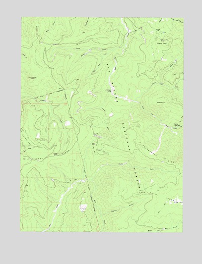
Hopkins Butte, CA USGS Topographic Map
Click on map above to begin viewing in our Map Viewer.

This topographic map contains these locations and features:
Feature Name Type Latitude Longitude GNIS ID View Map
Bear Wallow GulchValleyN41.2410°W123.5420°266432View Map
Black MountainSummitN41.2004°W123.5167°266460View Map
Bunchgrass CreekStreamN41.1251°W123.6070°266515View Map
Colgrove BranchStreamN41.1362°W123.5645°266587View Map
Ferris MineMineN41.1760°W123.5684°266706View Map
Hopkins ButteSummitN41.2143°W123.6181°266816View Map
Le Perron FlatFlatN41.2418°W123.5209°266902View Map
Le Perron PeakSummitN41.2349°W123.5139°1659743View Map
Leary CreekStreamN41.2340°W123.5456°266904View Map
LePerron Peak SpringSpringN41.2371°W123.5188°266903View Map
Lockharts (historical)Populated PlaceN41.2118°W123.5201°1665249View Map
Middle Fork Leary CreekStreamN41.2310°W123.5556°267002View Map
Middle Fork Red Cap CreekStreamN41.1860°W123.5101°267004View Map
Mill Creek GapGapN41.1810°W123.5695°267012View Map
North Fork Mill CreekStreamN41.1554°W123.5714°267076View Map
North Fork Red Cap CreekStreamN41.2010°W123.5376°267077View Map
Packsaddle RidgeRidgeN41.1649°W123.5051°267106View Map
Red Cap Central MineMineN41.1868°W123.5070°267164View Map
Schnable DiggingsLocaleN41.2068°W123.5573°267216View Map
South Fork Leary CreekStreamN41.2271°W123.5631°267469View Map
South Fork Red Cap CreekStreamN41.2068°W123.5564°267494View Map
Tenmile SpringSpringN41.1702°W123.5975°268146View Map

Note: Coordinates in the location and feature list above are referenced to NAD83 datum.


Copyright (C) 2008-2024 Ryan Niemi / Sunset Dynamics ... All Rights Reserved