TopoQuest Logo
Do you find TopoQuest useful?
Help keep TopoQuest running and adding new maps/features by donating!
Bitcoin:  19c7KJd3qBynnjoSw5npx9KScwjBe4ifkT
Litecoin:  LXs6TkuXGGXo1vDsWCkWVdjQX94eUKd6ui
Home View Maps Find Maps Find Places Resources & Links


Orleans Mountain, California Topographic Map

USGS Map Title: Orleans Mountain, CA
USGS Map MRC: 41123C4
DRG (GeoTIFF) Download: o41123c4.tif


Neighboring USGS Topographic Map Quads:


  Bark Shanty Gulch, CA  
41123D5
 

  Somes Bar, CA  
41123D4
 

  Medicine Mountain, CA  
41123D3
 

  Orleans, CA  
41123C5
 

  Orleans Mountain, CA  
41123C4
 

  Forks of Salmon, CA  
41123C3
 

  Hopkins Butte, CA  
41123B5
 

  Salmon Mountain, CA  
41123B4
 

  Youngs Peak, CA  
41123B3


Map MRC Location:

N42°
W124°
N42°
W123°
H8 H7 H6 H5 H4 H3 H2 H1
G8 G7 G6 G5 G4 G3 G2 G1
F8 F7 F6 F5 F4 F3 F2 F1
E8 E7 E6 E5 E4 E3 E2 E1
D8 D7 D6 D5 D4 D3 D2 D1
C8 C7 C6 C5 C4 C3 C2 C1
B8 B7 B6 B5 B4 B3 B2 B1
A8 A7 A6 A5 A4 A3 A2 A1
N41°
W124°
N41°
W123°

Orleans Mountain, CA USGS 1:24K Topographic Map Preview:
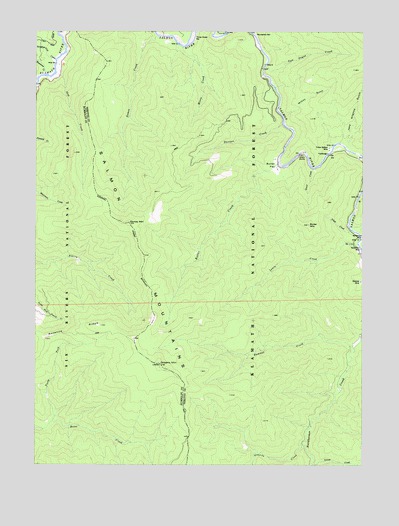
Orleans Mountain, CA USGS Topographic Map
Click on map above to begin viewing in our Map Viewer.

This topographic map contains these locations and features:
Feature Name Type Latitude Longitude GNIS ID View Map
Antenna RidgeRidgeN41.2879°W123.4884°256289View Map
Bloomer MineMineN41.3032°W123.3751°257219View Map
Butler CreekStreamN41.3368°W123.4092°257752View Map
Butler FlatFlatN41.3374°W123.4101°257753View Map
Butler MountainSummitN41.3190°W123.3970°257754View Map
Donahue Flat CreekStreamN41.3665°W123.4939°259468View Map
Duncan CreekStreamN41.3485°W123.4073°259608View Map
Granite CreekStreamN41.2565°W123.3987°260747View Map
Grant BluffsCliffN41.3393°W123.4009°260766View Map
Grant CreekStreamN41.3354°W123.3956°260767View Map
Hammel CreekStreamN41.2837°W123.3789°261048View Map
Ikes CreekStreamN41.3629°W123.4937°261685View Map
Indian Bottom MineMineN41.3412°W123.3892°261712View Map
Jake Allgood GulchValleyN41.3443°W123.3820°261890View Map
Lewis CreekStreamN41.3137°W123.3778°262426View Map
Monte CreekStreamN41.3704°W123.4464°263762View Map
Morehouse CreekStreamN41.3185°W123.3809°263814View Map
Morehouse MineMineN41.3151°W123.3764°263816View Map
North Fork Boise CreekStreamN41.2623°W123.4942°264139View Map
Orleans MountainSummitN41.2790°W123.4539°264398View Map
Orleans Mountain LookoutLocaleN41.2790°W123.4701°276308View Map
Red Cap RanchLocaleN41.3135°W123.3767°276309View Map
Rosaleno CreekStreamN41.3623°W123.4973°265567View Map
Somes CreekStreamN41.3737°W123.4562°267390View Map
Somes MountainSummitN41.3198°W123.4662°267391View Map
Three Dollar BarBarN41.3732°W123.4428°268253View Map
Tom Payne CreekStreamN41.3646°W123.4145°268336View Map
Tripp CreekStreamN41.3176°W123.3806°268418View Map
Wilson GulchValleyN41.3507°W123.4073°269205View Map

Note: Coordinates in the location and feature list above are referenced to NAD83 datum.


Copyright (C) 2008-2024 Ryan Niemi / Sunset Dynamics ... All Rights Reserved