TopoQuest Logo
Do you find TopoQuest useful?
Help keep TopoQuest running and adding new maps/features by donating!
Bitcoin:  19c7KJd3qBynnjoSw5npx9KScwjBe4ifkT
Litecoin:  LXs6TkuXGGXo1vDsWCkWVdjQX94eUKd6ui
Home View Maps Find Maps Find Places Resources & Links


Orleans, California Topographic Map

USGS Map Title: Orleans, CA
USGS Map MRC: 41123C5
DRG (GeoTIFF) Download: o41123c5.tif


Neighboring USGS Topographic Map Quads:


  Lonesome Ridge, CA  
41123D6
 

  Bark Shanty Gulch, CA  
41123D5
 

  Somes Bar, CA  
41123D4
 

  Fish Lake, CA  
41123C6
 

  Orleans, CA  
41123C5
 

  Orleans Mountain, CA  
41123C4
 

  Weitchpec, CA  
41123B6
 

  Hopkins Butte, CA  
41123B5
 

  Salmon Mountain, CA  
41123B4


Map MRC Location:

N42°
W124°
N42°
W123°
H8 H7 H6 H5 H4 H3 H2 H1
G8 G7 G6 G5 G4 G3 G2 G1
F8 F7 F6 F5 F4 F3 F2 F1
E8 E7 E6 E5 E4 E3 E2 E1
D8 D7 D6 D5 D4 D3 D2 D1
C8 C7 C6 C5 C4 C3 C2 C1
B8 B7 B6 B5 B4 B3 B2 B1
A8 A7 A6 A5 A4 A3 A2 A1
N41°
W124°
N41°
W123°

Orleans, CA USGS 1:24K Topographic Map Preview:
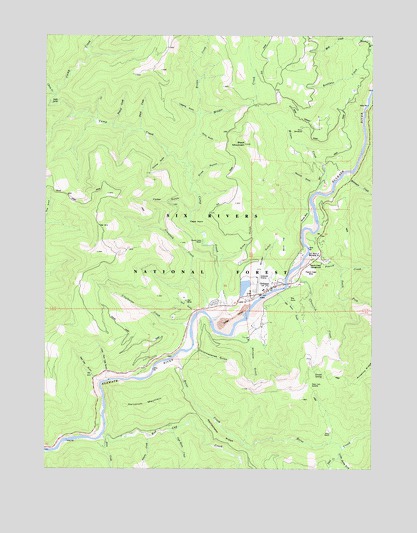
Orleans, CA USGS Topographic Map
Click on map above to begin viewing in our Map Viewer.

This topographic map contains these locations and features:
Feature Name Type Latitude Longitude GNIS ID View Map
Adams CreekStreamN41.2590°W123.5870°256112View Map
Allen CreekStreamN41.2587°W123.6037°266378View Map
Bacon FlatFlatN41.3148°W123.5353°256410View Map
Big RockPillarN41.2987°W123.5326°256994View Map
Big Rock GulchValleyN41.2998°W123.5364°256999View Map
Black MountainSummitN41.3435°W123.5506°257138View Map
Boise CreekStreamN41.2823°W123.5764°257324View Map
Bonda MineMineN41.3229°W123.5278°257334View Map
Brown CreekStreamN41.3523°W123.5681°257489View Map
Camp CreekStreamN41.2926°W123.5631°257869View Map
Cape HornCapeN41.3212°W123.5723°257954View Map
Captain Haun CreekStreamN41.2607°W123.5781°266535View Map
Cedar CreekStreamN41.3546°W123.6248°258123View Map
Cedar GulchValleyN41.3243°W123.5720°258134View Map
Cheenitch CreekStreamN41.3046°W123.5337°258232View Map
Chimmekanee GulchValleyN41.2840°W123.5692°258285View Map
China CreekStreamN41.3582°W123.6223°258302View Map
China GulchValleyN41.3460°W123.5701°258310View Map
Christie GulchValleyN41.3401°W123.5809°258352View Map
Crawford CreekStreamN41.2954°W123.5662°258894View Map
Deer Lick SaddleGapN41.2737°W123.5248°259241View Map
Dyer PlaceLocaleN41.3282°W123.6184°276337View Map
Dyer Place (historical)Populated PlaceN41.3285°W123.6178°1665218View Map
First CreekStreamN41.3504°W123.6070°1665224View Map
Fivemile CreekStreamN41.3437°W123.5039°260185View Map
H E Beck Junior Memorial BranchParkN41.3110°W123.5217°261001View Map
Head CampLocaleN41.3551°W123.6237°261201View Map
Hunter Little RanchLocaleN41.3154°W123.5670°261643View Map
Little Red Cap GulchValleyN41.2760°W123.6028°227341View Map
Little South Fork Boise CreekStreamN41.2560°W123.5123°266926View Map
Logging GulchValleyN41.3518°W123.5692°262790View Map
McHale MineMineN41.2618°W123.5773°1665255View Map
Mud CreekStreamN41.3740°W123.5067°263921View Map
Opegoi (historical)Populated PlaceN41.2596°W123.6062°1682147View Map
OrleansPopulated PlaceN41.3015°W123.5412°264396View Map
Orleans District Ranger StationLocaleN41.3035°W123.5381°276370View Map
Orleans Elementary SchoolSchoolN41.3016°W123.5422°1682012View Map
Orleans Post OfficePost OfficeN41.3023°W123.5383°2760081View Map
Orleans Volunteer Fire DepartmentBuildingN41.3019°W123.5384°2622136View Map
Owl GulchValleyN41.2954°W123.5692°264423View Map
Owl MineMineN41.2982°W123.5726°264425View Map
Panamenik (historical)Populated PlaceN41.3026°W123.5414°1682148View Map
Pearch CreekStreamN41.3121°W123.5251°1654929View Map
Pearch Creek CampgroundLocaleN41.3090°W123.5209°264596View Map
Pearch Creek MineMineN41.3057°W123.5248°264597View Map
Rattlesnake RidgeRidgeN41.2593°W123.5601°265229View Map
Red Cap CreekStreamN41.2587°W123.6051°267165View Map
Red Cap GulchValleyN41.2762°W123.6073°265258View Map
Reece HomesteadLocaleN41.3482°W123.5287°265357View Map
Sarvorum MountainSummitN41.2676°W123.5878°1659604View Map
Sawmill GulchValleyN41.3312°W123.5228°265871View Map
Second CreekStreamN41.3490°W123.6012°265960View Map
Short RanchLocaleN41.2604°W123.5167°266136View Map
Sims GulchValleyN41.3104°W123.5584°266209View Map
Slide GulchValleyN41.3323°W123.5703°266297View Map
South Fork Pearch CreekStreamN41.3076°W123.5134°1654962View Map
Sunset SpringSpringN41.2777°W123.5229°267978View Map
Third CreekStreamN41.3476°W123.5909°268218View Map
Trail CreekStreamN41.2535°W123.5134°268372View Map
Ullathorne CreekStreamN41.2912°W123.5709°268572View Map
Whiteys GulchValleyN41.2873°W123.5514°269037View Map
Whitmore CreekStreamN41.3354°W123.5114°269043View Map
Wilder CreekStreamN41.3373°W123.5706°269100View Map
Wilder GulchValleyN41.3079°W123.5431°269101View Map
Wilson CreekStreamN41.3298°W123.5214°269199View Map

Note: Coordinates in the location and feature list above are referenced to NAD83 datum.


Copyright (C) 2008-2024 Ryan Niemi / Sunset Dynamics ... All Rights Reserved