TopoQuest Logo
Do you find TopoQuest useful?
Help keep TopoQuest running and adding new maps/features by donating!
Bitcoin:  19c7KJd3qBynnjoSw5npx9KScwjBe4ifkT
Litecoin:  LXs6TkuXGGXo1vDsWCkWVdjQX94eUKd6ui
Home View Maps Find Maps Find Places Resources & Links


Hurley, Virginia Topographic Map

USGS Map Title: Hurley, VA
USGS Map MRC: 37082D1
DRG (GeoTIFF) Download: o37082d1.tif


Neighboring USGS Topographic Map Quads:


  Matewan, WV  
37082E2
 

  Majestic, KY  
37082E1
 

  Wharncliffe, WV  
37081E8
 

  Jamboree, KY  
37082D2
 

  Hurley, VA  
37082D1
 

  Panther, WV  
37081D8
 

  Harman, VA  
37082C2
 

  Grundy, VA  
37082C1
 

  Patterson, VA  
37081C8


Map MRC Location:

N38°
W83°
N38°
W82°
H8 H7 H6 H5 H4 H3 H2 H1
G8 G7 G6 G5 G4 G3 G2 G1
F8 F7 F6 F5 F4 F3 F2 F1
E8 E7 E6 E5 E4 E3 E2 E1
D8 D7 D6 D5 D4 D3 D2 D1
C8 C7 C6 C5 C4 C3 C2 C1
B8 B7 B6 B5 B4 B3 B2 B1
A8 A7 A6 A5 A4 A3 A2 A1
N37°
W83°
N37°
W82°

Hurley, VA USGS 1:24K Topographic Map Preview:
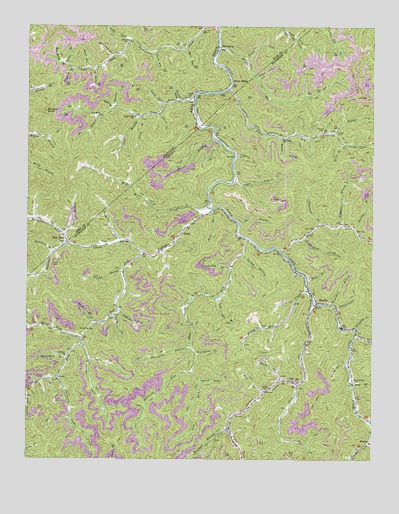
Hurley, VA USGS Topographic Map
Click on map above to begin viewing in our Map Viewer.

This topographic map contains these locations and features:
Feature Name Type Latitude Longitude GNIS ID View Map
Abners ForkStreamN37.4087°W82.1046°1462337View Map
ArgoPopulated PlaceN37.4807°W82.0632°486024View Map
Argo Post Office (historical)Post OfficeN37.4940°W82.0540°2337487View Map
Balls ForkStreamN37.4171°W82.0937°1462752View Map
Barn HollowValleyN37.4769°W82.0943°486372View Map
Bay BranchStreamN37.4421°W82.0065°1477026View Map
Bear HollowValleyN37.4934°W82.0681°486569View Map
Bear HollowValleyN37.4266°W82.0512°1497424View Map
Bearwallow BranchStreamN37.4079°W82.0651°1462910View Map
Belcher CemeteryCemeteryN37.3954°W82.0390°1463015View Map
Bethany ChurchChurchN37.4046°W82.1104°1463133View Map
Bill BranchStreamN37.3973°W82.0065°1463430View Map
Bill SidingLocaleN37.4940°W82.0546°487306View Map
Billy ForkStreamN37.4662°W82.0112°1463441View Map
Blankenship CemeteryCemeteryN37.3982°W82.0062°1463562View Map
Blue Spring BranchStreamN37.4879°W82.1085°487546View Map
Boardtree BranchStreamN37.4346°W82.1157°487584View Map
Brakes ForkStreamN37.4140°W82.1004°1463749View Map
Brierfield BranchStreamN37.4204°W82.0146°1463819View Map
Bubby BranchStreamN37.4676°W82.0332°1463967View Map
Buffalo ForkStreamN37.4693°W82.0140°1464042View Map
Burke SidingLocaleN37.4846°W82.0504°488432View Map
Calfpen HollowValleyN37.3750°W82.0465°1497435View Map
Camp CreekStreamN37.4796°W82.0640°488684View Map
Camp Creek (historical)Populated PlaceN37.4748°W82.0865°2120548View Map
Camp Creek SchoolSchoolN37.4740°W82.0860°488690View Map
Cedar BranchStreamN37.4548°W82.0504°1464584View Map
Coleman CemeteryCemeteryN37.4377°W82.1116°2120564View Map
Company HollowValleyN37.4910°W82.0945°489913View Map
Deadening BranchStreamN37.4307°W82.0507°1465678View Map
Devils BranchStreamN37.4676°W82.0573°490839View Map
Dooley HollowValleyN37.4026°W82.0092°1465886View Map
Dotson CemeteryCemeteryN37.4693°W82.0129°1465895View Map
Eli ForkStreamN37.4746°W82.0982°491624View Map
Elk Creek ChurchChurchN37.4676°W82.0326°1466216View Map
Elk School (historical)SchoolN37.4690°W82.0179°1466226View Map
Enoch ForkStreamN37.4748°W82.0768°491787View Map
Flyweed BranchStreamN37.4879°W82.1085°492288View Map
Greenbriar BranchStreamN37.4059°W82.0632°1467492View Map
Guess ForkStreamN37.4348°W82.0323°1467582View Map
Halfmile BranchStreamN37.3979°W82.0323°1467655View Map
Halls BranchStreamN37.4268°W82.0237°1467671View Map
High KnobSummitN37.4541°W82.1112°2120830View Map
Horse BranchStreamN37.4307°W82.0507°1468255View Map
Horseshoe BranchStreamN37.4054°W82.1093°1468311View Map
Hunts ForkStreamN37.4101°W82.1049°1468410View Map
HurleyPopulated PlaceN37.4204°W82.0198°1495733View Map
Hurley CemeteryCemeteryN37.4698°W82.0187°1468417View Map
Hurley Elementary - Middle SchoolSchoolN37.3847°W82.0006°1497455View Map
Hurley High SchoolSchoolN37.3800°W82.0007°2498460View Map
Hurley Post OfficePost OfficeN37.4201°W82.0206°2766378View Map
Hurley SchoolSchoolN37.4962°W82.0885°494799View Map
Hurricane (historical)Populated PlaceN37.4941°W82.0759°2120836View Map
Hurricane ForkStreamN37.4001°W82.0646°1468425View Map
Hurricane School (historical)SchoolN37.4941°W82.0748°2120839View Map
IraPopulated PlaceN37.4293°W82.0901°1497458View Map
Ira SchoolSchoolN37.4126°W82.1026°1468511View Map
Jacks BranchStreamN37.4743°W82.0832°495085View Map
KelsaPopulated PlaceN37.4407°W82.0687°1495776View Map
Kershaw BranchStreamN37.4432°W82.0115°1848397View Map
Knox Creek Volunteer Fire DepartmentBuildingN37.4081°W82.0069°2721125View Map
Knox DistrictCivilN37.4191°W82.0145°1927367View Map
Laurel ForkStreamN37.3973°W82.0621°1469178View Map
Laurel ForkStreamN37.4112°W82.0057°1469181View Map
Left Fork Hurricane CreekStreamN37.4958°W82.0886°2744692View Map
Left Fork Pawpaw CreekStreamN37.4343°W82.0829°1469296View Map
Left Fork Race ForkStreamN37.4387°W82.0451°1469297View Map
Lester CemeteryCemeteryN37.4132°W82.0398°1469315View Map
Lester ForkStreamN37.4198°W82.0207°1469317View Map
Lester Fork School (historical)SchoolN37.3934°W82.0404°1497467View Map
Lick BranchStreamN37.4398°W82.1115°496414View Map
Low Gap BranchStreamN37.4218°W82.0554°1469897View Map
Maleky BranchStreamN37.4293°W82.0899°1470026View Map
Malen HollowValleyN37.4922°W82.0791°497469View Map
Mariah ForkStreamN37.4787°W82.0696°497541View Map
Middle Elk CreekStreamN37.4933°W82.0559°498110View Map
Mile BranchStreamN37.3946°W82.0382°1470455View Map
Mill CreekStreamN37.4479°W82.0598°498245View Map
Monk HollowValleyN37.4882°W82.1035°498483View Map
Mounts CemeteryCemeteryN37.4654°W82.0054°1471205View Map
North Fork Left Fork Hurricane CreekStreamN37.4879°W82.1001°499553View Map
Old House HollowValleyN37.3789°W82.0471°1497475View Map
Oldhouse BranchStreamN37.4176°W82.0910°1471893View Map
Owen BranchStreamN37.4746°W82.0854°500053View Map
Paw PawPopulated PlaceN37.4376°W82.1107°500279View Map
Paw Paw Post Office (historical)Post OfficeN37.4377°W82.1108°2336957View Map
Pawpaw CreekStreamN37.4472°W82.0583°500284View Map
Pawpaw School (historical)SchoolN37.4115°W82.1040°1497476View Map
Phelps DivisionCivilN37.4981°W82.1194°1937200View Map
Pounding Mill CreekStreamN37.4237°W82.0229°1472725View Map
Preston BranchStreamN37.4762°W82.0924°501298View Map
Pumpkin BranchStreamN37.4432°W82.0196°1477027View Map
Puncheon BranchStreamN37.4426°W82.0193°1472862View Map
Puncheon Camp CreekStreamN37.3984°W82.1124°1472864View Map
Reedy ForkStreamN37.4912°W82.0451°501702View Map
Rife CemeteryCemeteryN37.4651°W82.0098°1473215View Map
Right Fork Hurricane CreekStreamN37.4958°W82.0886°501890View Map
Rockhouse ForkStreamN37.4371°W82.1096°502202View Map
Schoolhouse BranchStreamN37.4190°W82.0123°1474100View Map
Shepardmen ChurchChurchN37.4811°W82.0652°2337035View Map
Skinflint ForkStreamN37.4129°W82.0057°1474649View Map
South Fork Camp CreekStreamN37.4776°W82.0746°503909View Map
Spring BranchStreamN37.4343°W82.0468°1474977View Map
Sprout BranchStreamN37.4893°W82.1118°504167View Map
Staggerweed CreekStreamN37.4387°W82.0251°1475055View Map
State Line HollowValleyN37.4851°W82.0418°1475089View Map
Sulphur CreekStreamN37.4626°W82.0496°1475306View Map
Sulphur KnobSummitN37.4754°W82.1185°504739View Map
Swan ForkStreamN37.4387°W82.0909°504835View Map
Upper Elk CreekStreamN37.4819°W82.0523°505878View Map
Virginia Energy DamDamN37.4834°W82.0165°1489268View Map
Wolfpen BranchStreamN37.3840°W82.0515°1476913View Map

Note: Coordinates in the location and feature list above are referenced to NAD83 datum.


Copyright (C) 2008-2024 Ryan Niemi / Sunset Dynamics ... All Rights Reserved