TopoQuest Logo
Do you find TopoQuest useful?
Help keep TopoQuest running and adding new maps/features by donating!
Bitcoin:  19c7KJd3qBynnjoSw5npx9KScwjBe4ifkT
Litecoin:  LXs6TkuXGGXo1vDsWCkWVdjQX94eUKd6ui
Home View Maps Find Maps Find Places Resources & Links


Indian Grove, Missouri Topographic Map

USGS Map Title: Indian Grove, MO
USGS Map MRC: 39093E1
DRG (GeoTIFF) Download: o39093e1.tif


Neighboring USGS Topographic Map Quads:


  Sumner, MO  
39093F2
 

  Rothville, MO  
39093F1
 

  Marceline, MO  
39092F8
 

  Mendon, MO  
39093E2
 

  Indian Grove, MO  
39093E1
 

  Mike, MO  
39092E8
 

  Brunswick West, MO  
39093D2
 

  Brunswick East, MO  
39093D1
 

  Keytesville, MO  
39092D8


Map MRC Location:

N40°
W94°
N40°
W93°
H8 H7 H6 H5 H4 H3 H2 H1
G8 G7 G6 G5 G4 G3 G2 G1
F8 F7 F6 F5 F4 F3 F2 F1
E8 E7 E6 E5 E4 E3 E2 E1
D8 D7 D6 D5 D4 D3 D2 D1
C8 C7 C6 C5 C4 C3 C2 C1
B8 B7 B6 B5 B4 B3 B2 B1
A8 A7 A6 A5 A4 A3 A2 A1
N39°
W94°
N39°
W93°

Indian Grove, MO USGS 1:24K Topographic Map Preview:
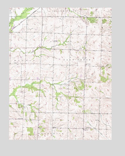
Indian Grove, MO USGS Topographic Map
Click on map above to begin viewing in our Map Viewer.

This topographic map contains these locations and features:
Feature Name Type Latitude Longitude GNIS ID View Map
158 DamDamN39.5517°W93.0835°761120View Map
Elm BranchStreamN39.5437°W93.1202°717499View Map
German CemeteryCemeteryN39.5247°W93.0252°718414View Map
Huessner LakeReservoirN39.5450°W93.0519°762334View Map
Huessner Lake DamDamN39.5450°W93.0519°762333View Map
Indian GrovePopulated PlaceN39.5106°W93.0349°720133View Map
Indian Grove SchoolSchoolN39.5103°W93.0341°734041View Map
NewcomerPopulated PlaceN39.5114°W93.0896°734042View Map
Newcomer CemeteryCemeteryN39.5303°W93.1085°723332View Map
Newcomer SchoolSchoolN39.5197°W93.1083°723333View Map
NewhallPopulated PlaceN39.5772°W93.0321°741101View Map
North Newhall School (historical)SchoolN39.6000°W93.0302°734039View Map
Old Mendon CemeteryCemeteryN39.5720°W93.1182°723764View Map
Powell ChurchChurchN39.5186°W93.0163°724813View Map
Saint Raphael ChurchChurchN39.5109°W93.0313°725901View Map
Siloam ChurchChurchN39.5847°W93.0135°726440View Map
South BranchStreamN39.5525°W93.0733°726702View Map
South Newhall SchoolSchoolN39.5706°W93.0316°735859View Map
Township of Salt CreekCivilN39.5706°W93.0311°766468View Map
West SchoolSchoolN39.5931°W93.0699°728624View Map
Woods School (historical)SchoolN39.5517°W93.0599°734040View Map
Zion ChurchChurchN39.5109°W93.0899°729248View Map
Zion SchoolSchoolN39.5117°W93.0719°729258View Map

Note: Coordinates in the location and feature list above are referenced to NAD83 datum.


Copyright (C) 2008-2024 Ryan Niemi / Sunset Dynamics ... All Rights Reserved