TopoQuest Logo
Do you find TopoQuest useful?
Help keep TopoQuest running and adding new maps/features by donating!
Bitcoin:  19c7KJd3qBynnjoSw5npx9KScwjBe4ifkT
Litecoin:  LXs6TkuXGGXo1vDsWCkWVdjQX94eUKd6ui
Home View Maps Find Maps Find Places Resources & Links


Brunswick East, Missouri Topographic Map

USGS Map Title: Brunswick East, MO
USGS Map MRC: 39093D1
DRG (GeoTIFF) Download: o39093d1.tif


Neighboring USGS Topographic Map Quads:


  Mendon, MO  
39093E2
 

  Indian Grove, MO  
39093E1
 

  Mike, MO  
39092E8
 

  Brunswick West, MO  
39093D2
 

  Brunswick East, MO  
39093D1
 

  Keytesville, MO  
39092D8
 

  Miami, MO  
39093C2
 

  New Frankfort, MO  
39093C1
 

  Cambridge, MO  
39092C8


Map MRC Location:

N40°
W94°
N40°
W93°
H8 H7 H6 H5 H4 H3 H2 H1
G8 G7 G6 G5 G4 G3 G2 G1
F8 F7 F6 F5 F4 F3 F2 F1
E8 E7 E6 E5 E4 E3 E2 E1
D8 D7 D6 D5 D4 D3 D2 D1
C8 C7 C6 C5 C4 C3 C2 C1
B8 B7 B6 B5 B4 B3 B2 B1
A8 A7 A6 A5 A4 A3 A2 A1
N39°
W94°
N39°
W93°

Brunswick East, MO USGS 1:24K Topographic Map Preview:
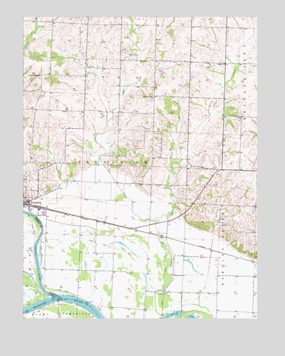
Brunswick East, MO USGS Topographic Map
Click on map above to begin viewing in our Map Viewer.

This topographic map contains these locations and features:
Feature Name Type Latitude Longitude GNIS ID View Map
Agee LakeReservoirN39.4770°W93.0508°761215View Map
Agee Lake DamDamN39.4784°W93.0519°761214View Map
Bethel ChurchChurchN39.4806°W93.0177°714067View Map
Bluff Point School (historical)SchoolN39.4314°W93.0610°734067View Map
Brandt School (historical)SchoolN39.3792°W93.0771°734070View Map
Brunswick City CemeteryCemeteryN39.4273°W93.1132°2681415View Map
Brunswick Fire DepartmentBuildingN39.4228°W93.1186°2621156View Map
Elliott Grove CemeteryCemeteryN39.4345°W93.1230°717485View Map
Foggin School (historical)SchoolN39.4517°W93.1019°734063View Map
Grand PortPopulated PlaceN39.3959°W93.1135°734072View Map
Grand RiverStreamN39.3845°W93.1080°718673View Map
Grand River City (historical)Populated PlaceN39.3881°W93.0958°734071View Map
Hazel Ridge SchoolSchoolN39.4756°W93.1155°719300View Map
Hickory Grove School (historical)SchoolN39.4814°W93.0363°734064View Map
Jordan School (historical)SchoolN39.4359°W93.0013°734066View Map
Lake CreekStreamN39.4153°W93.0555°720747View Map
Manson SchoolSchoolN39.3934°W93.0449°721811View Map
Manson School (historical)SchoolN39.4000°W93.0274°734068View Map
Missouri Village (historical)Populated PlaceN39.3981°W93.1075°2437209View Map
Number 275 DamDamN39.4900°W93.1235°761365View Map
Prairie ChapelChurchN39.4670°W93.0555°724823View Map
Prairie Chapel School (historical)SchoolN39.4678°W93.0544°734065View Map
Prairle Dell CemeteryCemeteryN39.4845°W93.0688°724902View Map
Reische LakeReservoirN39.4313°W93.0222°762336View Map
Reische Lake DamDamN39.4300°W93.0219°762335View Map
Shiloh AirparkAirportN39.4699°W93.0893°2770292View Map
Township of BrunswickCivilN39.4471°W93.0874°766458View Map

Note: Coordinates in the location and feature list above are referenced to NAD83 datum.


Copyright (C) 2008-2024 Ryan Niemi / Sunset Dynamics ... All Rights Reserved