TopoQuest Logo
Do you find TopoQuest useful?
Help keep TopoQuest running and adding new maps/features by donating!
Bitcoin:  19c7KJd3qBynnjoSw5npx9KScwjBe4ifkT
Litecoin:  LXs6TkuXGGXo1vDsWCkWVdjQX94eUKd6ui
Home View Maps Find Maps Find Places Resources & Links


Kearney SW, Missouri Topographic Map

USGS Map Title: Kearney SW, MO
USGS Map MRC: 39094C4
DRG (GeoTIFF) Download: o39094c4.tif


Neighboring USGS Topographic Map Quads:


  Smithville, MO  
39094D5
 

  Arley, MO  
39094D4
 

  Holt, MO  
39094D3
 

  Nashua, MO  
39094C5
 

  Kearney SW, MO  
39094C4
 

  Kearney, MO  
39094C3
 

  North Kansas City, MO  
39094B5
 

  Liberty, MO  
39094B4
 

  Missouri City, MO  
39094B3


Map MRC Location:

N40°
W95°
N40°
W94°
H8 H7 H6 H5 H4 H3 H2 H1
G8 G7 G6 G5 G4 G3 G2 G1
F8 F7 F6 F5 F4 F3 F2 F1
E8 E7 E6 E5 E4 E3 E2 E1
D8 D7 D6 D5 D4 D3 D2 D1
C8 C7 C6 C5 C4 C3 C2 C1
B8 B7 B6 B5 B4 B3 B2 B1
A8 A7 A6 A5 A4 A3 A2 A1
N39°
W95°
N39°
W94°

Kearney SW, MO USGS 1:24K Topographic Map Preview:
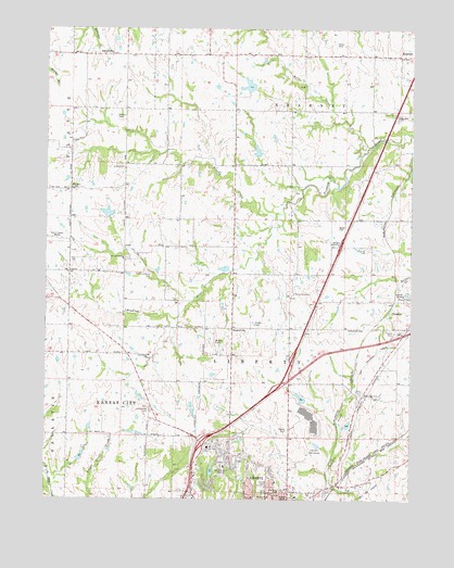
Kearney SW, MO USGS Topographic Map
Click on map above to begin viewing in our Map Viewer.

This topographic map contains these locations and features:
Feature Name Type Latitude Longitude GNIS ID View Map
Allen Lake DamDamN39.3600°W94.4302°760218View Map
Baker Evans CemeteryCemeteryN39.2679°W94.4172°713564View Map
BementLocaleN39.2758°W94.3938°759722View Map
Bennett ParkParkN39.2569°W94.4413°713953View Map
Browing HallBuildingN39.2500°W94.4119°2476956View Map
Brushy CreekStreamN39.3228°W94.4230°714890View Map
ChandlerPopulated PlaceN39.3003°W94.3827°740736View Map
Clay CountyCivilN39.3105°W94.4209°758478View Map
Claycrest Golf CourseLocaleN39.2619°W94.4102°755030View Map
Croat Lake DamDamN39.3077°W94.4182°761927View Map
EctonvillePopulated PlaceN39.3678°W94.4780°717394View Map
Evans HallBuildingN39.2505°W94.4153°2476967View Map
Francis SchoolSchoolN39.3386°W94.4736°746592View Map
Garrison SchoolSchoolN39.2503°W94.4190°718362View Map
Glenridge CemeteryCemeteryN39.2775°W94.3930°718497View Map
Hendren DamDamN39.2767°W94.4119°760259View Map
Hendron LakeReservoirN39.2768°W94.4124°760260View Map
Hester Alumni HallBuildingN39.2509°W94.4157°2476979View Map
Hodge Park Lake DamDamN39.2550°W94.4952°761788View Map
Holly LakeReservoirN39.2574°W94.4432°761682View Map
Holly Lake DamDamN39.2567°W94.4436°761681View Map
Interchange 17CrossingN39.2649°W94.4465°2477618View Map
Interchange 20CrossingN39.2794°W94.4217°2477632View Map
Jones HallBuildingN39.2504°W94.4135°2476983View Map
Kearney Police DepartmentBuildingN39.3673°W94.3761°2752566View Map
Kellybrook Elementary SchoolSchoolN39.2868°W94.4912°2545129View Map
Kitty Hawk Estates AirportAirportN39.3347°W94.4831°758758View Map
Lake Bar H DamDamN39.3250°W94.4786°760231View Map
LewisSchoolN39.2639°W94.4447°720931View Map
Lewis and Clark Elementary SchoolSchoolN39.2638°W94.4443°2477872View Map
Liberty Fire Department Station 3BuildingN39.2756°W94.4171°2476968View Map
Liberty HospitalHospitalN39.2750°W94.4237°2477699View Map
Little Shoal Baptist Church (historical)ChurchN39.2744°W94.4644°747078View Map
Little Shoal CemeteryCemeteryN39.2739°W94.4645°721315View Map
Little Shoal SchoolSchoolN39.2883°W94.4650°721319View Map
Melrose HallBuildingN39.2501°W94.4143°2477000View Map
Moore ParkParkN39.2503°W94.4236°722581View Map
Number 177 ReservoirReservoirN39.3423°W94.4281°761176View Map
Old Providence CemeteryCemeteryN39.3097°W94.4641°723776View Map
Pickett CemeteryCemeteryN39.2964°W94.4288°724309View Map
Pioneer VillageLocaleN39.2881°W94.4719°736118View Map
Prairie Home SchoolSchoolN39.3386°W94.4161°746593View Map
Proctor Lake DamDamN39.3417°W94.4286°761175View Map
Providence ChurchChurchN39.3136°W94.4738°724973View Map
Providence SchoolSchoolN39.3156°W94.4675°746594View Map
Robertson CemeteryCemeteryN39.2953°W94.3966°725408View Map
Rock CreekStreamN39.3431°W94.3894°725444View Map
RoostervillePopulated PlaceN39.2953°W94.4366°741211View Map
Roosterville AirportAirportN39.2928°W94.4418°758788View Map
Saint James Roman Catholic ChurchChurchN39.2511°W94.4200°747079View Map
Semple HallBuildingN39.2509°W94.4141°2477019View Map
Shoal Creek Elementary SchoolSchoolN39.2567°W94.4671°2477516View Map
Soper CemeteryCemeteryN39.3711°W94.4014°726691View Map
Spratt Sports ComplexBuildingN39.2544°W94.4097°2477024View Map
Township of LibertyCivilN39.2637°W94.4274°766508View Map
W-W ReservoirReservoirN39.3259°W94.4792°760232View Map
Wade CemeteryCemeteryN39.3228°W94.4002°728232View Map
Wagy School (historical)SchoolN39.3672°W94.4683°746591View Map
Walnut Grove Primitive Baptist Church (historical)ChurchN39.3058°W94.4152°747080View Map
Walnut Grove SchoolSchoolN39.3047°W94.4152°728315View Map
Warren Hills Elementary SchoolSchoolN39.2718°W94.4396°2545167View Map
Watkins CemeteryCemeteryN39.3514°W94.4763°728415View Map
WHB-AM (Kansas City)TowerN39.3189°W94.4969°759173View Map
Wilmar Ranch LakeReservoirN39.3599°W94.4313°760219View Map
WinnerPopulated PlaceN39.3325°W94.4919°741366View Map

Note: Coordinates in the location and feature list above are referenced to NAD83 datum.


Copyright (C) 2008-2024 Ryan Niemi / Sunset Dynamics ... All Rights Reserved