TopoQuest Logo
Do you find TopoQuest useful?
Help keep TopoQuest running and adding new maps/features by donating!
Bitcoin:  19c7KJd3qBynnjoSw5npx9KScwjBe4ifkT
Litecoin:  LXs6TkuXGGXo1vDsWCkWVdjQX94eUKd6ui
Home View Maps Find Maps Find Places Resources & Links


Kimball, Minnesota Topographic Map

USGS Map Title: Kimball, MN
USGS Map MRC: 45094C3
DRG (GeoTIFF) Download: o45094c3.tif


Neighboring USGS Topographic Map Quads:


  Cold Spring, MN  
45094D4
 

  Rockville, MN  
45094D3
 

  Saint Augusta, MN  
45094D2
 

  Watkins, MN  
45094C4
 

  Kimball, MN  
45094C3
 

  South Haven, MN  
45094C2
 

  Forest City, MN  
45094B4
 

  Kingston, MN  
45094B3
 

  French Lake, MN  
45094B2


Map MRC Location:

N46°
W95°
N46°
W94°
H8 H7 H6 H5 H4 H3 H2 H1
G8 G7 G6 G5 G4 G3 G2 G1
F8 F7 F6 F5 F4 F3 F2 F1
E8 E7 E6 E5 E4 E3 E2 E1
D8 D7 D6 D5 D4 D3 D2 D1
C8 C7 C6 C5 C4 C3 C2 C1
B8 B7 B6 B5 B4 B3 B2 B1
A8 A7 A6 A5 A4 A3 A2 A1
N45°
W95°
N45°
W94°

Kimball, MN USGS 1:24K Topographic Map Preview:
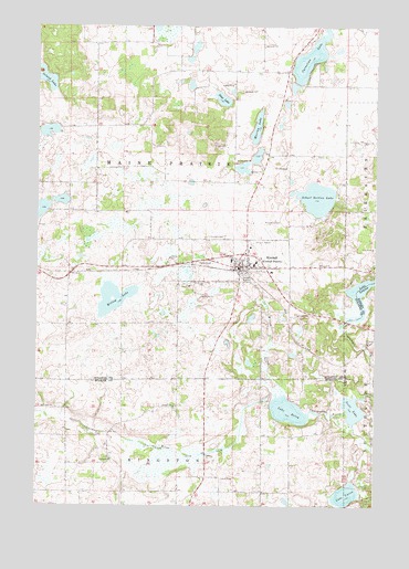
Kimball, MN USGS Topographic Map
Click on map above to begin viewing in our Map Viewer.

This topographic map contains these locations and features:
Feature Name Type Latitude Longitude GNIS ID View Map
Carnelian LakeLakeN45.3668°W94.2748°640921View Map
Church of ChristChurchN45.3153°W94.3028°2068037View Map
Church of Saint AnneChurchN45.2961°W94.2972°2068038View Map
City of KimballCivilN45.3143°W94.3008°2395529View Map
County Ditch Number FortysixCanalN45.2633°W94.3158°642116View Map
Days LakeLakeN45.3561°W94.3078°642664View Map
Island LakeLakeN45.3618°W94.3740°645496View Map
KimballPopulated PlaceN45.3125°W94.3003°646144View Map
KimballLocaleN45.3117°W94.3019°2068035View Map
Kimball CemeteryCemeteryN45.3202°W94.3058°646145View Map
Kimball Fire DepartmentBuildingN45.3180°W94.3021°2666654View Map
Kimball Golf ClubLocaleN45.2972°W94.2944°2068031View Map
Kimball Great River LibraryBuildingN45.3131°W94.3000°2068032View Map
Kimball High SchoolSchoolN45.3142°W94.3028°2068040View Map
Kimball Police DepartmentBuildingN45.3126°W94.3007°2068033View Map
Kimball Post OfficePost OfficeN45.3131°W94.3000°2068247View Map
Kimball Prairie Post Office (historical)Post OfficeN45.3133°W94.3008°2068279View Map
Kimball United Methodist ChurchChurchN45.3153°W94.3028°2068036View Map
Lake BetsyLakeN45.2748°W94.2817°640069View Map
Lake MarieLakeN45.3069°W94.2561°647531View Map
Lake UnionLakeN45.2531°W94.2605°653518View Map
Murray LakeLakeN45.3485°W94.2943°648397View Map
Powder Ridge Ski AreaLocaleN45.3444°W94.3111°2068034View Map
Saint Annes CemeteryCemeteryN45.3081°W94.3131°650504View Map
Saint John's Lutheran ChurchChurchN45.2964°W94.2967°2068039View Map
School Section LakeLakeN45.3302°W94.2722°651775View Map
Scott LakeLakeN45.2753°W94.2580°658192View Map
Township of Maine PrairieCivilN45.3594°W94.3142°664879View Map
Willow CreekStreamN45.2794°W94.2833°654181View Map
Willow LakeLakeN45.3038°W94.3451°654194View Map

Note: Coordinates in the location and feature list above are referenced to NAD83 datum.


Copyright (C) 2008-2024 Ryan Niemi / Sunset Dynamics ... All Rights Reserved