TopoQuest Logo
Do you find TopoQuest useful?
Help keep TopoQuest running and adding new maps/features by donating!
Bitcoin:  19c7KJd3qBynnjoSw5npx9KScwjBe4ifkT
Litecoin:  LXs6TkuXGGXo1vDsWCkWVdjQX94eUKd6ui
Home View Maps Find Maps Find Places Resources & Links


Saint Augusta, Minnesota Topographic Map

USGS Map Title: Saint Augusta, MN
USGS Map MRC: 45094D2
DRG (GeoTIFF) Download: o45094d2.tif


Neighboring USGS Topographic Map Quads:


  Saint Joseph, MN  
45094E3
 

  Saint Cloud, MN  
45094E2
 

  Cable, MN  
45094E1
 

  Rockville, MN  
45094D3
 

  Saint Augusta, MN  
45094D2
 

  Clearwater, MN  
45094D1
 

  Kimball, MN  
45094C3
 

  South Haven, MN  
45094C2
 

  Annandale, MN  
45094C1


Map MRC Location:

N46°
W95°
N46°
W94°
H8 H7 H6 H5 H4 H3 H2 H1
G8 G7 G6 G5 G4 G3 G2 G1
F8 F7 F6 F5 F4 F3 F2 F1
E8 E7 E6 E5 E4 E3 E2 E1
D8 D7 D6 D5 D4 D3 D2 D1
C8 C7 C6 C5 C4 C3 C2 C1
B8 B7 B6 B5 B4 B3 B2 B1
A8 A7 A6 A5 A4 A3 A2 A1
N45°
W95°
N45°
W94°

Saint Augusta, MN USGS 1:24K Topographic Map Preview:
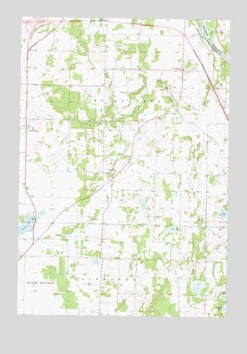
Saint Augusta, MN USGS Topographic Map
Click on map above to begin viewing in our Map Viewer.

This topographic map contains these locations and features:
Feature Name Type Latitude Longitude GNIS ID View Map
Beaver LakeLakeN45.4125°W94.2455°639838View Map
Bunt LakeLakeN45.4181°W94.1271°640648View Map
City of Saint AugustaCivilN45.4497°W94.1995°2396474View Map
Edgewater EstatesParkN45.4950°W94.1444°2067882View Map
Gethsemane CemeteryCemeteryN45.4153°W94.2075°644109View Map
Hinz LakeLakeN45.3837°W94.1272°645030View Map
Hulbert LakeLakeN45.3785°W94.1267°645280View Map
Interchange 167CrossingN45.4981°W94.2397°2068388View Map
Interchange 171CrossingN45.4931°W94.1528°2068387View Map
Johnson CreekStreamN45.4827°W94.1278°645678View Map
KXSS-FM (Waite Park)TowerN45.4839°W94.1369°663132View Map
LuxemburgPopulated PlaceN45.4527°W94.2464°647311View Map
Luxemburg Post Office (historical)Post OfficeN45.4528°W94.2461°2068275View Map
Mund LakeLakeN45.4113°W94.1597°648382View Map
Saint AugustaPopulated PlaceN45.4583°W94.1980°1922765View Map
Saint AugustaPopulated PlaceN45.4786°W94.1542°650522View Map
Saint Augusta Fire DepartmentBuildingN45.4639°W94.2015°2666518View Map
Saint Augusta Post Office (historical)Post OfficeN45.4786°W94.1539°2068258View Map
Saint Mary Help of Christians CemeteryCemeteryN45.4791°W94.1491°650829View Map
Saint Mary Help of Christians ChurchChurchN45.4797°W94.1514°2067859View Map
Saint Wendelin CemeteryCemeteryN45.4536°W94.2459°2068110View Map
Saint Wendelin of Luxemburg ChurchChurchN45.4533°W94.2447°2067870View Map
Township of Saint Augusta (historical)CivilN45.4497°W94.1939°665503View Map

Note: Coordinates in the location and feature list above are referenced to NAD83 datum.


Copyright (C) 2008-2024 Ryan Niemi / Sunset Dynamics ... All Rights Reserved