TopoQuest Logo
Do you find TopoQuest useful?
Help keep TopoQuest running and adding new maps/features by donating!
Bitcoin:  19c7KJd3qBynnjoSw5npx9KScwjBe4ifkT
Litecoin:  LXs6TkuXGGXo1vDsWCkWVdjQX94eUKd6ui
Home View Maps Find Maps Find Places Resources & Links


Lamar South, Missouri Topographic Map

USGS Map Title: Lamar South, MO
USGS Map MRC: 37094D3
DRG (GeoTIFF) Download: o37094d3.tif


Neighboring USGS Topographic Map Quads:


  Iantha, MO  
37094E4
 

  Lamar North, MO  
37094E3
 

  Milford, MO  
37094E2
 

  Nashville, MO  
37094D4
 

  Lamar South, MO  
37094D3
 

  Kenoma, MO  
37094D2
 

  Neck City, MO  
37094C4
 

  Jasper, MO  
37094C3
 

  Maple Grove, MO  
37094C2


Map MRC Location:

N38°
W95°
N38°
W94°
H8 H7 H6 H5 H4 H3 H2 H1
G8 G7 G6 G5 G4 G3 G2 G1
F8 F7 F6 F5 F4 F3 F2 F1
E8 E7 E6 E5 E4 E3 E2 E1
D8 D7 D6 D5 D4 D3 D2 D1
C8 C7 C6 C5 C4 C3 C2 C1
B8 B7 B6 B5 B4 B3 B2 B1
A8 A7 A6 A5 A4 A3 A2 A1
N37°
W95°
N37°
W94°

Lamar South, MO USGS 1:24K Topographic Map Preview:
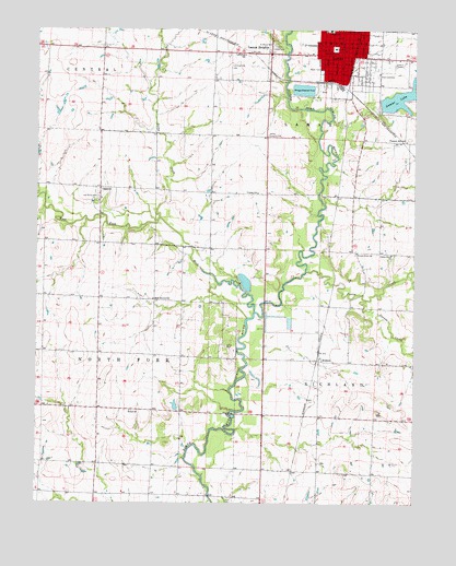
Lamar South, MO USGS Topographic Map
Click on map above to begin viewing in our Map Viewer.

This topographic map contains these locations and features:
Feature Name Type Latitude Longitude GNIS ID View Map
Barco Drive-InLocaleN37.4908°W94.2536°2559662View Map
Barton County Sheriff's OfficeBuildingN37.4956°W94.2788°2752481View Map
Berryhill Lake DamDamN37.3851°W94.3319°763248View Map
Bethel ChurchChurchN37.3992°W94.3441°714050View Map
Blue Star School (historical)SchoolN37.3764°W94.2999°746194View Map
BostonPopulated PlaceN37.4128°W94.2819°729848View Map
Boston School (historical)SchoolN37.4126°W94.2835°745759View Map
City of LamarCivilN37.4944°W94.2784°2395617View Map
City of Lamar HeightsCivilN37.4938°W94.2955°2395618View Map
Dicks ForkStreamN37.4503°W94.3344°716886View Map
Diggs Lake DamDamN37.4650°W94.3502°763285View Map
Dorris CreekStreamN37.4289°W94.2661°716991View Map
East Elementary SchoolSchoolN37.4939°W94.2544°2710022View Map
East Side CemeteryCemeteryN37.4878°W94.2622°717344View Map
EsromPopulated PlaceN37.4134°W94.3277°740440View Map
Esrom Post OfficePost OfficeN37.4134°W94.3277°1669628View Map
Forest Grove ChurchChurchN37.4412°W94.2691°718082View Map
Forest Grove School (historical)SchoolN37.4409°W94.2577°718086View Map
Killey CemeteryCemeteryN37.4164°W94.3127°720582View Map
Lake CemeteryCemeteryN37.4956°W94.2961°720743View Map
LamarPopulated PlaceN37.4950°W94.2766°720770View Map
Lamar City LakeReservoirN37.4822°W94.2527°762817View Map
Lamar Country ClubLocaleN37.4723°W94.2991°755256View Map
Lamar Fire DepartmentBuildingN37.4939°W94.2758°2621162View Map
Lamar HeightsPopulated PlaceN37.4937°W94.2977°720771View Map
Lamar LakeReservoirN37.4806°W94.2616°720772View Map
Lamar Lake DamDamN37.4800°W94.2619°762816View Map
Lamar Middle SchoolSchoolN37.4997°W94.2778°2710020View Map
Lamar Municipal AirportAirportN37.4929°W94.3114°758775View Map
Lamar Police DepartmentBuildingN37.4937°W94.2759°2752306View Map
Lamar Post OfficePost OfficeN37.4942°W94.2774°2783186View Map
Lawless LakeReservoirN37.4467°W94.3102°763244View Map
Ledbetter School (historical)SchoolN37.4937°W94.3069°720879View Map
Memory Gardens CemeteryCemeteryN37.4847°W94.2664°2681296View Map
Number 699 DamDamN37.4467°W94.3102°763243View Map
Number 703 DamDamN37.3884°W94.3286°763249View Map
Oak Grove CemeteryCemeteryN37.4556°W94.3547°723562View Map
OaktonPopulated PlaceN37.4581°W94.3541°729939View Map
Oakton School (historical)SchoolN37.4548°W94.3547°746195View Map
Pettis CreekStreamN37.4362°W94.2863°724268View Map
Pleasant Hill School (historical)SchoolN37.4706°W94.2530°724545View Map
Richards Lake DamDamN37.3884°W94.2886°763545View Map
Rocky Mound School (historical)SchoolN37.3995°W94.3458°746193View Map
Rose Branch School (historical)SchoolN37.4287°W94.3366°725556View Map
Saint Marys CemeteryCemeteryN37.4959°W94.2972°725832View Map
Tidballs DamDamN37.3934°W94.3386°763216View Map
Tidballs LakeReservoirN37.3934°W94.3386°763217View Map
Township of CityCivilN37.4944°W94.2784°766276View Map
Township of NorthforkCivilN37.4099°W94.3534°766284View Map
Twin Oaks AirportAirportN37.3923°W94.2836°2679346View Map
Victory School (historical)SchoolN37.4570°W94.3024°728192View Map
West Fork RiverStreamN37.4253°W94.3027°729982View Map

Note: Coordinates in the location and feature list above are referenced to NAD83 datum.


Copyright (C) 2008-2024 Ryan Niemi / Sunset Dynamics ... All Rights Reserved