TopoQuest Logo
Do you find TopoQuest useful?
Help keep TopoQuest running and adding new maps/features by donating!
Bitcoin:  19c7KJd3qBynnjoSw5npx9KScwjBe4ifkT
Litecoin:  LXs6TkuXGGXo1vDsWCkWVdjQX94eUKd6ui
Home View Maps Find Maps Find Places Resources & Links


Jasper, Missouri Topographic Map

USGS Map Title: Jasper, MO
USGS Map MRC: 37094C3
DRG (GeoTIFF) Download: o37094c3.tif


Neighboring USGS Topographic Map Quads:


  Nashville, MO  
37094D4
 

  Lamar South, MO  
37094D3
 

  Kenoma, MO  
37094D2
 

  Neck City, MO  
37094C4
 

  Jasper, MO  
37094C3
 

  Maple Grove, MO  
37094C2
 

  Webb City, MO  
37094B4
 

  Carthage, MO  
37094B3
 

  Avilla, MO  
37094B2


Map MRC Location:

N38°
W95°
N38°
W94°
H8 H7 H6 H5 H4 H3 H2 H1
G8 G7 G6 G5 G4 G3 G2 G1
F8 F7 F6 F5 F4 F3 F2 F1
E8 E7 E6 E5 E4 E3 E2 E1
D8 D7 D6 D5 D4 D3 D2 D1
C8 C7 C6 C5 C4 C3 C2 C1
B8 B7 B6 B5 B4 B3 B2 B1
A8 A7 A6 A5 A4 A3 A2 A1
N37°
W95°
N37°
W94°

Jasper, MO USGS 1:24K Topographic Map Preview:
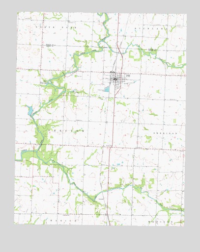
Jasper, MO USGS Topographic Map
Click on map above to begin viewing in our Map Viewer.

This topographic map contains these locations and features:
Feature Name Type Latitude Longitude GNIS ID View Map
Blue Community HallLocaleN37.3695°W94.3372°714400View Map
CarytownPopulated PlaceN37.2662°W94.3094°740725View Map
Carytown School (historical)SchoolN37.2629°W94.3070°745697View Map
City of CarytownCivilN37.2616°W94.3345°2393763View Map
City of JasperCivilN37.3354°W94.3022°2395460View Map
Coon CreekStreamN37.3581°W94.3113°716249View Map
Cripple CreekStreamN37.3262°W94.3133°716501View Map
Dewey School (historical)SchoolN37.2856°W94.2886°746069View Map
Dry ForkStreamN37.2926°W94.3594°717105View Map
Farmers Union School (historical)SchoolN37.3676°W94.2558°746207View Map
Hendricks CemeteryCemeteryN37.3245°W94.2577°719377View Map
JasperPopulated PlaceN37.3362°W94.3013°729908View Map
Jasper CemeteryCemeteryN37.3375°W94.3308°720268View Map
Jasper County Elementary SchoolSchoolN37.3403°W94.3044°2709717View Map
Jasper Farmers Fire Protection AssociationBuildingN37.3367°W94.2910°2620279View Map
Jasper High SchoolSchoolN37.3402°W94.3030°2709716View Map
Jasper Police DepartmentBuildingN37.3364°W94.3011°2752410View Map
Jasper Post OfficePost OfficeN37.3360°W94.3032°2782591View Map
Jasper Volunteer Fire DepartmentBuildingN37.3367°W94.3017°2620663View Map
King School (historical)SchoolN37.2851°W94.3350°746065View Map
Mount Moriah ChurchChurchN37.2556°W94.3347°722785View Map
Opossum CreekStreamN37.3281°W94.3386°723836View Map
Paradise CemeteryCemeteryN37.2964°W94.3058°724003View Map
Pleasant Hill School (historical)SchoolN37.3103°W94.3039°745707View Map
Rising Sun School (historical)SchoolN37.3120°W94.3391°746064View Map
Ruddick CemeteryCemeteryN37.3117°W94.3299°725654View Map
Salem ChurchChurchN37.2962°W94.2849°725932View Map
Scroggs LakeReservoirN37.3173°W94.3648°762946View Map
Scroggs Lake DamDamN37.3151°W94.3652°762945View Map
Seiferd FieldAirportN37.2761°W94.3507°2679313View Map
Sheridan School (historical)SchoolN37.3095°W94.2655°746067View Map
Stafford CemeteryCemeteryN37.3342°W94.3549°726985View Map
Township of PrestonCivilN37.3059°W94.3410°766817View Map
Union Valley School (historical)SchoolN37.3373°W94.2644°746066View Map
Waters CemeteryCemeteryN37.3709°W94.3649°728410View Map
Webbs LakeLakeN37.3325°W94.3525°728466View Map

Note: Coordinates in the location and feature list above are referenced to NAD83 datum.


Copyright (C) 2008-2024 Ryan Niemi / Sunset Dynamics ... All Rights Reserved