TopoQuest Logo
Do you find TopoQuest useful?
Help keep TopoQuest running and adding new maps/features by donating!
Bitcoin:  19c7KJd3qBynnjoSw5npx9KScwjBe4ifkT
Litecoin:  LXs6TkuXGGXo1vDsWCkWVdjQX94eUKd6ui
Home View Maps Find Maps Find Places Resources & Links


Leland, Mississippi Topographic Map

USGS Map Title: Leland, MS
USGS Map MRC: 33090D8
DRG (GeoTIFF) Download: o33090d8.tif


Neighboring USGS Topographic Map Quads:


  Scott, MS  
33091E1
 

  Stringtown, MS  
33090E8
 

  Shaw, MS  
33090E7
 

  Greenville, MS  
33091D1
 

  Leland, MS  
33090D8
 

  Holly Ridge, MS  
33090D7
 

  Wayside, MS  
33091C1
 

  Arcola, MS  
33090C8
 

  Tribbett, MS  
33090C7


Map MRC Location:

N34°
W91°
N34°
W90°
H8 H7 H6 H5 H4 H3 H2 H1
G8 G7 G6 G5 G4 G3 G2 G1
F8 F7 F6 F5 F4 F3 F2 F1
E8 E7 E6 E5 E4 E3 E2 E1
D8 D7 D6 D5 D4 D3 D2 D1
C8 C7 C6 C5 C4 C3 C2 C1
B8 B7 B6 B5 B4 B3 B2 B1
A8 A7 A6 A5 A4 A3 A2 A1
N33°
W91°
N33°
W90°

Leland, MS USGS 1:24K Topographic Map Preview:
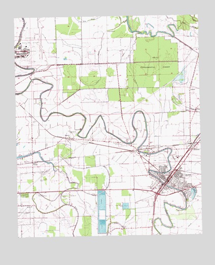
Leland, MS USGS Topographic Map
Click on map above to begin viewing in our Map Viewer.

This topographic map contains these locations and features:
Feature Name Type Latitude Longitude GNIS ID View Map
Ashley CrossingPopulated PlaceN33.4176°W90.9890°691673View Map
Beulah Grove Baptist ChurchChurchN33.4082°W90.8915°687164View Map
Christian Life CemeteryCemeteryN33.4701°W90.9843°668430View Map
Church of ChristChurchN33.4012°W90.9223°687174View Map
City of LelandCivilN33.4051°W90.8909°2404910View Map
Clark BayouStreamN33.4962°W90.9273°668501View Map
Cold Springs (historical)Populated PlaceN33.4684°W90.9857°687180View Map
Delta Branch Experimental Station Airport (historical)AirportN33.4251°W90.9070°680383View Map
Delta Experimental ForestForestN33.4723°W90.9045°669218View Map
Delta Experimental Station Pond DamDamN33.4451°W90.8968°682088View Map
Dry BayouStreamN33.4979°W90.9229°669394View Map
DunkirkPopulated PlaceN33.4573°W90.8818°691829View Map
Ebenezer Baptist ChurchChurchN33.4087°W90.8937°687185View Map
ElizabethPopulated PlaceN33.4237°W90.8812°669719View Map
First Baptist ChurchChurchN33.4023°W90.8995°687198View Map
Glendale ChurchChurchN33.3926°W90.9904°670432View Map
Glendale ChurchChurchN33.3985°W90.9640°670433View Map
Greenlawn Memorial GardensCemeteryN33.3990°W90.9873°670697View Map
Greenville Army Air Field (historical)MilitaryN33.4811°W90.9906°2085463View Map
Greenville Mid-Delta AirportAirportN33.4827°W90.9894°680391View Map
Hammett and Sons Lake DamDamN33.4868°W90.9501°682140View Map
Huntley Airport (historical)AirportN33.3987°W90.9676°680380View Map
Jake CemeteryCemeteryN33.3946°W90.8848°671796View Map
Jake Cemetery Number 2CemeteryN33.3965°W90.8787°671797View Map
Jerusalem TempleChurchN33.4135°W90.9032°687231View Map
King Solomon ChurchChurchN33.4915°W90.9368°672167View Map
Lake MonocnocLakeN33.3965°W90.8807°673730View Map
Lakeview Baptist ChurchChurchN33.4021°W90.8829°687240View Map
Lamont CemeteryCemeteryN33.3984°W90.9473°672289View Map
LelandPopulated PlaceN33.4054°W90.8976°672400View Map
Leland Elementary SchoolSchoolN33.4023°W90.8954°709282View Map
Leland High SchoolSchoolN33.4023°W90.8934°709283View Map
Leland Lagoon DamDamN33.3968°W90.9118°682055View Map
Leland Middle SchoolSchoolN33.4132°W90.8984°709284View Map
Leland Police DepartmentBuildingN33.4056°W90.8971°2754215View Map
Leland Post OfficePost OfficeN33.4047°W90.8979°2768605View Map
Leland Presbyterian ChurchChurchN33.4018°W90.9007°687241View Map
Leland United Methodist ChurchChurchN33.4043°W90.8979°687242View Map
Leland Volunteer Fire Department Station 1BuildingN33.4035°W90.9006°2665641View Map
Leland Volunteer Fire Department Station 2BuildingN33.4050°W90.9003°2665815View Map
Lewis Air Service Airport (historical)AirportN33.3953°W90.9082°2676429View Map
Lincoln High School (historical)SchoolN33.4140°W90.8993°709285View Map
MagentaPopulated PlaceN33.4312°W90.9634°692033View Map
McCuteheon BayouStreamN33.4901°W90.9148°673327View Map
Morning Star ChurchChurchN33.4346°W90.9634°673836View Map
Mount Ararat ChurchChurchN33.4279°W90.9301°673918View Map
Mount Koram ChurchChurchN33.4443°W90.9654°687260View Map
Nelia (historical)Populated PlaceN33.4298°W90.9420°687265View Map
New Mount Ararat ChurchChurchN33.4271°W90.9240°674783View Map
New Zion Baptist ChurchChurchN33.4004°W90.9018°687274View Map
Oakland CemeteryCemeteryN33.4418°W90.9876°675119View Map
Oakland Crossing (historical)LocaleN33.4232°W90.9223°709288View Map
Oakland Plantation (historical)LocaleN33.4201°W90.9240°709289View Map
Parkview Baptist ChurchChurchN33.4046°W90.8879°687281View Map
Pilgrim Home Baptist ChurchChurchN33.4096°W90.8907°687283View Map
Pleasant Point ChurchChurchN33.4468°W90.8768°676097View Map
Red Bridge BayouStreamN33.4126°W90.9740°676518View Map
Roper BayouStreamN33.4012°W90.9565°676837View Map
Rose Hill ChurchChurchN33.4454°W90.8843°676864View Map
Saint James African Methodist Episcopal ChurchChurchN33.4001°W90.9020°687300View Map
Saint James Catholic ChurchChurchN33.4035°W90.8954°687301View Map
Saint Johns Episcopal MissionChurchN33.4010°W90.9073°687306View Map
Saint Peters Baptist ChurchChurchN33.4085°W90.8962°687315View Map
Shady Grove School (historical)SchoolN33.3965°W90.9615°687319View Map
Shamrock CemeteryCemeteryN33.4657°W90.9868°677609View Map
Shell LakeLakeN33.4906°W90.9156°677640View Map
Shell Lake CutoffCanalN33.4798°W90.8782°677641View Map
StonevillePopulated PlaceN33.4240°W90.9151°678311View Map
Stoneville Post OfficePost OfficeN33.4225°W90.9176°2768828View Map
Stoneville-Leland CemeteryCemeteryN33.4271°W90.9270°678312View Map
Tamburo (historical)Populated PlaceN33.4737°W90.9237°687328View Map
Tate Airport (historical)AirportN33.4168°W90.8918°680382View Map
WBAD-FM (Leland)TowerN33.4154°W90.9884°680234View Map
WDDT-AM (Greenville)TowerN33.4182°W90.9951°680131View Map
WESY-AM (Leland)TowerN33.3796°W90.9298°680128View Map

Note: Coordinates in the location and feature list above are referenced to NAD83 datum.


Copyright (C) 2008-2024 Ryan Niemi / Sunset Dynamics ... All Rights Reserved