TopoQuest Logo
Do you find TopoQuest useful?
Help keep TopoQuest running and adding new maps/features by donating!
Bitcoin:  19c7KJd3qBynnjoSw5npx9KScwjBe4ifkT
Litecoin:  LXs6TkuXGGXo1vDsWCkWVdjQX94eUKd6ui
Home View Maps Find Maps Find Places Resources & Links


Arcola, Mississippi Topographic Map

USGS Map Title: Arcola, MS
USGS Map MRC: 33090C8
DRG (GeoTIFF) Download: o33090c8.tif


Neighboring USGS Topographic Map Quads:


  Greenville, MS  
33091D1
 

  Leland, MS  
33090D8
 

  Holly Ridge, MS  
33090D7
 

  Wayside, MS  
33091C1
 

  Arcola, MS  
33090C8
 

  Tribbett, MS  
33090C7
 

  Avon, MS  
33091B1
 

  Swan Lake NW, MS  
33090B8
 

  Hollandale, MS  
33090B7


Map MRC Location:

N34°
W91°
N34°
W90°
H8 H7 H6 H5 H4 H3 H2 H1
G8 G7 G6 G5 G4 G3 G2 G1
F8 F7 F6 F5 F4 F3 F2 F1
E8 E7 E6 E5 E4 E3 E2 E1
D8 D7 D6 D5 D4 D3 D2 D1
C8 C7 C6 C5 C4 C3 C2 C1
B8 B7 B6 B5 B4 B3 B2 B1
A8 A7 A6 A5 A4 A3 A2 A1
N33°
W91°
N33°
W90°

Arcola, MS USGS 1:24K Topographic Map Preview:
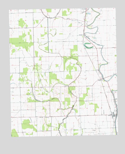
Arcola, MS USGS Topographic Map
Click on map above to begin viewing in our Map Viewer.

This topographic map contains these locations and features:
Feature Name Type Latitude Longitude GNIS ID View Map
Abide AirparkAirportN33.2988°W90.9893°680373View Map
AldridgePopulated PlaceN33.3621°W90.9098°687151View Map
AlmyPopulated PlaceN33.3493°W90.8793°687155View Map
Aqua Farms DamDamN33.2968°W90.9484°681982View Map
ArcolaPopulated PlaceN33.2698°W90.8798°666352View Map
Arcola CemeteryCemeteryN33.2826°W90.8784°666353View Map
Arcola Post OfficePost OfficeN33.2694°W90.8769°2768614View Map
Arcola Volunteer Fire DepartmentBuildingN33.2708°W90.8782°2665847View Map
Ballard Lake DamDamN33.2735°W90.9501°681967View Map
Bethlehem ChurchChurchN33.2551°W90.9012°667006View Map
BurdettePopulated PlaceN33.3485°W90.9148°667797View Map
HaysPopulated PlaceN33.3465°W90.8987°687222View Map
Huddleston LakeLakeN33.3392°W90.9124°671555View Map
IsenbergPopulated PlaceN33.3748°W90.9095°687230View Map
JohnstonPopulated PlaceN33.2821°W90.8857°711132View Map
Jones ChapelPopulated PlaceN33.3568°W90.9112°687232View Map
L and W Catfish Ponds DamDamN33.2751°W90.9518°681969View Map
Morning Star CemeteryCemeteryN33.3632°W90.9270°673822View Map
Morning Star ChurchChurchN33.3648°W90.9320°673835View Map
Mount Carmel ChurchChurchN33.3137°W90.8959°673961View Map
Mount Galilee ChurchChurchN33.3565°W90.9820°673996View Map
Mount Zion ChurchChurchN33.3048°W90.8940°674380View Map
New Morning Star ChurchChurchN33.3643°W90.9265°687270View Map
New Prosperity ChurchChurchN33.2690°W90.9557°674799View Map
Old Morning Star ChurchChurchN33.3737°W90.9104°675208View Map
Paxton CemeteryCemeteryN33.2921°W90.8832°675516View Map
Quay (historical)Populated PlaceN33.3165°W90.8957°687292View Map
Rolling BayouStreamN33.3690°W90.9201°676826View Map
Saint Johns ChurchChurchN33.2546°W90.9873°677084View Map
Saint Marys ChurchChurchN33.3357°W90.8801°677155View Map
Saint Marys ChurchChurchN33.3471°W90.9101°677156View Map
Saint Matthews ChurchChurchN33.3660°W90.8968°687310View Map
Sligo Plantation (historical)LocaleN33.3048°W90.9020°709293View Map
Sunrise ChurchChurchN33.2982°W90.9623°678433View Map
Supervisor District 2CivilN33.2730°W90.9419°712126View Map
Swiftwater BayouStreamN33.2773°W90.9276°678503View Map
Town of ArcolaCivilN33.2705°W90.8800°2405162View Map
Washington CountyCivilN33.2837°W90.9475°695796View Map
Whitehall Plantation (historical)LocaleN33.3476°W90.9204°709296View Map
Widow BayouStreamN33.2996°W90.9323°679663View Map
WilmotPopulated PlaceN33.3051°W90.8926°692327View Map
Wingfield Lake DamDamN33.2635°W90.9068°681961View Map

Note: Coordinates in the location and feature list above are referenced to NAD83 datum.


Copyright (C) 2008-2024 Ryan Niemi / Sunset Dynamics ... All Rights Reserved