TopoQuest Logo
Do you find TopoQuest useful?
Help keep TopoQuest running and adding new maps/features by donating!
Bitcoin:  19c7KJd3qBynnjoSw5npx9KScwjBe4ifkT
Litecoin:  LXs6TkuXGGXo1vDsWCkWVdjQX94eUKd6ui
Home View Maps Find Maps Find Places Resources & Links


Lepanto, Arkansas Topographic Map

USGS Map Title: Lepanto, AR
USGS Map MRC: 35090E3
DRG (GeoTIFF) Download: o35090e3.tif


Neighboring USGS Topographic Map Quads:


  Hatchie Coon, AR  
35090F4
 

  Rivervale, AR  
35090F3
 

  Etowah, AR  
35090F2
 

  Marked Tree, AR  
35090E4
 

  Lepanto, AR  
35090E3
 

  Joiner, AR  
35090E2
 

  Joyland, AR  
35090D4
 

  Tyronza, AR  
35090D3
 

  Frenchmans Bayou, AR  
35090D2


Map MRC Location:

N36°
W91°
N36°
W90°
H8 H7 H6 H5 H4 H3 H2 H1
G8 G7 G6 G5 G4 G3 G2 G1
F8 F7 F6 F5 F4 F3 F2 F1
E8 E7 E6 E5 E4 E3 E2 E1
D8 D7 D6 D5 D4 D3 D2 D1
C8 C7 C6 C5 C4 C3 C2 C1
B8 B7 B6 B5 B4 B3 B2 B1
A8 A7 A6 A5 A4 A3 A2 A1
N35°
W91°
N35°
W90°

Lepanto, AR USGS 1:24K Topographic Map Preview:
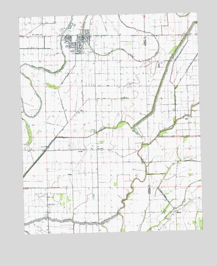
Lepanto, AR USGS Topographic Map
Click on map above to begin viewing in our Map Viewer.

This topographic map contains these locations and features:
Feature Name Type Latitude Longitude GNIS ID View Map
AltoPopulated PlaceN35.5701°W90.3312°57261View Map
Browns Lake (historical)LakeN35.6029°W90.2662°61959View Map
Church of GodChurchN35.5501°W90.3579°65769View Map
City of LepantoCivilN35.6081°W90.3333°2404913View Map
Conaster CemeteryCemeteryN35.5854°W90.2993°65770View Map
Ditch Number 39CanalN35.5862°W90.2632°82242View Map
Ditch Number 40CanalN35.5545°W90.2584°82254View Map
Ditch Number 45aCanalN35.6109°W90.3570°82273View Map
Ditch Number 45bCanalN35.6070°W90.3670°82274View Map
Ditch Number 47CanalN35.5584°W90.3476°82277View Map
Ditch Number 47aCanalN35.5876°W90.3451°82283View Map
Ditch Number 48CanalN35.5537°W90.3695°82284View Map
Ditch Number 48CanalN35.5912°W90.2737°82285View Map
Ditch Number 49CanalN35.5770°W90.3134°82287View Map
Ditch Number 50CanalN35.5881°W90.3315°82307View Map
Ditch Number 51CanalN35.6206°W90.3148°82310View Map
Ditch Number 51bCanalN35.6131°W90.3065°82312View Map
Ditch Number 6CanalN35.5948°W90.2709°82338View Map
Ditch Number 68CanalN35.5842°W90.3143°82363View Map
Ditch Number 69CanalN35.6204°W90.3584°82366View Map
Ditch Number 72CanalN35.5745°W90.3570°82382View Map
DubPopulated PlaceN35.5223°W90.3576°57680View Map
Dunn CemeteryCemeteryN35.5145°W90.2876°82744View Map
East Poinsett County Elementary SchoolSchoolN35.6104°W90.3420°65775View Map
East Poinsett County High SchoolSchoolN35.6086°W90.3429°65776View Map
Emery Chapel (historical)ChurchN35.5262°W90.3445°82745View Map
Frys MillPopulated PlaceN35.5484°W90.3348°57777View Map
Greenwood CemeteryCemeteryN35.6040°W90.3270°65783View Map
Greenwood School (historical)SchoolN35.5979°W90.3051°82746View Map
Helm Landing Strip (historical)AirportN35.6145°W90.3626°65785View Map
Kerr School (historical)SchoolN35.5251°W90.2690°61960View Map
LepantoPopulated PlaceN35.6112°W90.3298°77476View Map
Lepanto Elementary SchoolSchoolN35.6104°W90.3423°2039116View Map
Lepanto Police DepartmentBuildingN35.6130°W90.3304°2118510View Map
Lepanto Volunteer Fire DepartmentBuildingN35.6128°W90.3303°2116707View Map
Pentecostal ChurchChurchN35.5687°W90.2573°53277View Map
Pine Rest CemeteryCemeteryN35.6037°W90.3365°65804View Map
Potter Memorial CemeteryCemeteryN35.6167°W90.3459°82836View Map
Price Field (historical)AirportN35.5001°W90.2584°83737View Map
Rock of Ages CemeteryCemeteryN35.5154°W90.3570°54082View Map
Rock of Ages ChurchChurchN35.5170°W90.3568°54083View Map
Sky LakeLakeN35.5329°W90.2743°75130View Map
Spear LakePopulated PlaceN35.5481°W90.3218°58667View Map
Spear LakeLakeN35.5575°W90.2946°75137View Map
Spear Lake CemeteryCemeteryN35.5592°W90.3231°55059View Map
Spear Lake School (historical)SchoolN35.5584°W90.3232°82764View Map
Tupelo LakeLakeN35.5123°W90.2754°75181View Map
Ward CemeteryCemeteryN35.5323°W90.2584°56040View Map
WhittonPopulated PlaceN35.5115°W90.2684°58879View Map
Whitton Baptist ChurchChurchN35.5076°W90.2740°61961View Map
Whitton CemeteryCemeteryN35.5067°W90.2731°82735View Map
Whitton ChurchChurchN35.5251°W90.2687°56338View Map
Whitton School (historical)SchoolN35.5109°W90.2679°82736View Map
WilbethPopulated PlaceN35.5345°W90.3398°58883View Map
Woolsey CemeteryCemeteryN35.5704°W90.3023°82770View Map

Note: Coordinates in the location and feature list above are referenced to NAD83 datum.


Copyright (C) 2008-2024 Ryan Niemi / Sunset Dynamics ... All Rights Reserved