TopoQuest Logo
Do you find TopoQuest useful?
Help keep TopoQuest running and adding new maps/features by donating!
Bitcoin:  19c7KJd3qBynnjoSw5npx9KScwjBe4ifkT
Litecoin:  LXs6TkuXGGXo1vDsWCkWVdjQX94eUKd6ui
Home View Maps Find Maps Find Places Resources & Links


Lu Verne, Iowa Topographic Map

USGS Map Title: Lu Verne, IA
USGS Map MRC: 42094H1
DRG (GeoTIFF) Download: o42094h1.tif


Neighboring USGS Topographic Map Quads:


  Algona, IA  
43094A2
 

  Sexton, IA  
43094A1
 

  Wesley, IA  
43093A8
 

  Saint Joseph, IA  
42094H2
 

  Lu Verne, IA  
42094H1
 

  Corwith, IA  
42093H8
 

  Livermore, IA  
42094G2
 

  Hardy, IA  
42094G1
 

  Renwick, IA  
42093G8


Map MRC Location:

N43°
W95°
N43°
W94°
H8 H7 H6 H5 H4 H3 H2 H1
G8 G7 G6 G5 G4 G3 G2 G1
F8 F7 F6 F5 F4 F3 F2 F1
E8 E7 E6 E5 E4 E3 E2 E1
D8 D7 D6 D5 D4 D3 D2 D1
C8 C7 C6 C5 C4 C3 C2 C1
B8 B7 B6 B5 B4 B3 B2 B1
A8 A7 A6 A5 A4 A3 A2 A1
N42°
W95°
N42°
W94°

Lu Verne, IA USGS 1:24K Topographic Map Preview:
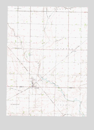
Lu Verne, IA USGS Topographic Map
Click on map above to begin viewing in our Map Viewer.

This topographic map contains these locations and features:
Feature Name Type Latitude Longitude GNIS ID View Map
Ash Post Office (historical)Post OfficeN42.8930°W94.0302°1926077View Map
Bode Cooperative ElevatorLocaleN42.9083°W94.0836°1925175View Map
City of Lu VerneCivilN42.9092°W94.0836°2395780View Map
Drainage Ditch Number 103CanalN42.9614°W94.0455°465758View Map
Drainage Ditch Number 117CanalN42.9911°W94.0650°465766View Map
HannaPopulated PlaceN42.9491°W94.0208°464571View Map
Hanna (historical)LocaleN42.9491°W94.0208°1925112View Map
Hanna Post Office (historical)Post OfficeN42.9491°W94.0208°1925111View Map
Lu VerneLocaleN42.9083°W94.0875°1925176View Map
Lu VernePopulated PlaceN42.9083°W94.0738°458670View Map
Lu Verne City HallBuildingN42.9083°W94.0836°1925174View Map
Lu Verne First RespondersBuildingN42.9094°W94.0841°2599962View Map
Lu Verne Post OfficePost OfficeN42.9083°W94.0836°1925171View Map
Lu Verne Public LibraryBuildingN42.9083°W94.0836°1925173View Map
Luverne Elementary School / Corwith - Wesley - Luverne Middle SchoolSchoolN42.9126°W94.0855°1925177View Map
Luverne Township CemeteryCemeteryN42.9157°W94.0713°1925178View Map
Township of Lu VerneCivilN42.9511°W94.0305°468310View Map
Zion Lutheran ChurchChurchN42.9083°W94.0836°1925172View Map

Note: Coordinates in the location and feature list above are referenced to NAD83 datum.


Copyright (C) 2008-2024 Ryan Niemi / Sunset Dynamics ... All Rights Reserved