TopoQuest Logo
Do you find TopoQuest useful?
Help keep TopoQuest running and adding new maps/features by donating!
Bitcoin:  19c7KJd3qBynnjoSw5npx9KScwjBe4ifkT
Litecoin:  LXs6TkuXGGXo1vDsWCkWVdjQX94eUKd6ui
Home View Maps Find Maps Find Places Resources & Links


Sexton, Iowa Topographic Map

USGS Map Title: Sexton, IA
USGS Map MRC: 43094A1
DRG (GeoTIFF) Download: o43094a1.tif


Neighboring USGS Topographic Map Quads:


  Burt, IA  
43094B2
 

  Titonka, IA  
43094B1
 

  Woden, IA  
43093B8
 

  Algona, IA  
43094A2
 

  Sexton, IA  
43094A1
 

  Wesley, IA  
43093A8
 

  Saint Joseph, IA  
42094H2
 

  Lu Verne, IA  
42094H1
 

  Corwith, IA  
42093H8


Map MRC Location:

N44°
W95°
N44°
W94°
H8 H7 H6 H5 H4 H3 H2 H1
G8 G7 G6 G5 G4 G3 G2 G1
F8 F7 F6 F5 F4 F3 F2 F1
E8 E7 E6 E5 E4 E3 E2 E1
D8 D7 D6 D5 D4 D3 D2 D1
C8 C7 C6 C5 C4 C3 C2 C1
B8 B7 B6 B5 B4 B3 B2 B1
A8 A7 A6 A5 A4 A3 A2 A1
N43°
W95°
N43°
W94°

Sexton, IA USGS 1:24K Topographic Map Preview:
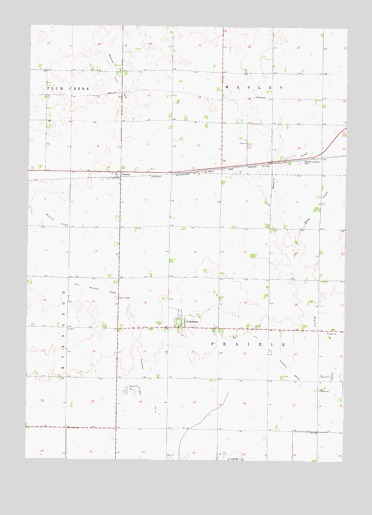
Sexton, IA USGS Topographic Map
Click on map above to begin viewing in our Map Viewer.

This topographic map contains these locations and features:
Feature Name Type Latitude Longitude GNIS ID View Map
Drainage Ditch Number 177CanalN43.0164°W94.0780°465775View Map
Drainage Ditch Number 84CanalN43.1180°W94.0938°465817View Map
Eddy CreekStreamN43.0597°W94.0200°456223View Map
Rahm Post Office (historical)Post OfficeN43.0416°W94.0641°1925101View Map
Saint BenedictPopulated PlaceN43.0380°W94.0644°460944View Map
Saint Benedict (historical)LocaleN43.0433°W94.0641°1925102View Map
Saint Benedict Catholic CemeteryCemeteryN43.0384°W94.0537°1925259View Map
Saint Benedict Census Designated PlaceCensusN43.0440°W94.0610°2585485View Map
Saint Benedict Post Office (historical)Post OfficeN43.0380°W94.0644°1925100View Map
Saint Benedict Wildlife AreaParkN43.0172°W94.0836°1925078View Map
Saint Benedicts ChurchChurchN43.0383°W94.0655°1925260View Map
SextonLocaleN43.0814°W94.0919°1925098View Map
SextonPopulated PlaceN43.0827°W94.0891°461516View Map
Sexton Census Designated PlaceCensusN43.0749°W94.0892°2585487View Map
Sexton Post Office (historical)Post OfficeN43.0827°W94.0891°1925099View Map
Township of PrairieCivilN43.0386°W94.0301°468572View Map
Wesley Evergreen CemeteryCemeteryN43.0861°W94.0183°462802View Map

Note: Coordinates in the location and feature list above are referenced to NAD83 datum.


Copyright (C) 2008-2024 Ryan Niemi / Sunset Dynamics ... All Rights Reserved