TopoQuest Logo
Do you find TopoQuest useful?
Help keep TopoQuest running and adding new maps/features by donating!
Bitcoin:  19c7KJd3qBynnjoSw5npx9KScwjBe4ifkT
Litecoin:  LXs6TkuXGGXo1vDsWCkWVdjQX94eUKd6ui
Home View Maps Find Maps Find Places Resources & Links


Manley, Nebraska Topographic Map

USGS Map Title: Manley, NE
USGS Map MRC: 40096H2
DRG (GeoTIFF) Download: o40096h2.tif


Neighboring USGS Topographic Map Quads:


  Ashland East, NE  
41096A3
 

  Springfield, NE  
41096A2
 

  Cedar Creek, NE  
41096A1
 

  Murdock, NE  
40096H3
 

  Manley, NE  
40096H2
 

  Weeping Water NE, NE  
40096H1
 

  Elmwood, NE  
40096G3
 

  Weeping Water, NE  
40096G2
 

  Avoca, NE  
40096G1


Map MRC Location:

N41°
W97°
N41°
W96°
H8 H7 H6 H5 H4 H3 H2 H1
G8 G7 G6 G5 G4 G3 G2 G1
F8 F7 F6 F5 F4 F3 F2 F1
E8 E7 E6 E5 E4 E3 E2 E1
D8 D7 D6 D5 D4 D3 D2 D1
C8 C7 C6 C5 C4 C3 C2 C1
B8 B7 B6 B5 B4 B3 B2 B1
A8 A7 A6 A5 A4 A3 A2 A1
N40°
W97°
N40°
W96°

Manley, NE USGS 1:24K Topographic Map Preview:
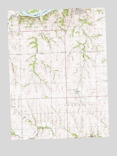
Manley, NE USGS Topographic Map
Click on map above to begin viewing in our Map Viewer.

This topographic map contains these locations and features:
Feature Name Type Latitude Longitude GNIS ID View Map
Camp HardingLocaleN40.9908°W96.2122°827898View Map
Camp KitakiLocaleN40.9919°W96.2350°827900View Map
Camp NewmanLocaleN40.9892°W96.2231°827907View Map
Cass CountyCivilN40.9097°W96.1409°835834View Map
Cass County Emergency Management AgencyBuildingN40.9141°W96.1403°2553754View Map
Center Election PrecinctCivilN40.9150°W96.1793°1928770View Map
City of LouisvilleCivilN40.9975°W96.1605°2395772View Map
College Hill School (historical)SchoolN40.9575°W96.1472°828262View Map
Decker CreekStreamN40.9936°W96.2083°828632View Map
Dutch School (historical)SchoolN40.9578°W96.2072°828904View Map
Emmanuel ChurchChurchN40.9578°W96.2361°829116View Map
First Christian ChurchChurchN40.9994°W96.1614°1897954View Map
Greenwood Farmers Cooperative ElevatorLocaleN40.9197°W96.1658°1897944View Map
Immanuel ChurchChurchN40.9583°W96.1828°830251View Map
LouisvillePopulated PlaceN40.9978°W96.1622°830916View Map
Louisville Care CenterHospitalN40.9978°W96.1656°1897947View Map
Louisville Election PrecinctCivilN40.9877°W96.1567°1929044View Map
Louisville Lakes State Recreation AreaParkN40.9997°W96.1831°830917View Map
Luetchens DamDamN40.9517°W96.2270°1766967View Map
Luetchens ReservoirReservoirN40.9517°W96.2270°1766968View Map
ManleyLocaleN40.9200°W96.1642°1897945View Map
ManleyPopulated PlaceN40.9197°W96.1658°831022View Map
Manley Fire HallBuildingN40.9204°W96.1648°1897943View Map
Manley Post OfficePost OfficeN40.9196°W96.1649°1897941View Map
Manley Public SchoolSchoolN40.9206°W96.1678°1897946View Map
Midwestern Feeding Company ReservoirReservoirN40.9208°W96.1392°1766962View Map
Midwestern Feedlot Retention DamDamN40.9217°W96.1403°1766961View Map
Mill CreekStreamN40.9992°W96.1603°831302View Map
Platte River State ParkParkN40.9889°W96.2170°1898006View Map
Platte River State Park TrailsTrailN40.9889°W96.2170°1898005View Map
Saint Patricks Catholic ChurchChurchN40.9197°W96.1658°1897942View Map
Saint Patricks CemeteryCemeteryN40.9578°W96.1394°833034View Map
Saint Patricks Cemetery Historical MarkerParkN40.9578°W96.1397°1897921View Map
Township of CenterCivilN40.9139°W96.1753°1898062View Map
Township of LouisvilleCivilN40.9994°W96.1670°1898014View Map
Village of ManleyCivilN40.9199°W96.1664°2399242View Map

Note: Coordinates in the location and feature list above are referenced to NAD83 datum.


Copyright (C) 2008-2024 Ryan Niemi / Sunset Dynamics ... All Rights Reserved