TopoQuest Logo
Do you find TopoQuest useful?
Help keep TopoQuest running and adding new maps/features by donating!
Bitcoin:  19c7KJd3qBynnjoSw5npx9KScwjBe4ifkT
Litecoin:  LXs6TkuXGGXo1vDsWCkWVdjQX94eUKd6ui
Home View Maps Find Maps Find Places Resources & Links


Weeping Water, Nebraska Topographic Map

USGS Map Title: Weeping Water, NE
USGS Map MRC: 40096G2
DRG (GeoTIFF) Download: o40096g2.tif


Neighboring USGS Topographic Map Quads:


  Murdock, NE  
40096H3
 

  Manley, NE  
40096H2
 

  Weeping Water NE, NE  
40096H1
 

  Elmwood, NE  
40096G3
 

  Weeping Water, NE  
40096G2
 

  Avoca, NE  
40096G1
 

  Unadilla, NE  
40096F3
 

  Syracuse, NE  
40096F2
 

  Dunbar, NE  
40096F1


Map MRC Location:

N41°
W97°
N41°
W96°
H8 H7 H6 H5 H4 H3 H2 H1
G8 G7 G6 G5 G4 G3 G2 G1
F8 F7 F6 F5 F4 F3 F2 F1
E8 E7 E6 E5 E4 E3 E2 E1
D8 D7 D6 D5 D4 D3 D2 D1
C8 C7 C6 C5 C4 C3 C2 C1
B8 B7 B6 B5 B4 B3 B2 B1
A8 A7 A6 A5 A4 A3 A2 A1
N40°
W97°
N40°
W96°

Weeping Water, NE USGS 1:24K Topographic Map Preview:
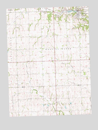
Weeping Water, NE USGS Topographic Map
Click on map above to begin viewing in our Map Viewer.

This topographic map contains these locations and features:
Feature Name Type Latitude Longitude GNIS ID View Map
Avoca CemeteryCemeteryN40.7994°W96.1281°827126View Map
Cass County Cooperative Association ElevatorLocaleN40.8683°W96.1420°1897887View Map
Cass County FairgroundsLocaleN40.8700°W96.1406°1897886View Map
Christian ChurchChurchN40.8711°W96.1433°1897899View Map
City of Weeping WaterCivilN40.8692°W96.1401°2397243View Map
Cottage Hill School (historical)SchoolN40.8131°W96.2170°828360View Map
Faith Missionary ChurchChurchN40.8664°W96.1397°1897898View Map
First Congregational ChurchChurchN40.8711°W96.1414°1897900View Map
Jensen Chiropractic ClinicHospitalN40.8700°W96.1406°1897896View Map
KNCY-FM (Nebraska City)TowerN40.7633°W96.1800°837818View Map
Mohr DamDamN40.7692°W96.2098°1767448View Map
North Branch ChurchChurchN40.7647°W96.1761°831660View Map
Olde-Fashioned Weeping Water Main Street and Museum ComplexBuildingN40.8700°W96.1406°1897783View Map
Roper DamDamN40.7619°W96.1901°1767460View Map
Saint Paul Lutheran ChurchChurchN40.8633°W96.1422°1897901View Map
Township of Weeping WaterCivilN40.8250°W96.1670°1897791View Map
United Methodist ChurchChurchN40.8700°W96.1406°1897897View Map
Waterloo School (historical)SchoolN40.7697°W96.2161°834502View Map
Weeping WaterLocaleN40.8689°W96.1411°1897892View Map
Weeping WaterPopulated PlaceN40.8700°W96.1406°834529View Map
Weeping Water Academy Historical MarkerParkN40.8711°W96.1422°1897889View Map
Weeping Water Election PrecinctCivilN40.8494°W96.1773°1929370View Map
Weeping Water Family PracticeHospitalN40.8700°W96.1406°1897895View Map
Weeping Water Fire DepartmentBuildingN40.8697°W96.1432°1897893View Map
Weeping Water Junior - Senior High SchoolSchoolN40.8657°W96.1410°1897888View Map
Weeping Water MineMineN40.8747°W96.1950°2635690View Map
Weeping Water Police DepartmentBuildingN40.8700°W96.1406°1897894View Map
Weeping Water Post OfficePost OfficeN40.8707°W96.1433°1897891View Map
Weeping Water Public LibraryBuildingN40.8711°W96.1422°1897890View Map
Weeping Water QuarryMineN40.8686°W96.1594°2635689View Map
Weeping Water Rescue SquadBuildingN40.8697°W96.1432°2553726View Map
Wilson Creek Dam 11-ADamN40.7907°W96.2401°1769128View Map
Wilson Creek Dam 12-11DamN40.7623°W96.1565°1768445View Map
Wilson Creek Dam 12-17DamN40.7624°W96.1975°1767464View Map
Wilson Creek Dam 12-6DamN40.7565°W96.1360°1768507View Map
Wilson Creek Dam 12-9BDamN40.7574°W96.1636°1768428View Map
Wilson Creek Dam 12-SDamN40.8163°W96.2245°1769958View Map
Wilson Creek Dam 12-TDamN40.7770°W96.2181°1770030View Map
Wilson Creek Reservoir 11-AReservoirN40.7906°W96.2441°1769129View Map
Wilson Creek Reservoir 12-11ReservoirN40.7638°W96.1564°1768446View Map
Wilson Creek Reservoir 12-16ReservoirN40.7619°W96.1912°1767461View Map
Wilson Creek Reservoir 12-17ReservoirN40.7623°W96.1982°1767465View Map
Wilson Creek Reservoir 12-18ReservoirN40.7685°W96.2102°1767449View Map
Wilson Creek Reservoir 12-6ReservoirN40.7575°W96.1366°1768508View Map
Wilson Creek Reservoir 12-9BReservoirN40.7587°W96.1647°1768429View Map
Wilson Creek Reservoir 12-SReservoirN40.8203°W96.2257°1769959View Map
Wilson Creek Reservoir 12-TReservoirN40.7771°W96.2227°1770031View Map

Note: Coordinates in the location and feature list above are referenced to NAD83 datum.


Copyright (C) 2008-2024 Ryan Niemi / Sunset Dynamics ... All Rights Reserved